Live GPS Tracking
Posted: 13 Feb 2012 10:58
For my recent trip to Madagascar I equipped myself with a netbook, TransDEM and the Soviet topographic maps 1:200,000, possibly still the best maps you can get for that region. I also took my reliable Garmin GPS device and loaded it with Open Street Map data. OSM coverage of Madagascar, however, is sparse. Outside of towns you'll get the major road and nothing else. Google has a bit more, but Google is proprietary data, no way to use it with Garmin units.
The problem I encountered was to bring GPS and the Soviet maps in sync while riding the train or the bus. I manually transferred coordinates between the Garmin and TransDEM but this seemed somewhat cumbersome. So, having returned home now, I went for improvement: Adding a GPS live feed function to TransDEM.
There is a handy protocol for this: NMEA0183. It's a bit dated and requires a serial RS232 interface, but it's supported by many GPS devices. However, these days neither netbooks or laptops offer a serial COM interface. And some GPS devices don't have RS232 either. Many have USB only. Fortunately, there is 3rd party software to translate from USB to virtual COM.
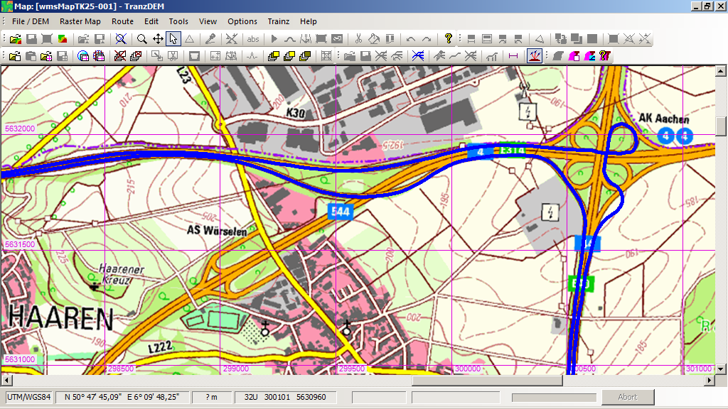
Last weekend I implemented the basic functionality for GPS tracking into TransDEM and successfully connected my GPSMap60CSx to it. The GPS units usually send the current fix (position) once a second over NMEA0183 and TransDEM will draw the series of fixes as a polyline, like you would do manually with the built-in Simple Route Editor. TransDEM will also offer to save such tracklogs as ordinary vector data.
The problem I encountered was to bring GPS and the Soviet maps in sync while riding the train or the bus. I manually transferred coordinates between the Garmin and TransDEM but this seemed somewhat cumbersome. So, having returned home now, I went for improvement: Adding a GPS live feed function to TransDEM.
There is a handy protocol for this: NMEA0183. It's a bit dated and requires a serial RS232 interface, but it's supported by many GPS devices. However, these days neither netbooks or laptops offer a serial COM interface. And some GPS devices don't have RS232 either. Many have USB only. Fortunately, there is 3rd party software to translate from USB to virtual COM.
Last weekend I implemented the basic functionality for GPS tracking into TransDEM and successfully connected my GPSMap60CSx to it. The GPS units usually send the current fix (position) once a second over NMEA0183 and TransDEM will draw the series of fixes as a polyline, like you would do manually with the built-in Simple Route Editor. TransDEM will also offer to save such tracklogs as ordinary vector data.