TransDEM Forum

TransDEM News, Support, Hints and Resources
It is currently 21 Dec 2024 18:19

All times are UTC + 1 hour


Post new topic Reply to topic  [ 16 posts ]  Go to page Previous  1, 2
Author Message
PostPosted: 08 Apr 2021 18:30 
Offline

Joined: 05 Jan 2011 16:45
Posts: 1489
A new version of TransDEM has been released: 2.6.5.

Download from my website under Download. Or directly:
Update Trainz Edition 2.6.* - 2.6.5 (English/German, 32bit)
Update Trainz Edition 2.6.* - 2.6.5 (English/German, 64bit)

These are free updates for TransDEM 2.6 users. They require the full TransDEM product being installed, minimum version 2.6.0.0. Please verify that you download the correct variant for your installation, 32 or 64 bit.

The update is cumulative again. It will figure out which version is currently installed and patch it to the latest one.

TransDEM-Version 2.6.4.3
  • Support for Belgian hi-res LIDAR DEMs. This required a new EPSG code for the Belgian Lambert coordinate system and also a tiny GeoTIFF reader modification for more flexible handling of so-called "planar configurations".
    http://geoportail.wallonie.be/catalogue ... 7af92.html
  • New TransDEM customers in the last few weeks will already have received this version.

TransDEM-Version 2.6.5
  • Support for Japanese DEMs in GML file format, an XML variant, and addition of the Japanese geodetic datums JGD2000 and JGD2011. These are treated by TransDEM as an equivalent to WGS84. There is 10m and 5m data. There are a few obstacles, though. Those who want to try should either speak the language or use online translation, as the relevant web pages are all in Japanese:
    https://fgd.gsi.go.jp/download/menu.php
    You also need to register a (free) account to be able to download data. Data is pre-packaged and can be select via a map window. Unfortunately, the DEMs come with many black holes. This includes all water bodies. Post-processing is needed. Presumably the easiest way is to fill up with SRTM data. See screenshots below.
  • Australia has a new geodetic datum GDA2020, which has also been added to TransDEM and again treated like WGS84. And there is a geo data server for Queensland which offers topo maps and ortho imagery in GeoPDF file format:
    https://qtopo.information.qld.gov.au/
    I made the necessary changes to GeoPDF in TransDEM to be able handle these files.
  • Manually entered georferencing parameters are now cached for the session and will be used as the preset for the next file to be read. This will save a few mouse clicks.
  • All vector drawings in the main window, coordinate grid, route polylines, triangles etc are now drawn with anti-aliasing. TransDEM does not use the GPU, but anti-aliasing is also available for CPU rendering, via the GPU+ API, and TransDEM now finally makes use of this feature.
  • Coordinate labels in the main window are now better readable, always drawn with a distinct background, even if no raster maps are loaded.
  • DEM shading is now active by default. You can switch it off again and your choice will be saved in the user settings. Reason to activate it is that almost any user screenshot of TransDEM seen in the forums shows the DEM with flat colours. While theoretically there is all information in them, it's rather difficult for the human eye to really figure out the details. With shading, the DEMs gets a pseudo-3D texture and its structure becomes much clearer. See the side-by-side comparison in the screenshots below.
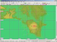
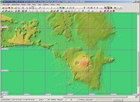
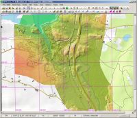
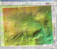
Screenshots: Japanese 5m DEM on the east coast, with an Open Top Map overlay and holes filled up with SRTM:

Image Image


Top
 Profile  
 
PostPosted: 23 Dec 2021 13:39 
Offline

Joined: 05 Jan 2011 16:45
Posts: 1489
Another little TransDEM update: 2.6.5.1.

Download from my website under Download. Or directly:
Update Trainz Edition 2.6.* - 2.6.5.1 (English/German, 32bit)
Update Trainz Edition 2.6.* - 2.6.5.1 (English/German, 64bit)

These are free updates for TransDEM 2.6 users. They require the full TransDEM product being installed, minimum version 2.6.0.0. Please verify that you download the correct variant for your installation, 32 or 64 bit.

The update is cumulative again. It will figure out which version is currently installed and patch it to the latest one. There is no change to the manuals by this update. If you already have 2.6.5.0 installed, the update procedure will report the manuals as already being up to date.

This latest version of TransDEM has been built against a new set of MS C++ runtime libraries. This set is also bundled with the setup package and should be installed as well.

TransDEM-Version 2.6.5.1
  • Support for Irish LIDAR DEMs:
    https://dcenr.maps.arcgis.com/apps/weba ... 8c1572c9f5
    The DEMs (DTM, digital terrain model) are in the Irish Transverse Mercator (ITM) projection, familiar to TransDEM for quite a few years. However, if in GeoTIFF format, these DEMs do not indicate the EPSG code for ITM as it is common for GeoTIFF but instead specify the projection parameters in explicit form. TransDEM has been enhanced to read and process those parameters.
  • Support for Polish LIDAR DEMs:
    https://mapy.geoportal.gov.pl
    The DEMs (DTM, digital terrain model) are in the Euref Poland 1992 projection, also familiar to TransDEM for some time. And in GeoTIFF they are specified by the EPSG code. However, due to a bug in the internal mapping of EPSG codes to spatial reference systems, the projection could not be recognized. The bug has been fixed. The data is also available in ESRI ASCII Grid format, but comes with different x and y grid raster parameters, instead of the typical uniform cell width. TransDEM has been enhanced to also handle this option.

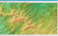
Screenshot: Irish 2m LIDAR DEM (DTM) with Open Topo Map background

Image


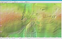
Screenshot: Polish 1m LIDAR DEM (DTM) with Open Topo Map background

Image


Top
 Profile  
 
PostPosted: 19 Feb 2023 15:40 
Offline

Joined: 05 Jan 2011 16:45
Posts: 1489
A new version of TransDEM has been released: 2.6.6.

Download from my website under Download. Or directly:
Update Trainz Edition 2.6.* - 2.6.6 (English/German, 64bit)

This is a free update for TransDEM 2.6 users. It requires the full TransDEM product being installed, minimum version 2.6.0.0. Please note that this update is 64 bit only.

The update is cumulative again. It will figure out which version is currently installed and patch it to the latest one.

Once again, this latest version of TransDEM has been built against a new set of MS C++ runtime libraries. This set is also bundled with the setup package and should be installed as well.

I am also archiving the 32 bit variant of TransDEM now. Hardly anyone is using it these days anyway. And with the growing availability of hi-res LIDAR-DEMs, memory demands are steadily increasing. The 32bit address space becomes too much of a limitation here. I will keep the 32bit variant and its patches on the server but will no longer update it.


TransDEM-Version 2.6.6
  • Support for South Korean Transverse Mercator coordinate systems
    • UTM Korea : (EPSG 5179)Transverse Mercator projection for South Korea, since
      2010, GRS1980 ellipsoid, one zone for entire country, origin 38°N, 127.5°E, scale
      factor 0.9996 like UTM.
    • UTM Korea (Belts) : Transverse Mercator projection for South Korea, since 2010,
      GRS1980 ellipsoid, four zones of 2 degrees each, scale factor 1
      1. West belt (EPSG 5185), origin 38°N, 125°E
      2. Central belt (EPSG 5186), origin 38°N, 127°E
      3. East belt (EPSG 5187), origin 38°N, 129°E
      4. East sea belt (EPSG 5188), origin 38°N, 131°E
    Tested with DEM sample data, kindly provided by a Korean user, file formats GeoTIFF and ERDAS Imagine

No screenshots this time, unfortunately. Korean DEM copyright seems to not allow this.


Top
 Profile  
 
PostPosted: 18 Aug 2023 17:11 
Offline

Joined: 05 Jan 2011 16:45
Posts: 1489
A new version of TransDEM has been released: 2.6.6.1.

Download from my website under Download. Or directly:
Update Trainz Edition 2.6.* - 2.6.6.1 (English/German, 64bit)

This is a free update for TransDEM 2.6 users. It requires the full TransDEM product being installed, minimum version 2.6.0.0. Please note that this update is 64 bit only.

The update is cumulative again. It will figure out which version is currently installed and patch it to the latest one. If some files are reported to be already up to date during the patching procedure, then that’s an info, not an error.

TransDEM-Version 2.6.6.1
  • Support for DB_Ref, the coordinate system of Deutsch Bahn (German Railways) (Gauss/Krueger-Potsdam, adapted to ETRS89), EPSG 5682 – 5685 (deprecated 5832 – 5835).
  • XYZ import
    • Support for Gauss/Krueger xyz data with zone prefix in the easting value.
    • Caching of projection parameters, manually entered via dialog.
    • Estimation of grid width, based on the xyz data read.
  • GeoTIFF DEM
    • GeoTIFF DEMs which miss the obligatory GEOKEYDIRECTORY tag are no longer rejected. Instead, they are assumed to be in geographic WGS84 coordinates.
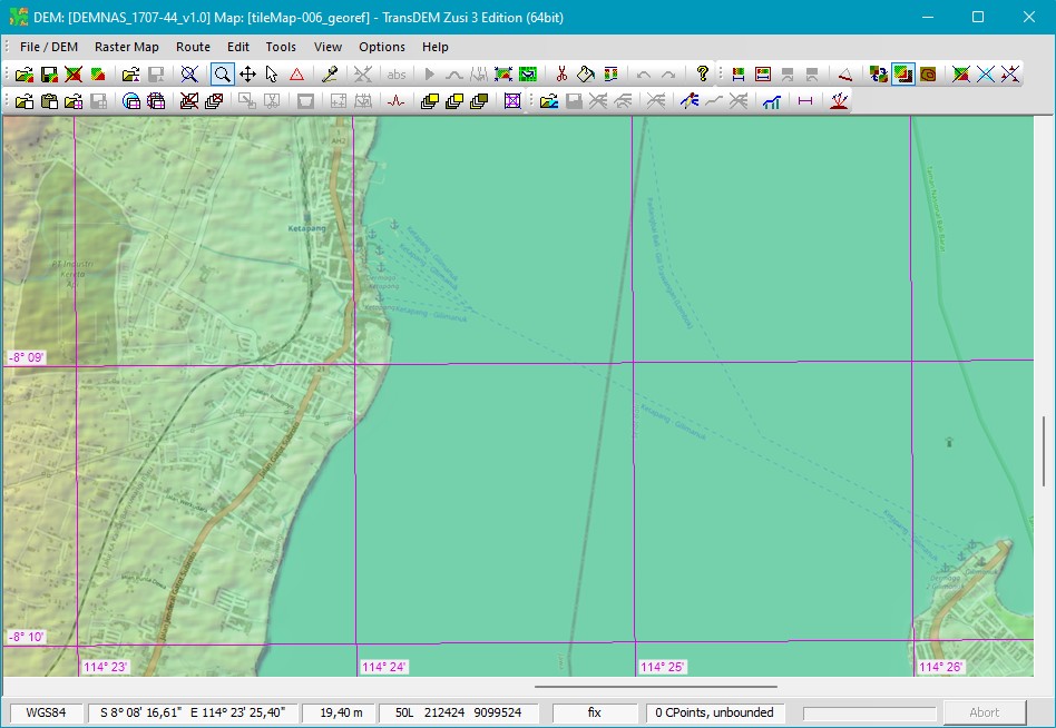
    • Allows to read Indonesian DEMNAS files.
    • The non-standard but widely used GDAL_NODATA tag will now be read. It defines the encoding of values not present.


Screenshots for DB and other 1m DTM

XYZ import, in 1m nominal raster. West of Aschaffenburg main station, north-western Bavaria. Apparently, this is a raw scan, the matrix isn’t fully populated.:

Image

After filling up the missing points with the built-in TransDEM function:

Image

Surrounded by legacy 50m DEM for Bavaria:

Image

And here with the new Bavarian 1m data, which only have become available for free in January this year:

Image

Even zoomed in, no seam can be detected. This means that not only the coordinate conversion from DB_REF to UTM is correct but also the elevation base is the same for both data sources:

Image

Still not all German federal states have released their 1m data to the general public, so that external sources, like DB here, can still be quite helpful (if you happen to come by such data).


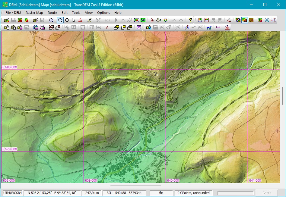
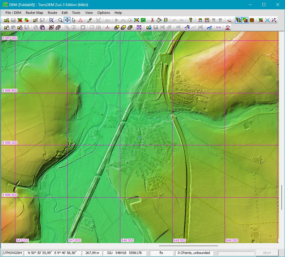
To finish the images on xyz import and 1m data another example from the state of Hesse, their hi-res LIDAR DTM also available for free now.

Image


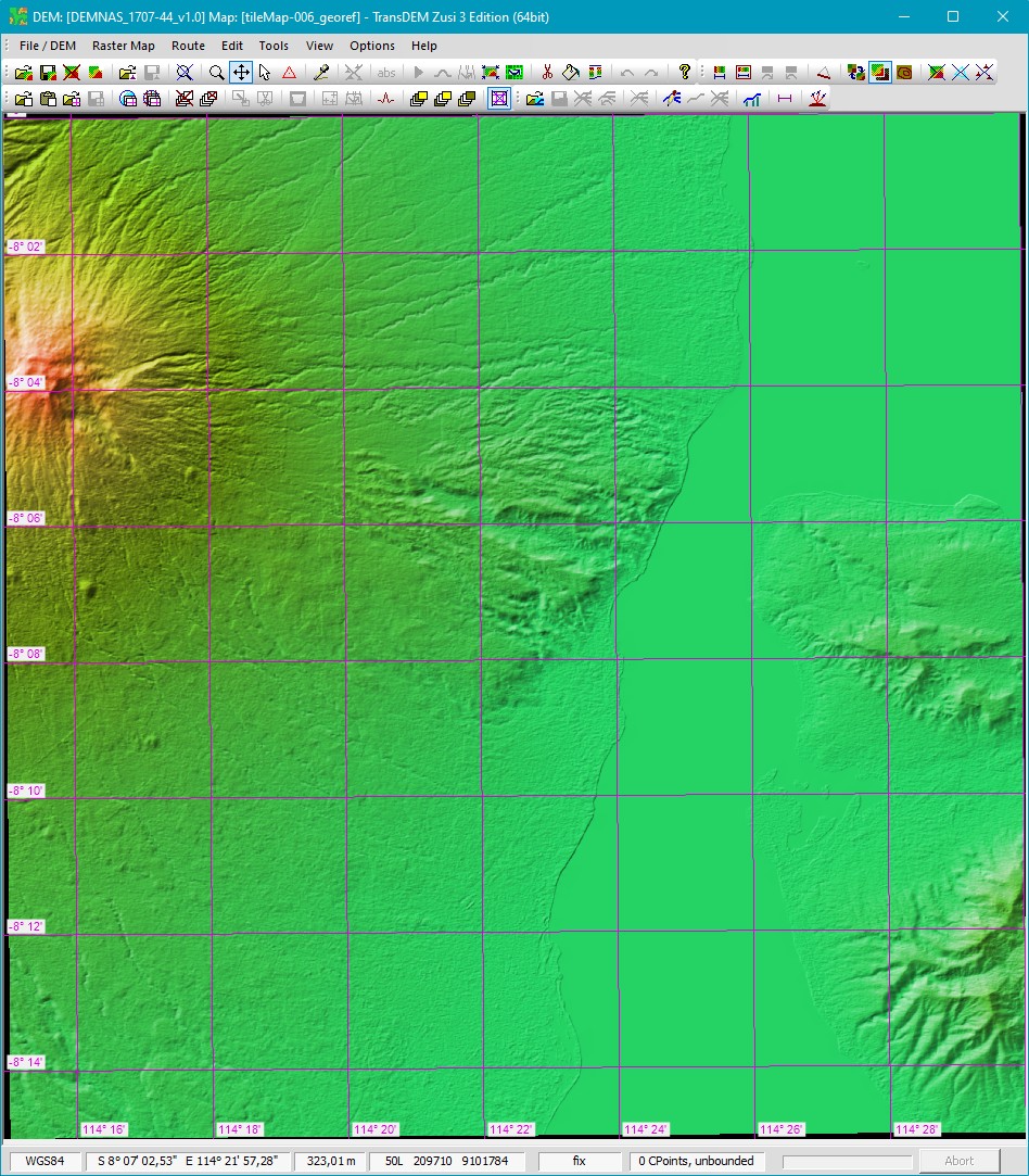
Example for GeoTIFF DEMNAS, Indonesia

Source: DEMNAS (Registartion required and you might need an online translation tool). I was pointed to this data source by a TransDEM user: viewtopic.php?p=3430#p3430

The sound between Java and Bali, with a volcano adding to the picture. Nominal raster width is 0.27 arc minutes, around 8m, actual resolution seem lower though:

Image

Overlay with OpenTopoMap – for those Bali holiday makers, who travel in style by train all across Java and take the ferry from here:

Image


Example for missing data in GeoTIFF

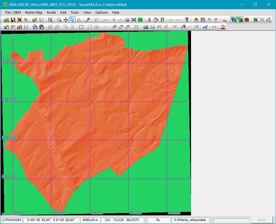
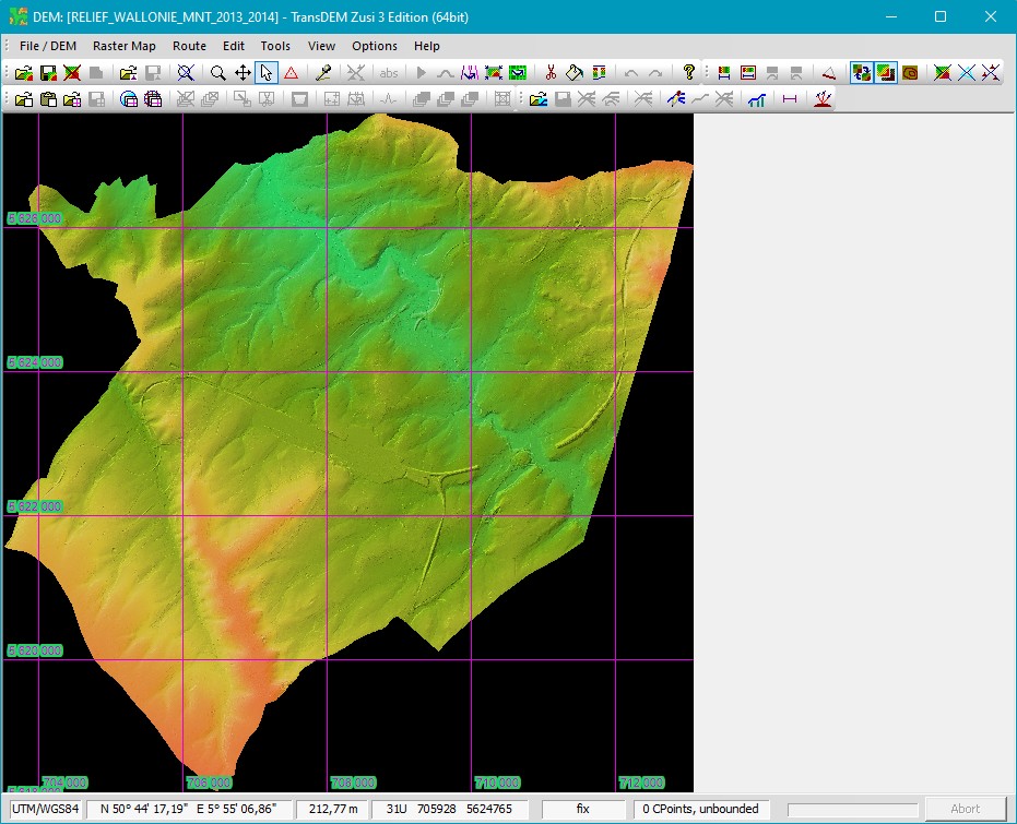
1m data from Belgium, Monntzen yard and Moresnet viaduct, close to the German border. Missing values are encoded as -9999. TransDEM up to now didn’t recognise this. And it couldn’t be easily fixed by post-processing, because the data is not native UTM but Belgian Lambert, and interpolation during conversion integrated and altered the no data values:

Image

Latest TransDEM Version 2.6.6.1. The GDAL_NODATA tag now works:

Image


Top
 Profile  
 
PostPosted: 06 Jan 2024 12:13 
Offline

Joined: 05 Jan 2011 16:45
Posts: 1489
A new version of TransDEM has been released: 2.6.6.2.

Download from my website under Download. Or directly:
Update Trainz Edition 2.6.* - 2.6.6.2 (English/German, 64bit)

This is a free update for TransDEM 2.6 users. It requires the full TransDEM product being installed, minimum version 2.6.0.0. Please note that this update is 64 bit only.

The update is cumulative again. It will figure out which version is currently installed and patch it to the latest one. If some files are reported to be already up to date during the patching procedure, then that’s an info, not an error.

TransDEM-Version 2.6.6.2
  • Bypass GeoTIFF for missing geo model key. This is a mistake on the provider side, but usually this key can be deduced from other keys.

Example 1m GeoTIFF DEM from German federal state of Hesse 1m data which has this bug and where the bypass was applied:

Image


Top
 Profile  
 
PostPosted: 19 Aug 2024 15:54 
Offline

Joined: 05 Jan 2011 16:45
Posts: 1489
A new version of TransDEM has been released: 2.6.7.

Download from my website under Download. Or directly:
Update Trainz Edition 2.6.* - 2.6.7 (English/German, 64bit)

This is a free update for TransDEM 2.6 users. It requires the full TransDEM product being installed, minimum version 2.6.0.0. Please note that this update is 64 bit only.

The update is cumulative again. It will figure out which version is currently installed and patch it to the latest one. If some files are reported to be already up to date during the patching procedure, then that’s an info, not an error.

TransDEM-Version 2.6.7
  • Updated Dutch coordinate system Rijksdriehoeksnet RD. It's been supported by TransDEM for several years, however, the associated EPSG code was incorrect.
  • New Belgian coordinate system Belge Lambert 2008. Like the older system a Lambert Conic Conformal projection with two standard parallels. Datum now ETRS89, simplified for TransDEM to WGS84.
  • GeoTIFF DEM export now includes tag GDAL_NODATA.

Tested with Dutch and Wallonian elevation data, see also separate posting.

Example Aachen Three Corner region, with Digital Terrain Models (DTM) of all three countries, 1m from German North-Rhine Westphalia, and 50cm data, converted to 1m, from the Netherlands and Wallonia:
Image

Example Dutch/Belgian border between Vaals and Gemmenich (near Aachen). Looking closely, you can recognize a kind of seam along the border line, where the two data sources meet:
Image


Top
 Profile  
 
Display posts from previous:  Sort by  
Post new topic Reply to topic  [ 16 posts ]  Go to page Previous  1, 2

All times are UTC + 1 hour


Who is online

Users browsing this forum: No registered users and 0 guests


You cannot post new topics in this forum
You cannot reply to topics in this forum
You cannot edit your posts in this forum
You cannot delete your posts in this forum

Search for:
Jump to:  

Imprint & Privacy

Powered by phpBB® Forum Software © phpBB Group