I wouldn't bet on it but OSM may be based on the same vector data source as Tasmania Land's topo map. Quite a few government mapping agencies contribute their data to the OSM project these days.
Anyway, here are the settings for Tasmania map tiles:
Code: Select all
<?xml version="1.0" encoding="iso-8859-1" ?>

<TileServer version="1.0" >
  <Provider name="Tasmania" guid="a006a672-a360-4fcc-9780-5d1bfce2c038" >
    <URL guid="47bb7131-e2d3-406a-b7cb-0bde7111b573" addr="http://services.thelist.tas.gov.au" prefix="arcgis/rest/services/Basemaps/Orthophoto/ImageServer/Tile" standalone="1" >
      <Matrix order="3" prefixClm="/" prefixRow="/" prefixZoom="/" minZoom="1" maxZoom="19" />
      <Mercator origLat="90" origLon="-180" signLat="-1" signLon="1" projection="4" />
    </URL>
    <URL guid="0680fc05-10dd-4c27-b801-6011685242da" addr="http://services.thelist.tas.gov.au" prefix="arcgis/rest/services/Basemaps/TasmapRaster/ImageServer/Tile" standalone="1" type="1" >
      <Matrix order="3" prefixClm="/" prefixRow="/" prefixZoom="/" minZoom="1" maxZoom="16" />
      <Mercator origLat="90" origLon="-180" signLat="-1" signLon="1" projection="4" />
    </URL>
    <URL name="Topographic" guid="bb9258d8-8ca9-4521-8b65-eba210697d4f" addr="http://services.thelist.tas.gov.au" prefix="arcgis/rest/services/Basemaps/Topographic/ImageServer/Tile" standalone="1" type="8" >
      <Matrix order="3" prefixClm="/" prefixRow="/" prefixZoom="/" minZoom="1" maxZoom="18" />
      <Mercator origLat="90" origLon="-180" signLat="-1" signLon="1" projection="4" />
    </URL>
    <URL name="Tasmap25K " guid="8975481c-77ea-44b2-aea6-25038d2a3d71" addr="http://services.thelist.tas.gov.au" prefix="arcgis/rest/services/Basemaps/Tasmap25K/ImageServer/Tile" standalone="1" type="9" >
      <Matrix order="3" prefixClm="/" prefixRow="/" prefixZoom="/" minZoom="1" maxZoom="16" />
      <Mercator origLat="90" origLon="-180" signLat="-1" signLon="1" projection="4" />
    </URL>
  </Provider>
</TileServer>
The maps, even "Topographic", may not add much value, but the orthophotos look good, sharper and more detailed than Google and Bing, at least for the populated places.
I also looked at the DEM again and checked for 5m data on ELVIS. The only bit they seem to have for the Wilderness Railway is the terminus at Regatta Point. I combined 5 m and 25 m (using the "Fill" function) for this example:
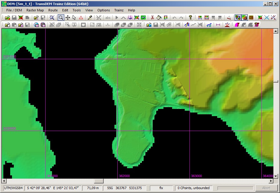
You will notice the seam. It would need smoothing.