Every once-in-a-while, when I download a GeoPDF from the USGS "National Map" web page, Transdem seems to misinterpret the longitude of the GeoPDF. Thus when I "Convert to UTM", the transformation is way off. Here's what I mean:
This GeoPDF from the USGS web site is a topo map of San Juan Bautista from 1939. In Transdem, when you "Convert to UTM", the georeferencing comes out wrong. It seems that Transdem thinks the map is in UTM Zone 9 when it is actually in Zone 10.
https://prd-tnm.s3.amazonaws.com/Staged ... 757154.pdf
The following GeoPDF is also from the USGS web site, for the same location, from a different year. This one works fine in Transdem (the UTM transformation works as it should).
https://prd-tnm.s3.amazonaws.com/Staged ... 757152.pdf
I *think* both GeoPDFs are valid, I mean I can browse them in Adobe Reader with the Terrago Toolbar installed, and the correct longitudes are displayed.
Transdem (2.6.1) Misinterpreting Longitudes in some GeoPDFs
-
Kookaburra
- Posts: 35
- Joined: 19 Feb 2011 00:32
Re: Transdem (2.6.1) Misinterpreting Longitudes in some GeoP
There could be something wrong with the embedded geo-referencing meta-data. We had it with other maps in the past.
Have a look at this thread:
https://forum.transdem.de/viewtopic.php?f=7&t=261
Follow the suggestions there, replace "Transverse Mercator" with "Polyconic". Should work.
The people at USGS who did all the magnificent work digitizing these maps had to do this manually. And they are only humans, just like us. And humans sometimes make mistakes.
-
Kookaburra
- Posts: 35
- Joined: 19 Feb 2011 00:32
Re: Transdem (2.6.1) Misinterpreting Longitudes in some GeoP
That did the trick, thanks!
-
Kookaburra
- Posts: 35
- Joined: 19 Feb 2011 00:32
Re: Transdem (2.6.1) Misinterpreting Longitudes in some GeoP
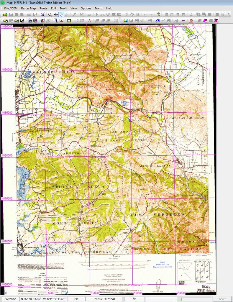
Oh, wait a sec... it *almost* worked. After fixing PROJECTION, the transformation looks better (the second image, below), but the UTM grid lines (for longitude) are still wrong. Something else in the metadata? Maybe I'm doing something wrong.
Conversion to UTM before changing PROJECTION to Polyconic in XML file...
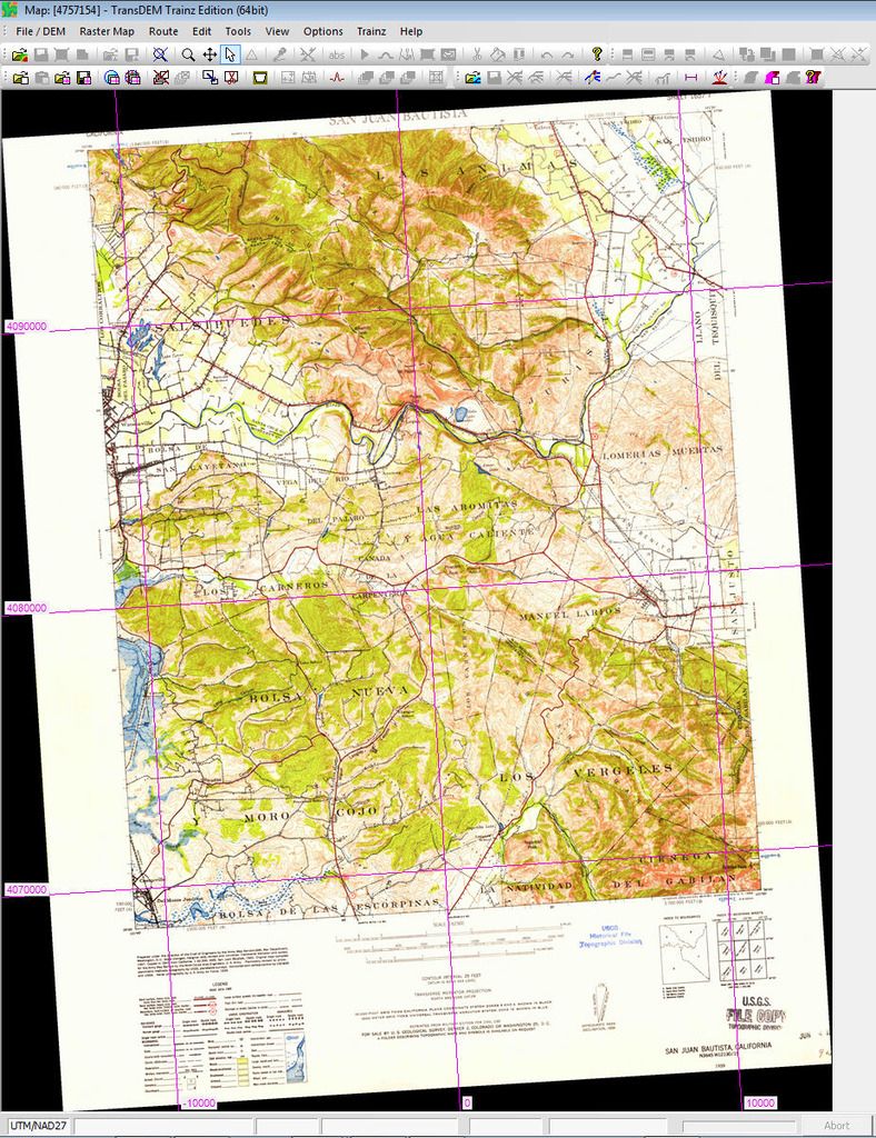
Conversion to UTM after changing PROJECTION to Polyconic in XML file. Looks better, but the UTM grid lines for longitude should range from about 610000 to 630000 (not 0 to 20000)...
Conversion to UTM before changing PROJECTION to Polyconic in XML file...
Conversion to UTM after changing PROJECTION to Polyconic in XML file. Looks better, but the UTM grid lines for longitude should range from about 610000 to 630000 (not 0 to 20000)...
Re: Transdem (2.6.1) Misinterpreting Longitudes in some GeoP
That's just the view. Coordinates system displayed is still "Polyconic", from the import. Change it back to "UTM/WGS84" and you should be fine. The Polyconic projection is the one the map is actually based on. You often find it being mentioned in the legend on these map sheets.Kookaburra wrote:Looks better, but the UTM grid lines for longitude should range from about 610000 to 630000 (not 0 to 20000)...
-
Kookaburra
- Posts: 35
- Joined: 19 Feb 2011 00:32
Re: Transdem (2.6.1) Misinterpreting Longitudes in some GeoP
Ah, right, the view.. That worked, thanks!