Not sure if this can be related to previous posts about the TransDEM Sample Settings, but using those I get an error when attempting to connect to the USGS National Map that simply states WMS Error 'No Error.'
I have made no adjustments to the file that was downloaded.
USGS WMS Error
Re: USGS WMS Error
While this service is still listed in the USGS WMS catalogue, it apparently no longer exists. I did a bit of research now and found out that this service was hosted by ESRI's ArcGIS Online portal. Digging further I discovered a Map Tile service providing the same data. I decoded it (simple enough, it follows the Open Street Map scheme) and created a set of TransDEM map tile parameters for it:
Copy the code section into a text editor, save as an xml file and import into TransDEM with the Map Tile Client / Settings.
Code: Select all
<?xml version="1.0" encoding="iso-8859-1" ?>

<TileServer version="1.0" >
  <Provider name="_10 USA Topo" >
    <URL addr="http://services.arcgisonline.com" prefix="ArcGIS/rest/services/USA_Topo_Maps/MapServer/tile" standalone="1" type="1" >
      <Matrix prefixClm="/" prefixRow="/" prefixZoom="/" minZoom="1" maxZoom="18" order="3" />
      <Mercator origLat="90" origLon="-180" signLat="-1" signLon="1" projection="4" />
    </URL>
  </Provider>
</TileServer>Re: USGS WMS Error
G'day geophil,
...I tried your suggestion above, Roland. with success but when I tried to access the maps, there was no options available for me to select from in the Tile Type drop down box and if I tried to "Get Map..", I was confronted with the error message..
.."...No layer selected..."...
...where should I go from here?...
Jerker {:)}
Re: USGS WMS Error
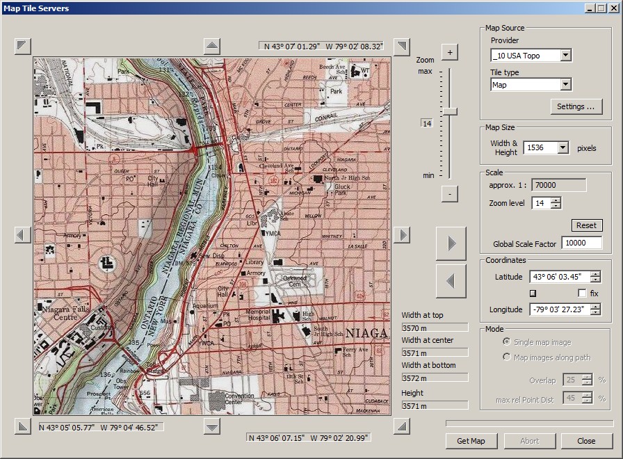
Provider should be set to "__10 USA Topo" and Tile type to "Map":
Re: USGS WMS Error
G'day geophil,
...that's the problem, Roland, when I select "_10 USA Topo" from the Drop Down List for the "Provider" Text Box, there is NO option available to select ANY kind of map from the "Tile Type" Drop Down List...

later edit..
...I decided to redo everything from scratch and I now seem to have it all working as I would expect it to be. My apologies for any inconvenience...
Jerker {:)}
...that's the problem, Roland, when I select "_10 USA Topo" from the Drop Down List for the "Provider" Text Box, there is NO option available to select ANY kind of map from the "Tile Type" Drop Down List...
later edit..
...I decided to redo everything from scratch and I now seem to have it all working as I would expect it to be. My apologies for any inconvenience...
Jerker {:)}
Re: USGS WMS Error
Thank you for resolving this issue for us.
John
John
Re: USGS WMS Error
G'day jcitron,
...you're welcome, John..
...although I'm still not 100% percent sure exactly what went wrong, I am presuming that some error during the creation of the *.xml file occurred when I created it, initially, using MS Word. When I redid everything, I deleted the faulty files and created the *.xml file, anew, directly from 'Notepad' (which I had done in the past), subsequently, the new file worked perfectly and I have since made use of the Tile Map Server using the 'new' resource to obtain the topographic maps, without issue...
...by the way, has anyone else noticed that the maps from this new source, have "hill shading" applied to them as part of the 'raster'? I do not recall that being the case with the USGS versions. I have yet to see how this will look in Trainz with a DEM behind them but I suspect it will be an "improvement"..
Jerker {:)}