In my never ending desire to create a total wilderness route for Trainz, I discovered this site:
http://kansalaisen.karttapaikka.fi/kart ... ml?lang=en
for Finland which has a highly detailed zoomable, scrollable (and colourful!) topographic map. I can't see any reference to a WMS facility so data collection will need to be via taking map clippings and assembling in a paint package, but it's much better than OSM or Google for the area neither of which show much detail.
Hope this is of some use.
Finland Topo Maps
Re: Finland Topo Maps
Vern, thanks a lot.
Well, georeferencing has to be manual. The maps have 1000m crosshair marks, which reflect the Finnish TM35 coordinate system. The centre coordinates appear underneath the "Map Site" logo. So, it's not too difficult.
Since Finland lies north of the 60th parallel, we can't use SRTM. But Viewfinder Panoramas helps out.
Here's a 2 x 2 km example in uninhabited wilderness:
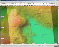
I compared the 700 m and 760 m contour lines and the DEM seems accurate enough.
Well, georeferencing has to be manual. The maps have 1000m crosshair marks, which reflect the Finnish TM35 coordinate system. The centre coordinates appear underneath the "Map Site" logo. So, it's not too difficult.
Since Finland lies north of the 60th parallel, we can't use SRTM. But Viewfinder Panoramas helps out.
Here's a 2 x 2 km example in uninhabited wilderness:
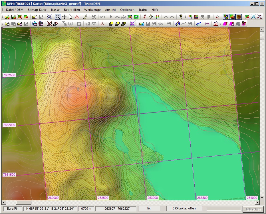
I compared the 700 m and 760 m contour lines and the DEM seems accurate enough.
Re: Finland Topo Maps
Definitely a WIP, this one as the test route I set up (about 60km), in the eastern corner the mapping more or less matched the DEM but on the western side I was too far out - lakes on top of hills, track going straight over hills. Possibly my georeferencing at fault as I took UTM Lat/Lon from Google Maps and transposed it to the same locations on the topo maps. As a control to test accuracy of the DEM, I set the same route up in Railworks and have compiled a chain of markers in Google Earth to test how those lie on the terrain - won't be able to tell until later today after extracting the terrain in ReDem. However I still suspect my referencing and/or trying to use one compiled map for the whole route is the main suspect.
Re: Finland Topo Maps
Vern, the far north is a bit sensitive, cylinder vs. ellipsoid. Georeferencing inaccuracies may have a more dramatic effect than at more moderate latitudes. I'd recommend the crosshair map marks. (The Finnish grid is closely related to UTM but not identical, Finnish zone 15 is wider than standard UTM.)
Re: Finland Topo Maps
I think you are correct Roland. The route I tried was in the north (Kemijarvi), but I've since set up one further south and the results were much better, not perfect, but workable. In addition I don't think the maps show tunnels so where the line crosses a steep ridge, reference back to GM or OSM may be necessary to see if it goes under rather than over.
Re: Finland Topo Maps
Why not use the aerial images the Finnish Map Site provides? Look underneath Map Site logo and coordinates for this option.BigVern wrote:In addition I don't think the maps show tunnels so where the line crosses a steep ridge, reference back to GM or OSM may be necessary to see if it goes under rather than over.
Re: Finland Topo Maps
Good idea. I noticed they are much higher resolution than the ones provided by Google Erath, too.