From Ordnance Survey downloaded, Land-Form PANORAMA, Data type: Vector (Contours), Grid (DTM), Supply format: DXF [Contours], ASCII grid [DTM], NTF [DTM], Version: 04/2010.
Processed DEM’s for Area SE, DTM, ASCII, *.asc files, through TranzDEM.
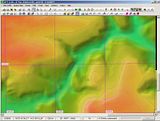
Results were fine until I started to add some raster georef maps to test area. Had problem so checked Northing, should have been about N53 but was found to be about N3.
Looks like England has slipped to just above the equator.
My exercise is a rerun, with latest data from OS, to allow a revised Yorkshire area rout to be created.
The existing rout I am working on was originally created with same DEM data a couple of years ago.
I have since building in Trainz12 added more and more track details for stations etc., but needed to extend a little.
My intention this time is to add overlays of all the station data to google data so that I do not have to worry about position and size of trackwork.
Anyone seen this before, or am I doing something wrong
England Has Moved 50 deg. South
Re: England Has Moved 50 deg. South
Did you switch the coordinate system to OSGB36 when importing the DEM (DTM)?jackdrake wrote:Processed DEM’s for Area SE, DTM, ASCII, *.asc files, through TranzDEM.
Re: England Has Moved 50 deg. South
Yesgeophil wrote:Did you switch the coordinate system to OSGB36 when importing the DEM (DTM)?jackdrake wrote:Processed DEM’s for Area SE, DTM, ASCII, *.asc files, through TranzDEM.
See this
https://www.facebook.com/photo.php?fbid ... =1&theater
Re: England Has Moved 50 deg. South
Is it the DEM that ends up in the Gulf of Guinea or the raster map? What kind of raster map?
You could you give me the exact location and I'll try myself this evening.
You could you give me the exact location and I'll try myself this evening.
Re: England Has Moved 50 deg. South
It is the DEM that is misplaced.
The Raster Map has the correct coordinates
Both items are from the OS reference SE
The Raster Map has the correct coordinates
Both items are from the OS reference SE
Re: England Has Moved 50 deg. South
I had it working with "SD" a while ago, for the release announcement of TransDEM 2.1:
I'll check this evening with "SE".

I'll check this evening with "SE".
Re: England Has Moved 50 deg. South
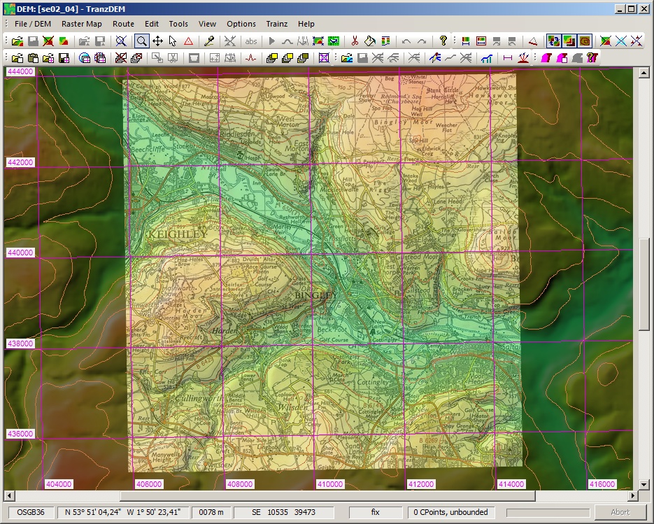
Tested it myself now and found no problems. The place is Bingley, using Historic UK map tiles for the raster map.
Land-form Panorama DEM/DTM:
<..>\panorama_gb\DTM\ASCII\data\se\02.asc
<..>\panorama_gb\DTM\ASCII\data\se\04.asc
Coordinate system set to OSGB36 and left at OSGB36 when opening the DEM file.
Land-form Panorama DEM/DTM:
<..>\panorama_gb\DTM\ASCII\data\se\02.asc
<..>\panorama_gb\DTM\ASCII\data\se\04.asc
Coordinate system set to OSGB36 and left at OSGB36 when opening the DEM file.
Re: England Has Moved 50 deg. South
Sorry but it looks as though I was not taking the default coordinate system for the DEM
"Ordnance Survey Great Britain 1936"
I was changing it to UTM/WGS84 where I had to also add the Zone (30).
Thank you for putting me on the correct track.
Seniors moment once again
Sorry to take up your time
"Ordnance Survey Great Britain 1936"
I was changing it to UTM/WGS84 where I had to also add the Zone (30).
Thank you for putting me on the correct track.
Seniors moment once again
Sorry to take up your time
Re: England Has Moved 50 deg. South
No problem. Always an opportunity to check that things still work as intended, when adding or enhancing functionality as I am currently doing.