I wouldn't bet on it but OSM may be based on the same vector data source as Tasmania Land's topo map. Quite a few government mapping agencies contribute their data to the OSM project these days.
Anyway, here are the settings for Tasmania map tiles:
Code:
<?xml version="1.0" encoding="iso-8859-1" ?>
<TileServer version="1.0" >
<Provider name="Tasmania" guid="a006a672-a360-4fcc-9780-5d1bfce2c038" >
<URL guid="47bb7131-e2d3-406a-b7cb-0bde7111b573" addr="http://services.thelist.tas.gov.au" prefix="arcgis/rest/services/Basemaps/Orthophoto/ImageServer/Tile" standalone="1" >
<Matrix order="3" prefixClm="/" prefixRow="/" prefixZoom="/" minZoom="1" maxZoom="19" />
<Mercator origLat="90" origLon="-180" signLat="-1" signLon="1" projection="4" />
</URL>
<URL guid="0680fc05-10dd-4c27-b801-6011685242da" addr="http://services.thelist.tas.gov.au" prefix="arcgis/rest/services/Basemaps/TasmapRaster/ImageServer/Tile" standalone="1" type="1" >
<Matrix order="3" prefixClm="/" prefixRow="/" prefixZoom="/" minZoom="1" maxZoom="16" />
<Mercator origLat="90" origLon="-180" signLat="-1" signLon="1" projection="4" />
</URL>
<URL name="Topographic" guid="bb9258d8-8ca9-4521-8b65-eba210697d4f" addr="http://services.thelist.tas.gov.au" prefix="arcgis/rest/services/Basemaps/Topographic/ImageServer/Tile" standalone="1" type="8" >
<Matrix order="3" prefixClm="/" prefixRow="/" prefixZoom="/" minZoom="1" maxZoom="18" />
<Mercator origLat="90" origLon="-180" signLat="-1" signLon="1" projection="4" />
</URL>
<URL name="Tasmap25K " guid="8975481c-77ea-44b2-aea6-25038d2a3d71" addr="http://services.thelist.tas.gov.au" prefix="arcgis/rest/services/Basemaps/Tasmap25K/ImageServer/Tile" standalone="1" type="9" >
<Matrix order="3" prefixClm="/" prefixRow="/" prefixZoom="/" minZoom="1" maxZoom="16" />
<Mercator origLat="90" origLon="-180" signLat="-1" signLon="1" projection="4" />
</URL>
</Provider>
</TileServer>
(Copy to a text editor, save as .xml file and import with TransDEM.)The maps, even "Topographic", may not add much value, but the orthophotos look good, sharper and more detailed than Google and Bing, at least for the populated places.
I also looked at the DEM again and checked for 5m data on ELVIS. The only bit they seem to have for the Wilderness Railway is the terminus at Regatta Point. I combined 5 m and 25 m (using the "Fill" function) for this example:
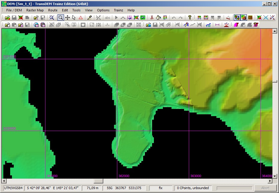
You will notice the seam. It would need smoothing.


