300 miles too long or 300 years too soon
Posted: 19 May 2014 04:21
The Carson and Colorado narrow gauge line ran 300 miles through the Nevada and California deserts. Built by the same people that controlled the Virginia and Truckee, the intent was for the C&C to be a feeder line to the V&T; capturing the rich ores in Nevada and California. However, it was not to be, and after years of losses, the V&T sold the line to the Southern Pacific - just months before a major ore strike along the line.
Because of it's size, it wasn't possible to create this line before. 300 miles of terrain overwhelmed the 32-bit TransDEM, and the file sizes were too much for pre-TS12 to load. But now, it can be done!
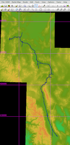
The DEM files for the route are 4.6GB, and the route loaded into Trainz is just shy of 1GB.
The track was imported in to TrainsDEM via .kmz files from Andrew Brandon ( http://www.pacificng.com/ ), and the terrain is from MS Ortho photos (Google kept kicking me off after 6 files ;-P )
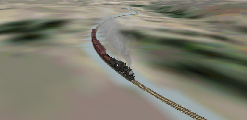
It's amazing what can be done with just a few evenings work!!
Now, detailing the line will take a lifetime, but hey; let's not worry about details like that....
Thanks, Dr. Ziegler!
Curtis
Because of it's size, it wasn't possible to create this line before. 300 miles of terrain overwhelmed the 32-bit TransDEM, and the file sizes were too much for pre-TS12 to load. But now, it can be done!
The DEM files for the route are 4.6GB, and the route loaded into Trainz is just shy of 1GB.
The track was imported in to TrainsDEM via .kmz files from Andrew Brandon ( http://www.pacificng.com/ ), and the terrain is from MS Ortho photos (Google kept kicking me off after 6 files ;-P )
It's amazing what can be done with just a few evenings work!!
Now, detailing the line will take a lifetime, but hey; let's not worry about details like that....
Thanks, Dr. Ziegler!
Curtis