Open Street Map
Posted: 09 Mar 2012 14:11
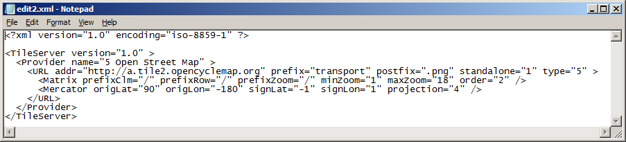
Here are the settings to access the "Transport Map" rendering for Open Street Map data:
Copy the following code section into a text editor, save as an xml file and import into TransDEM with the Map Tile Client / Settings.
It replaces "Other 2" which was no longer working.
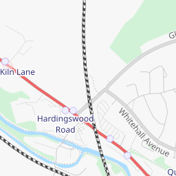
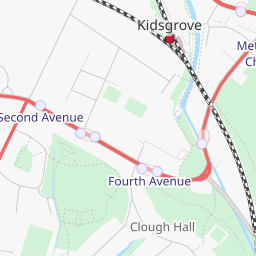
Standard vs Transport:


Copy the following code section into a text editor, save as an xml file and import into TransDEM with the Map Tile Client / Settings.
It replaces "Other 2" which was no longer working.
Code: Select all
<?xml version="1.0" encoding="iso-8859-1" ?>

<TileServer version="1.0" >
  <Provider name="5 Open Street Map" >
    <URL addr="http://a.tile2.opencyclemap.org" prefix="transport" postfix=".png" standalone="1" type="5" >
      <Matrix prefixClm="/" prefixRow="/" prefixZoom="/" minZoom="1" maxZoom="18" order="2" />
      <Mercator origLat="90" origLon="-180" signLat="-1" signLon="1" projection="4" />
    </URL>
  </Provider>
</TileServer>