Garry,
LISTmap isn't a map tile system. There could be a WMS behind it, but that's hidden from us.
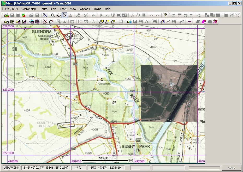
However, the map viewer is fairly easy to use with 3+1 point georeferencing. Coordinates are MGA/GDA94, zone 55, by default. For our purposes, MGA/GDA94 is the same as UTM/WGS84. The maps in the viewer bear a 1000m grid (unless you switch it off). With the coordinate display in the map viewer status bar you should have all the information required. Don't forget to click "Southern Hemisphere" for the fist map clipping. From the second clipping onward and as long as you do not change map viewer scale, you will only need the first point for each clipping, usually a grid line intersection near the SW corner, because TransDEM remembers the other transformation parameters.
Georeferenced LISTmap clipping with orthophoto overlay from Virtual Earth /Bing Maps:
 Regarding OSM, that's mostly up to us as users and contributors. For Madagascar, a fellow traveller and I have completed the railway network in the last few weeks, based on our GPS track logs and observations. I'm now diving into my archives of two other trips a few years ago, to Eritrea and Burma, also with useful and usable GPS data.