Any chance of the Support for the new Australian 2020 Geo Standards in TransDem?
Some Servers have removed their 94 Standard content. Since I came back on the scene.
Japan also has its own GIS servers, It seems that the DEM format is not supported either. I would be interested in using that Japan data, to create something..
Chris.
Australia GDA and Grid 2020? (plus Japan)
-
chrisj2110
- Posts: 12
- Joined: 08 Jun 2013 21:59
- Location: Maribrynong, Victoria, Australia.
Re: Austrailia GDA and Grid 2020?
I would need a few links to the geo data servers in question.
-
chrisj2110
- Posts: 12
- Joined: 08 Jun 2013 21:59
- Location: Maribrynong, Victoria, Australia.
Re: Austrailia GDA and Grid 2020?
The Queensland QTopo is in 1:25000 and are downloadable free of charge, It is now in GDA 2020 It is GeoPDF. and is Creative commons located here: https://qtopo.information.qld.gov.au/geophil wrote:I would need a few links to the geo data servers in question.
And the official The Japan one, You will need Google Translator. That one is here: https://www.gsi.go.jp/ENGLISH/page_e30030.html
(they have some of the site in English now, Since I last used it, Which is useful.)
The Datum is Japanese Geodetic Datum 2011 JGD2011 for the Japan stuff.
Chris.
Re: Austrailia GDA and Grid 2020?
It's one of those things with the tectonic plates slowly shifting and in Japan also the earthquakes.
I looked at GDA2020 and they say it's about 1.6 m average shift compared to GDA94. For the other plates and geodetic datums I just ignore this for TransDEM purposes. For really large scale it's much more complicated. But even with our simplified conversion, spatial reference systems with GDA2020 have new EPSG codes which TransDEM is not yet aware of.
Where did you find the Japanese DEM server and what are the formats and spatial reference systems on offer?
I looked at GDA2020 and they say it's about 1.6 m average shift compared to GDA94. For the other plates and geodetic datums I just ignore this for TransDEM purposes. For really large scale it's much more complicated. But even with our simplified conversion, spatial reference systems with GDA2020 have new EPSG codes which TransDEM is not yet aware of.
I tried one the 1:10000 maps and TransDEM opens them but asked for the coordinate system. I entered UTM/WGS84, zone 55, southern hemisphere and it worked. But I will add the new EPSG codes, nonetheless.chrisj2110 wrote:The Queensland QTopo is in 1:25000 and are downloadable free of charge, It is now in GDA 2020 It is GeoPDF. and is Creative commons located here: https://qtopo.information.qld.gov.au
JDG2000 and JGD2011 have a similar relationship as GDA94 and GDA2020. But TransDEM doesn't know either. There was no demand, apparently.And the official The Japan one, You will need Google Translator. That one is here: https://www.gsi.go.jp/ENGLISH/page_e30030.html
(they have some of the site in English now, Since I last used it, Which is useful.)
The Datum is Japanese Geodetic Datum 2011 JGD2011 for the Japan stuff.
Where did you find the Japanese DEM server and what are the formats and spatial reference systems on offer?
Re: Australia GDA and Grid 2020? (plus Japan)
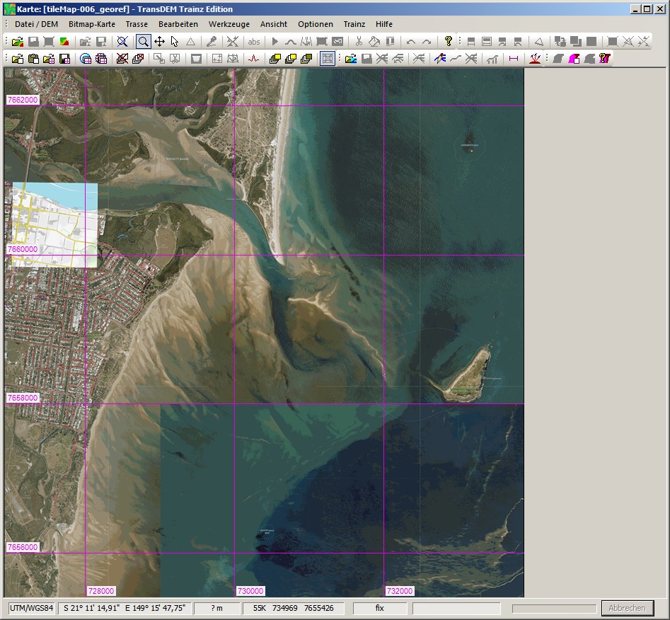
I have modified added some code and the QLD GeoPDFs seem to work in my lab environment, including the neat line, with an Open Topo Map inlay:

As I said, for TransDEM purposes I treat GDA2020, GDA94 and WGS84 as equivalent.
Japan is more of a challenge. Is this the site you were referring to: https://fgd.gsi.go.jp/download/menu.php ?
I managed to register myself there, with the help of online translation, and then downloaded some 5m DEMs. The data format is rather simple, it's an XML dialect called GML. But it will need new code as I didn't come across that before. The geo data encoding looked more complicated but that might not be the case. What confused me at first is that they say it's 5m data but apparently encoded as Plate carrée arc secs. If that's the case - I will only know once I have implemented the new file format - then it will be easy. It will take a while, though.