Thought Id share a little of what Im using TransDEM for. The route I got it for has expanded a little thanks to it... the tool is easy enough to plan for that I think I can make a bit more than I planned to!
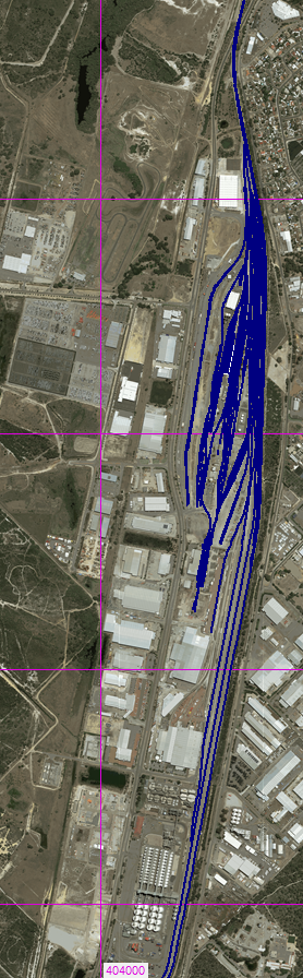
I started out intending just to create the yards at Kewdale, Perth. Then I thought, this is easy enough... perhaps expand it to include Forrestfield as well (the two are about as close as two different yards can be and still be called two different yards).

The vector data for the vertical upper section (Forrestfield, the horizontal lower part is Kewdale) is not yet complete, but already I think that is a lot of track. Is there a tool that can tell me the total length described by the polylines? I am curious as to how long it is... certainly tens of kilometers.
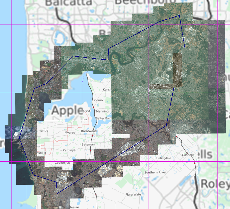
Anyway, this too has been pretty easy going, so I thought... why not make it from being just a yard, to be a route to a destination as well? First problem is, most of the traffic through here is going to Sydney, Adelaide and Melbourne... and I dont think Trainz can handle 6,000 km of track in a route. As cool as that would be! But then I thought, Fremantle Port is nearby, and is also a common destination for 'hook and pull' from here. So the scope has expanded further:

Laying some very basic vector data over the OSM raster, and pulling map tiles, I can get orthoimagery for the route as a base too:
Probably the hardest part of the prep stage is going to be getting the LiDAR DEMs and stitching them together for the route, I guess. Will be great to see the output for getting started in Surveyor!