Another example of GeoPDF and DEM, this time for an area, we usually regard as being flat: Chicago. We set our project in the 1940s, in railroad heyday.
One of the misconceptions about DEMs is that they are good for mountainous regions but too much of a hassle for the plains. If we want to see the wider picture, however, we need to understand that DEMs are just one aspect of something we call geospatial data or geo data in short. Geo data is about digital cartography. And taking and processing geo data is a way of transferring the real world to a Trainz route, taking advantage of standardized and automated mapping methods. That's what TransDEM does. This includes DEMs, raster maps and vector maps.
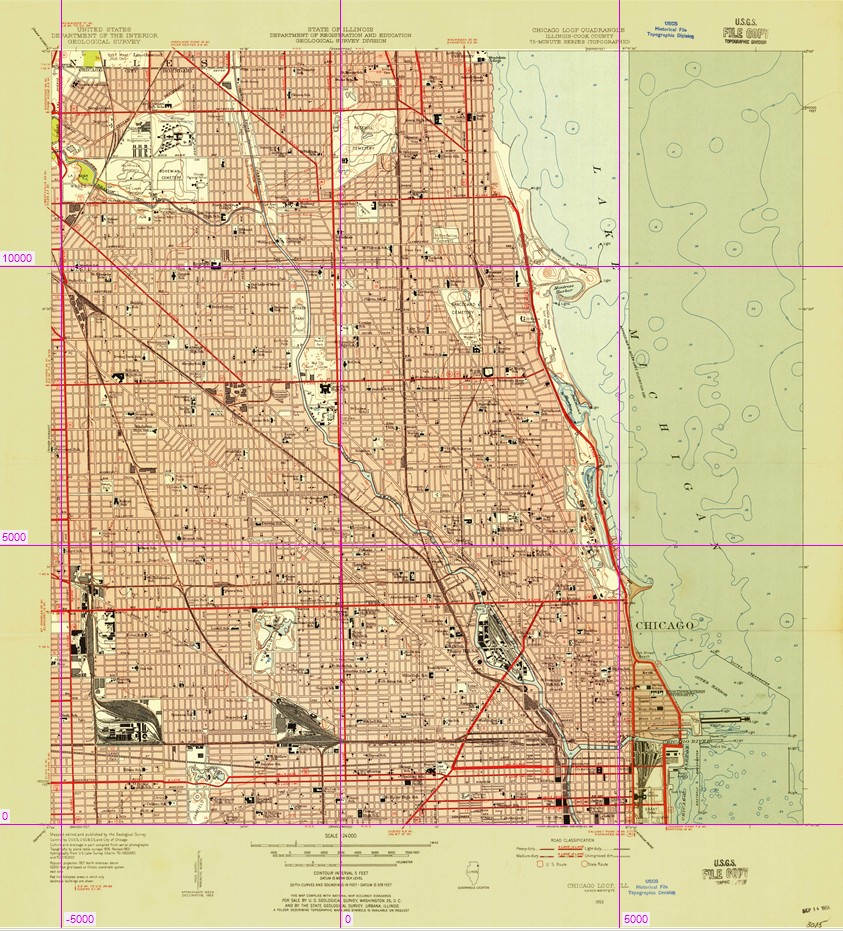
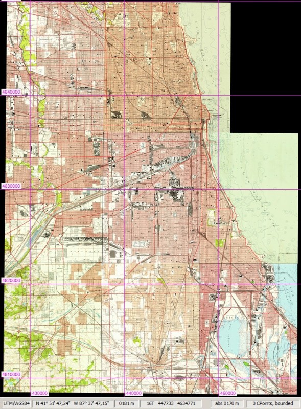
Coming back to Chicago, we should have a look at easily available geo data to assist us. One of the role of the United States Geological Survey is that of a mapping agency, and as such, it has provided excellent topographic maps for more than a century. Recently, many of the historic paper maps have been digitized and are now offered for free download, in a format called GeoPDF.
Brand new TransDEM 2.4 can read these historical maps (with the help of GDAL utilities). GeoPDF files include geo coordinates which make the old paper maps appear as "geo-referenced". This speeds up the process, as each map sheet will be correctly scaled and positioned just by importing it into TransDEM.
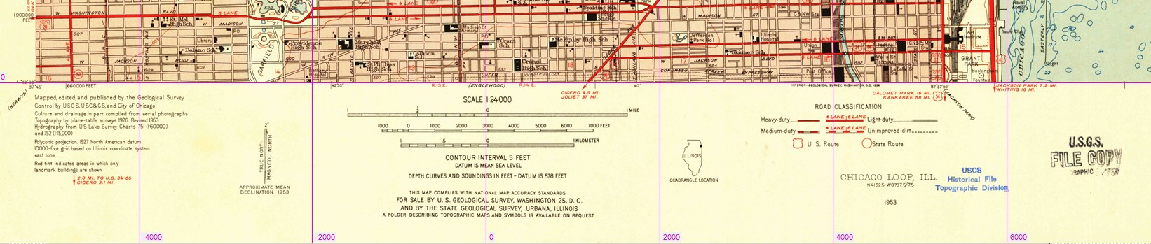
I checked the Chicago area for the 1940s and found the 1953 edition which is closest. I downloaded 8 map sheets, each 7.5 min and 1:24,000 scale. One map sheet, Chicago Loop, is a bit wider and extends into Lake Michigan, saving an extra sheet.
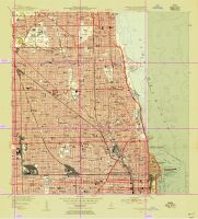
The GeoPDF maps come with a so-called neat line which marks the map frame. It is pre-set at 7.5 arc min for this map as well (see semi-transparent pale yellow collar) but can easily be adjusted.
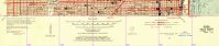
Looking at the legend at the bottom, we find that this is indeed the 1953 edition and that the map projection is polyconic (which is
iconic and unique to USGS topo maps). The geodetic datum is North American 1927. TransDEM 2.4 should understand it all.
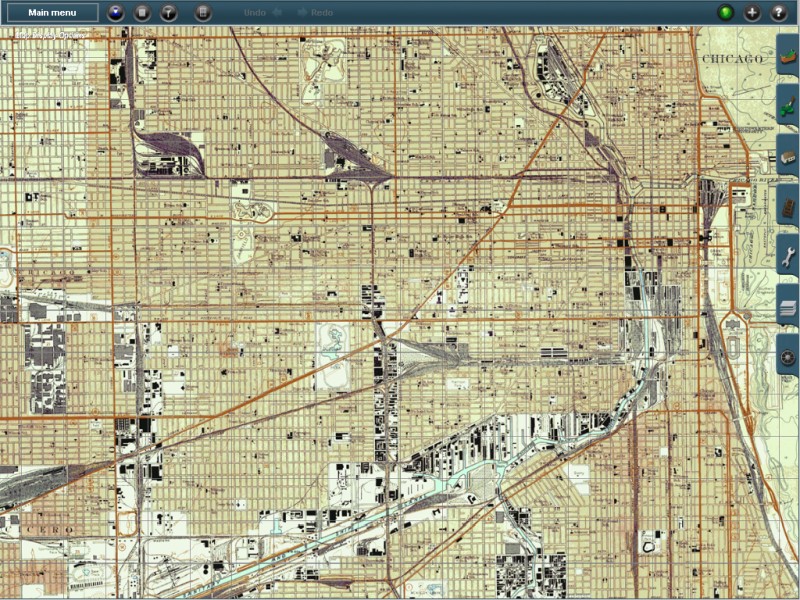
As each of the 8 map sheets is cut and positioned automatically, they can be combined by simply loading one after the other.
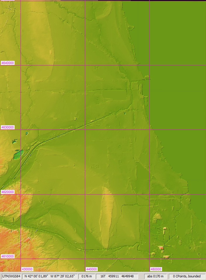
Unfortunately, there is no historical elevation data and we have to get on with present day data. I went for 1/3 arc sec. They say it's flat and you don't need need a DEM. But we'll find it's not completely true. There are hillocks, there are water courses, there's the lake. Why do the terrain shaping ourselves, when the good people at USGS already accomplished this for us?

Now we transfer everything to Trainz and can easily find our way around. The advantage of geo data in Trainz is clearly visible: A mile is a mile. It's all to scale, automatically.
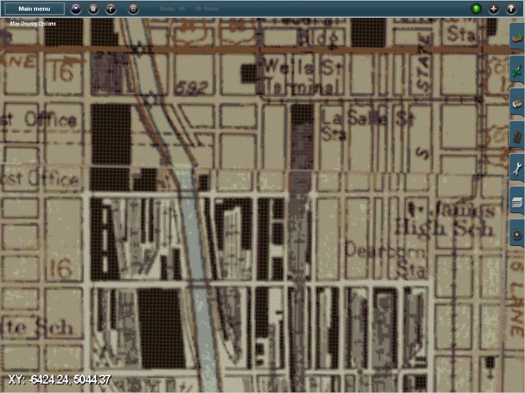
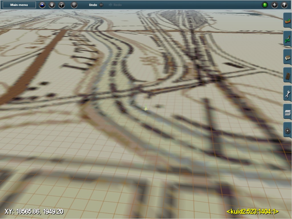
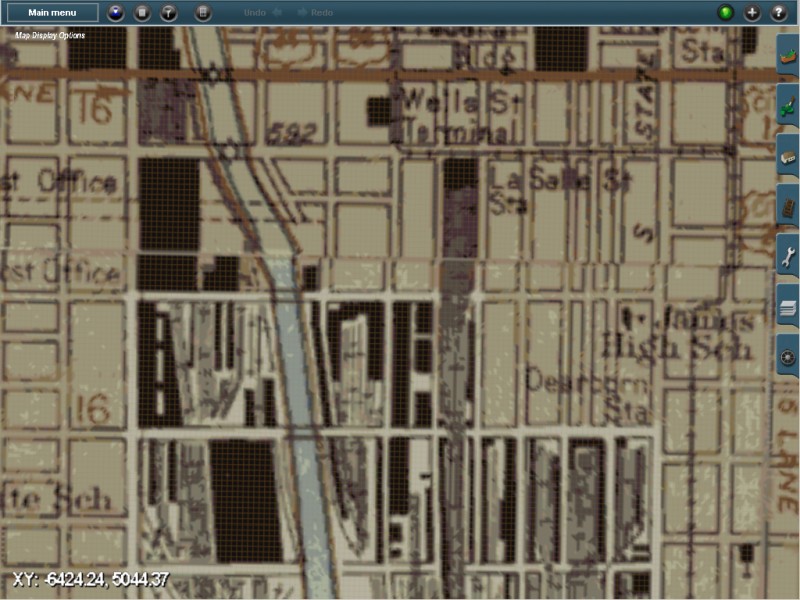
Let's zoom in to the Loop and La Salle St and Dearborn Stations in the early 50s:
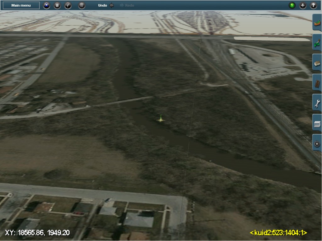
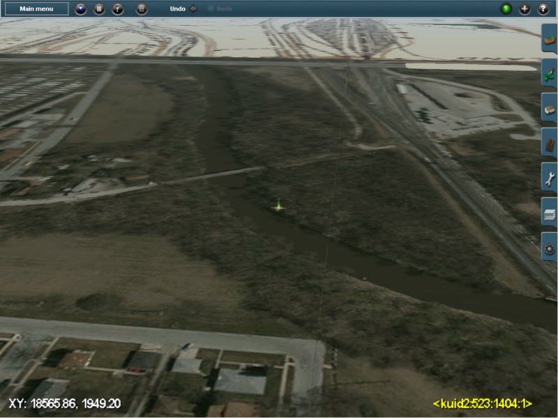
Or to the Blue Island area and the Little Calumet River. The DEM has already formed our river bed. One of the many railroad yards seen in the background.

Need more detail than provided by the topo maps? Add ortho-images. Unfortunately these are present day again. USGS has a historical collection here, too, but very few have been georeferenced so far.
All this was created in less than one hour, and you spend most of the time waiting for the geo data to download or TransDEM to process the data. You can watch and relax and enjoy your coffee or your cold beer.