MikeBr wrote:
Can anyone point me to some code that translate lat/lon to WGS84 format.
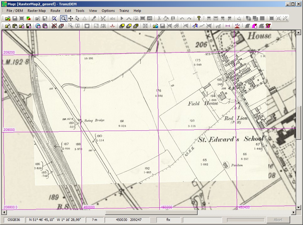
That's actually rather straightforward because manual (or more precisely semi-manual) georeferencing is built into TransDEM.
Go through tutorial 1 in the TransDEM main manual, from page 118 in the current edition, to get the idea and some hands-on experience.
Then take your browser screenshot (Alt+Print), preferably in full screen mode, paste into TransDEM (Ctrl+V), draw a rectangular mask to get rid of non-map margins. Save the mask for later use (Ctrl+M, or Tools | Edit Rectangular Mask) by assigning a name to it. Crop to the mask (Shift+C).
In the View menu set the coordinate system to OSGB36. Start georeferencing as in the tutorial. Find an identifiable map point in the browser map. Check the coordinate values, browser bottom right. You will need the second row. These are the full O/S grid coordinates. Locate the same point in TransDEM for coordinate input. Enter the values. Repeat for point 2 and 3. Proceed as in the tutorial.
For the next map screenshot retrieve the clipping mask with Shift+M (provided you did not modify dimensions).
Needs a bit of practice but there are shortcut keys for most steps to minimize mouse movement. Best with two monitors.
25 inch on top of 6 inch map (
proof of concept):