The NetherlandsHi-res terrain models free to download via ESRI/ARCGIS.
The data is named Actueel Hoogtebestand Nederland, versie 4
https://hub.arcgis.com/maps/esrinl-cont ... -1/exploreThere is 50cm and 5m data, as terrain model DTM and surface model DSM.
Format is GeoTIFF, in Dutch coordinate system RD, TransDEM 2.6.7 required.
Unlike many other DTM resources, the Dutch DTM (and to a limited extent the DSM as well) does not fill in missing values. In particular, the DTM shows all buildings as holes.
If you want to fix this in TransDEM, you can with the integrated tool, but I recommend the 5m data for this, as the fill algorithm may not be able to cope with the relatively large holes in 50cm resolution. Afterwards, you can fill the 50cm DTM with the hole-free 5m DTM.
I have played around with the 50cm DSM. Apparently the data was collected in summer time, all trees show lost of foliage.
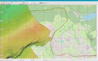
Example Aachen Three Corners Point with the small commercial fun park on the Dutch side, featuring the labyrinth with its hedges and a well shaded car park:

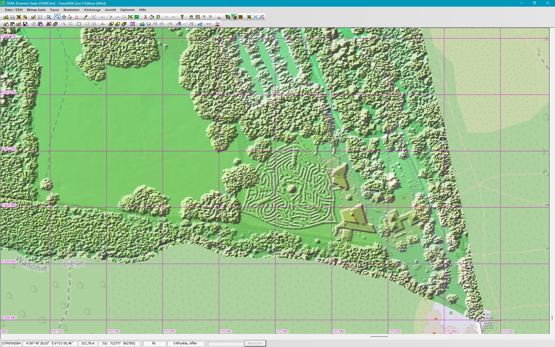
Example Heerlen railway station. The DSM includes catenary gantries and poles, parked train sets and more:
This illustrates that DSMs are no really suited for route building, DTMs should be preferred.
Belgium/Wallonia(I haven't checked Flanders.)It's a bit complicated, terrain models are free, but you need to register and also explicitly apply for a license where you have to give a purpose for wanting the data. You will be granted a license key which will come with an expiry date.
The portal:
https://geoportail.wallonie.beRelevant for route building is the 50cm DTM:
https://geoportail.wallonie.be/catalogu ... 09278.htmlI ordered my test data by selected districts. Be aware, if you combine several in one order you will get a single huge download file.
Format is GeoTIFF, in new coordinate system Belge Lambert 2008, TransDEM 2.6.7 required.
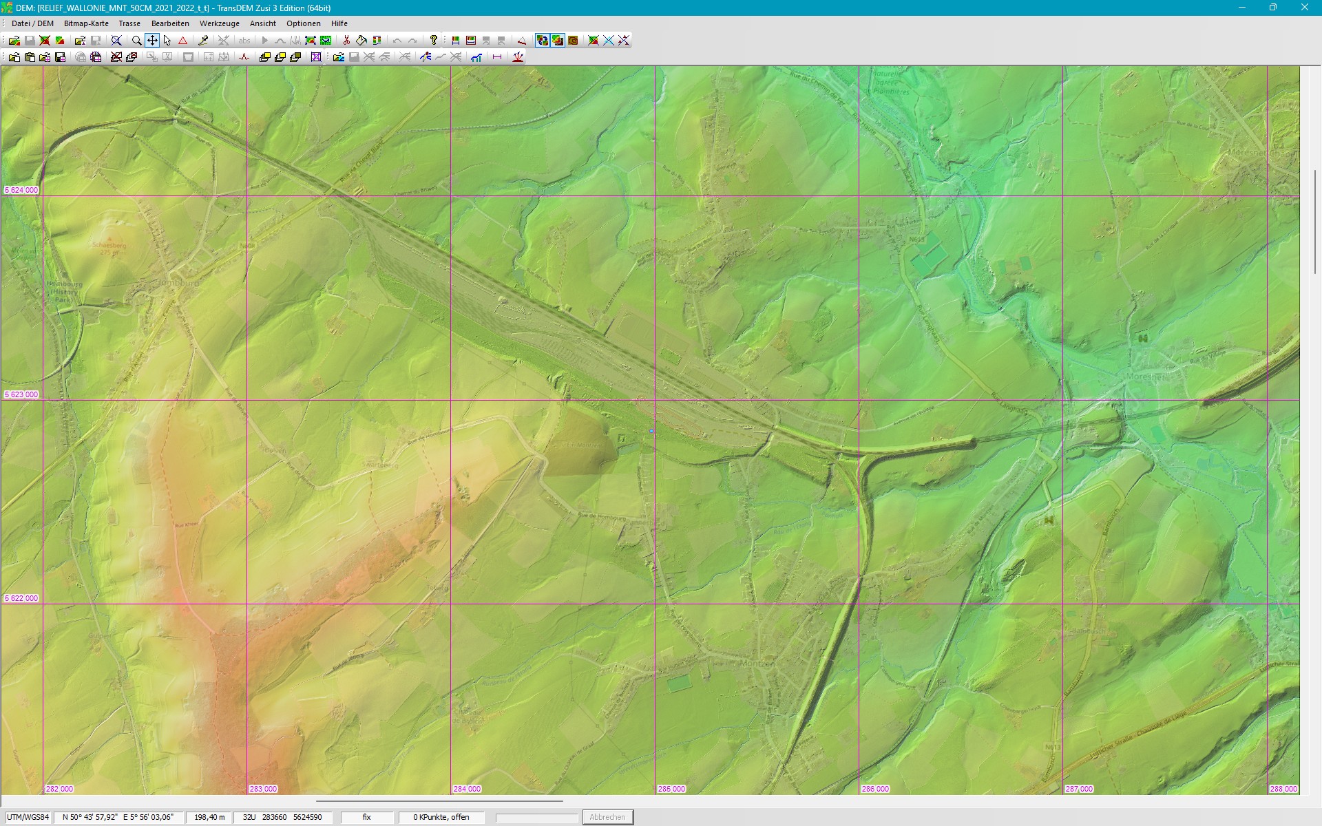
Example Montzen yard and Moresnet viaduct (Ligne 24), Hombourg station (museum, former Ligne 38), link to Welkenraedt (Ligne 39) and ramins of other branches of former Ligne39 to Plombières and La Calamine:

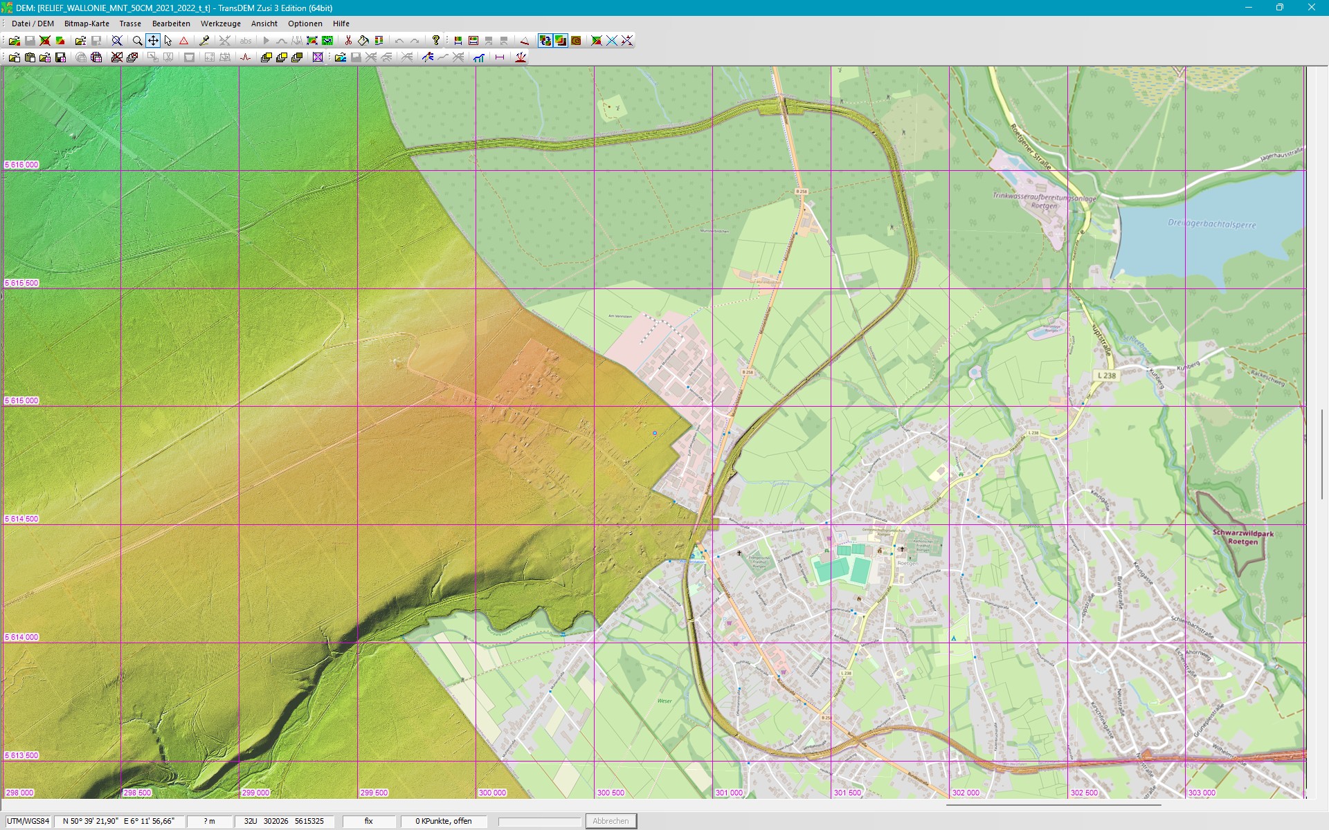
Example Vennbahn curiosity (former Ligne 48). Became Belgian territory after World War I and remained so, even as its original Prussian military purpose is long since history, and NATO usage during the Cold War also gone. The railway line no longer exists. Today, it's a cycling path. Here passing Roetgen, south of Aachen: