TransDEM Forum https://forum.transdem.de/ |
|
How to convert scanned maps to DEM's exportable to Trainz? https://forum.transdem.de/viewtopic.php?f=7&t=599 |
Page 1 of 1 |
Author: | Nictrain123 [ 27 Mar 2021 04:16 ] |
Post subject: | How to convert scanned maps to DEM's exportable to Trainz? |
Howdy. I'd like to ask how you can convert simple maps into DEM maps with actual elevation points that you can be able to convert into Trainz. The map in particular I am referencing to is as linked. 
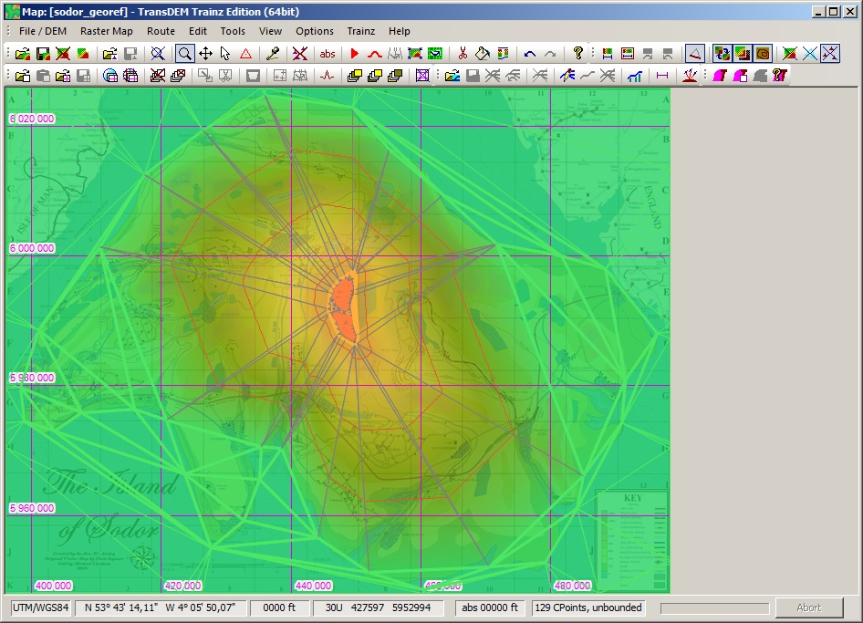
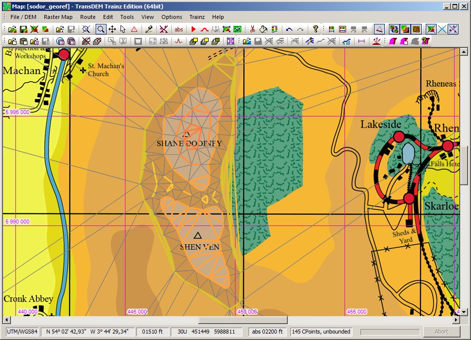
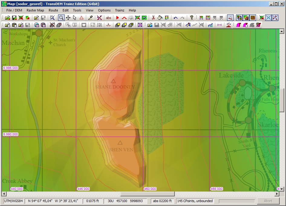
Now you can judge me all you want on the map in question, but this is a project that's partial to my childhood that I'd really like to do: to picture Sodor as a real place of the British Isles, more than just a land of talking trains as the creator Rev. W. Awdry had intended. For that I'd like to know how I can be able to import this map into TransDEM with an actual DEM elevation based on the topography and scale the map is pictured in with real figures Awdry gave, so I can have a fully accurate, properly scaled Sodor map to work with in Trainz. I have talked to someone I know who tried a similar project to this before, and what he said to do is to georeference the map to the right location with adding control points to the contours so that TransDEM can be able to create a Digital Elevation Model from the map, but the georeferencing points tab is rather tricky. Whereas it works with north/east for example, the coordinates I need to point Barrow-in-Furness railway station and Castletown railway station from what I looked up need to be north/west. How exactly do I work the values into TransDEM so that they're readable by the program? Might anyone be able to help me out by telling me how to convert this map properly into a DEM? Any advice, tips or tricks would be very much appreciated! |
Author: | geophil [ 27 Mar 2021 10:26 ] |
Post subject: | Re: How to convert scanned maps to DEM's exportable to Train |
It's doable. Firstly, the georeferencing. It needs a reference point and scale. If you want to put it in the Irish Sea, I suggest to pick a point using real world data. You could use OpenStreetMap or OpenTopoMap (via the map tile client), obtain a map clipping of the Irish Sea and decide on a single point in UTM coordinates for the south west corner of your fictitious map. Then scale. Your map has a scale legend. It seems the grid line raster is about 7.5 km. Use 3+1 point georeferencing in TransDEM. Start with the lower left corner 1-2/K-J, your south west point. Enter your UTM coordinate point from the Irish Sea. Next is the top right corner, the NE point. 12-13/B-A. That's 11 grid lines to the east and 9 grid lines to the north, or 11 * 7.5 km / 9 * 7.5 km. Add these to the SW point coordinates and you get your NE point in UTM coordinates. Enter those coordinates. Next is the SE point. The generated presets should be ok if you did the other two correctly. Same for the last one, the NW point. Finalize the georeferencing, save the georef map. Secondly the elevations. You have to build your own DEM here. You do that with the triangular network. Switch on the "emphasize contour lines" option. Use the map legend and map coloring as your guide. As the elevation on you map appear to be in ft, change the global settings in TransDEM accordingly. Then place your control points. It will take a while. Save your work often. Process the control points to create your DEM. Add more control points or adjust control points until your DEM reflects the map. You may want to do tutorial 9 from The TransDEM main manual first. It illustrates a similar task. |
Author: | Nictrain123 [ 28 Mar 2021 06:45 ] |
Post subject: | Re: How to convert scanned maps to DEM's exportable to Train |
geophil wrote: It's doable. Firstly, the georeferencing. It needs a reference point and scale. If you want to put it in the Irish Sea, I suggest to pick a point using real world data. You could use OpenStreetMap or OpenTopoMap (via the map tile client), obtain a map clipping of the Irish Sea and decide on a single point in UTM coordinates for the south west corner of your fictitious map. Then scale. Your map has a scale legend. It seems the grid line raster is about 7.5 km. Use 3+1 point georeferencing in TransDEM. Start with the lower left corner 1-2/K-J, your south west point. Enter your UTM coordinate point from the Irish Sea. Next is the top right corner, the NE point. 12-13/B-A. That's 11 grid lines to the east and 9 grid lines to the north, or 11 * 7.5 km / 9 * 7.5 km. Add these to the SW point coordinates and you get your NE point in UTM coordinates. Enter those coordinates. Next is the SE point. The generated presets should be ok if you did the other two correctly. Same for the last one, the NW point. Finalize the georeferencing, save the georef map. Secondly the elevations. You have to build your own DEM here. You do that with the triangular network. Switch on the "emphasize contour lines" option. Use the map legend and map coloring as your guide. As the elevation on you map appear to be in ft, change the global settings in TransDEM accordingly. Then place your control points. It will take a while. Save your work often. Process the control points to create your DEM. Add more control points or adjust control points until your DEM reflects the map. You may want to do tutorial 9 from The TransDEM main manual first. It illustrates a similar task. Okay, I believe I've done the georeferencing part okay, but I can't find the "emphasize contour lines" option in TransDEM and the "Create control points" button is unclickable. How would I be able to activate it once I've opened the georeferenced Sodor map I saved? |
Page 1 of 1 | All times are UTC + 1 hour |
Powered by phpBB® Forum Software © phpBB Group http://www.phpbb.com/ |