Try Open Street Map:
| TransDEM Forum https://forum.transdem.de/ |
|
| Where and how to for Queensland Trainzdem https://forum.transdem.de/viewtopic.php?f=7&t=484 |
Page 1 of 2 |
| Author: | jake_druery [ 26 Feb 2017 10:56 ] |
| Post subject: | Where and how to for Queensland Trainzdem |
Hi everyone, I have been attempting to create the Redcliffe and Springfield lines in SEQ for TANE. I am unable to find raster or vector maps to go with the DEM. Any help is greatly appreciated. Cheers, Jake |
|
| Author: | geophil [ 26 Feb 2017 12:30 ] |
| Post subject: | Re: Where and how to for Queensland Trainzdem |
Try Open Street Map:
|
|
| Author: | jake_druery [ 27 Feb 2017 12:23 ] |
| Post subject: | Re: Where and how to for Queensland Trainzdem |
Hi geophil, As I am completely new can you point me in the right direction to get this set up? Cheers, Jake |
|
| Author: | geophil [ 27 Feb 2017 12:39 ] |
| Post subject: | Re: Where and how to for Queensland Trainzdem |
Do tutorial #7 in the TransDEM main manual. It will show you the concept of Map Tiles and provide first hands-on experience. Map tiles are the quickest way to obtain raster maps. This tutorial is also recommended in the TransDEM Quick Start Guide. |
|
| Author: | jake_druery [ 01 Mar 2017 11:14 ] |
| Post subject: | Re: Where and how to for Queensland Trainzdem |
Hi geophil, I also notice that you have a transport layer set up as well, I tried to add a map layer but got stumped trying to add it. If you could assist me in setting that layer, i would be over the moon as this will the the main layer for my use. Thanks Jake |
|
| Author: | geophil [ 01 Mar 2017 13:24 ] |
| Post subject: | Re: Where and how to for Queensland Trainzdem |
It's all preconfigured. Once you have imported the "sample settings" xml file, you will have all the providers and all the tile types at your disposal. They may not all work, but Open Street Map / Transport should. You simply select the tile type from the drop down box. Another very nice rendering for Open Street Map is Open Topo Map, but that's hosted by a slow server with occasional down times. |
|
| Author: | jake_druery [ 03 Mar 2017 11:19 ] |
| Post subject: | Re: Where and how to for Queensland Trainzdem |
Hi Geophil, I am unable to get the WMS sample pack to read correctly. Could that be the reason as to why I am unable to access the transport map? On another note, i am unable to properly get a raster map for the Springfield route as it seems to cut the main part of the route that travels down the Centenary Highway. Your help is greatly appreciated, Jake |
|
| Author: | geophil [ 03 Mar 2017 12:42 ] |
| Post subject: | Re: Where and how to for Queensland Trainzdem |
The "Sample Settings" package has two xml files. One is for WMS, the other for Map Tiles. While both represent web services and offer related functionality, they have completely different parameters. So, the WMS xml settings will only work with the TransDEM WMS client and the Map Tile xml settings only with the Map Tile client. And we are concentrating on Map Tiles here. Have you been able to successfully complete the Map Tile tutorial, #7, from page 143 in the TransDEM main manual (current edition 2.6)? If yes, you should find a number of "providers" in the "Map Source" fields and a number of different "Tile Types" for many of the providers. Is that the case? jake_druery wrote: On another note, i am unable to properly get a raster map for the Springfield route as it seems to cut the main part of the route that travels down the Centenary Highway. You can select the size of each tile in the map tile client, from 512 pixels to 2048 pixels. You can and usually will acquire more than a single tile. The easiest way is to let TransDEM handle that, via the "Map images along a path" feature. Have a look at tutorial #7, it illustrates the method step-by-step. |
|
| Author: | jake_druery [ 04 Mar 2017 13:36 ] |
| Post subject: | Re: Where and how to for Queensland Trainzdem |
Hi geophil, I have completed the tutorial, I also have seen the 5 providers that are there and none of them have had a transport specific map tile. On the Springfield note the problem is that I go on the WMS for the raster map and it does not give me the same area that I click get map on, it seems to give me an area one tile over and it does the same with more pixels and further zoomed out, it also does the same with different servers. Your help is greatly appreciated, Jake |
|
| Author: | geophil [ 04 Mar 2017 16:41 ] |
| Post subject: | Re: Where and how to for Queensland Trainzdem |
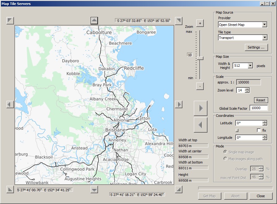
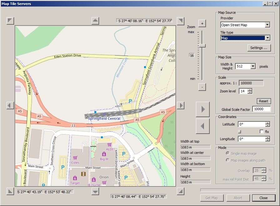
jake_druery wrote: I also have seen the 5 providers that are there Only 5? If you imported "Map Tile Sample Settings Oct 2016.xml", as attached to the delivery email and also available on my website, you should have 12 providers. And as you can see from the screenshot, "Transport" is a tile type for "Open Street Map". Note: If your provider names start with a number, you may have an older version of the settings. For TransDEM 2.6 and a recent settings file, you shouldn't see any numbers in the provider name.jake_druery wrote: On the Springfield note the problem is that I go on the WMS for the raster map and it does not give me the same area that I click get map on, it seems to give me an area one tile over and it does the same with more pixels A WMS for Queensland? We're still talking Map Tiles, I think. In the Map Tile client, the preview window is always 512 x 512 pixel. Each map tile is 256 x 256 pixel, so the preview will show 4 tiles combined. For downloading you set the actual size to a value between 512 and 2048 pixel. I most often use 1536. A size of 2048 pixel will download 64 tiles and merge them into one image, 1536 pixel will download 36 tiles and 1024 pixel will get 16 tiles. (This is internal behaviour.) If you are missing areas you also would like to have, just reposition the preview window, use the big arrow button pointing right and download the next image. Or, if you followed the tutorial and have an underlying overview map in a smaller scale, zoom in in the main window and position the map centre (there is that small round indicator in magenta and cyan). The Map Tile client will automatically follow that position. If you did tutorial #7 you will have already have these functionality. If you are unsure, repeat the tutorial. It sometimes takes more than run to completely understand how TransDEM handles this. |
|
| Page 1 of 2 | All times are UTC + 1 hour |
| Powered by phpBB® Forum Software © phpBB Group http://www.phpbb.com/ |
|