Interesting, a metric grid on a British map in WW I. Under French influence? Regrettably, I don't have any background information here. As I said, I investigated on the WW II maps for Yugoslavia but never looked into WW I military cartography until now. But I have read Andrew Martin's crime novel "The Somme Stations" which tells us quite a bit about the Trench Railways. (The German counterpart was called "Heeresfeldbahn"). And I also had a glimpse or two at those maps on the NLS website.
Unfortunately, the map grid is unknown to TransDEM. But as the area in question is a rural one, with limited change to the watercourses and infrastructure over the last 100 years, I tried to use a modern map as a reference. This will always increase the error, so we better do it with smaller clippings. I downloaded a PDF screenshot of the SW corner of your map, about 3 x 2 km, and tried to georeference that, using Open Topo Map as the reference. (Open Topo Map is one of the more appealing styles for Open Street Map rendering.)
That's the result:
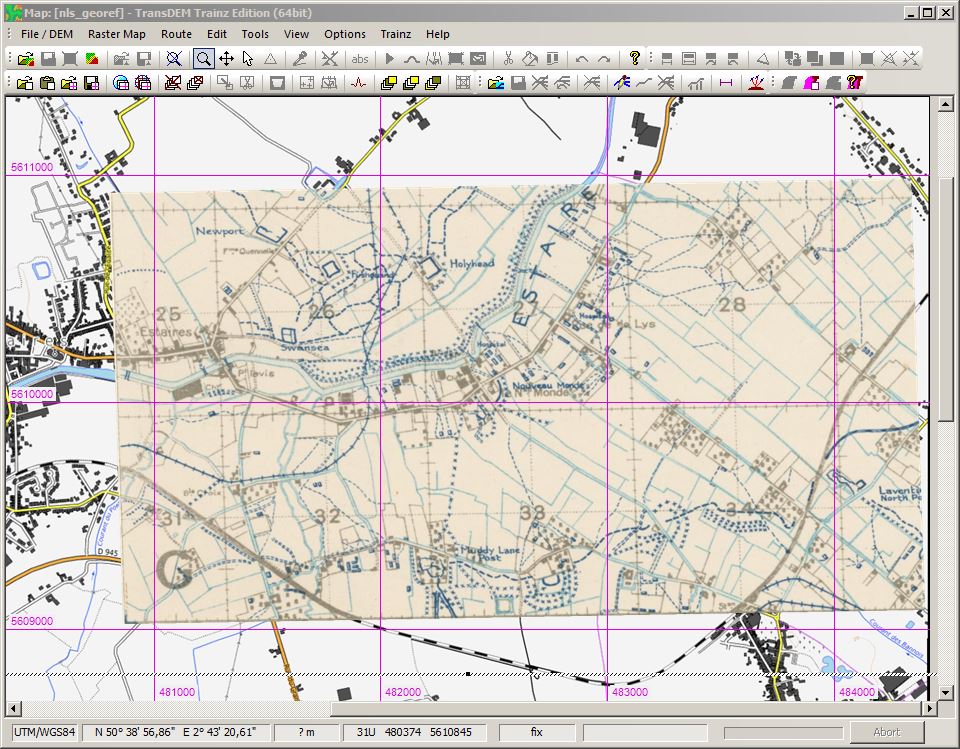
Not that bad, I'd say.
RJC0235 wrote:
also as a side note, congratulations on 1000 posts
Thank you. It probably comes with the "job". When running a product support forum, you are more or less expected to write a significant share of the posts.


