TransDEM Forum

TransDEM News, Support, Hints and Resources
It is currently 10 May 2024 22:14

All times are UTC + 1 hour


Post new topic Reply to topic  [ 3 posts ] 
Author Message
PostPosted: 16 Feb 2016 23:21 
Offline

Joined: 25 Jan 2013 20:19
Posts: 13
I seem to have a problem in georeferencing google earth images. I followed the steps in the "Tutorial 2: Google Earth™ and TransDEM" exactly. After getting the first few images georeferenced sucessfully, now it no longer works. When I import the image into TransDEM,
Quote:
4. Semi-automatic Georeferencing In TransDEM
...
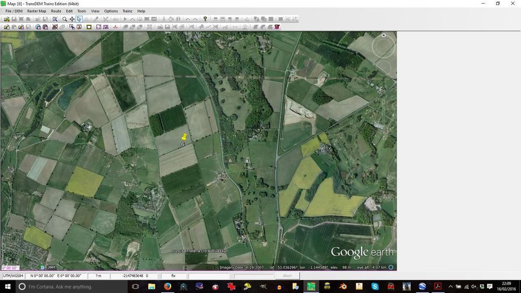
On success TransDEM shall draw a coordinate grid.

instead of the correct grid I now get just a single gridline on the lower edge of the image, labelled 0° 00’ 02”

Image

I'm using TransDEM V2.6.0.0 and Google Earth 7.1.5.1557

Any ideas what's different?


Top
 Profile  
 
PostPosted: 17 Feb 2016 01:06 
Offline

Joined: 20 Nov 2012 01:41
Posts: 65
David,

GeoPhil posted an update (Version 2.6.0.1) 3 days ago that may have specifically corrected this problem:

http://forum.transdem.de/viewtopic.php?f=3&t=399#p2180

Andrew


Top
 Profile  
 
PostPosted: 17 Feb 2016 10:54 
Offline

Joined: 25 Jan 2013 20:19
Posts: 13
Thanks, Andrew. I'd done a forum search, but I didn't see any other references to this problem - and I totally missed the upgrade... Will check it out later.

Edit: Problem solved, many thanks.


Top
 Profile  
 
Display posts from previous:  Sort by  
Post new topic Reply to topic  [ 3 posts ] 

All times are UTC + 1 hour


Who is online

Users browsing this forum: Ahrefs [Bot], Yandex [Bot] and 5 guests


You cannot post new topics in this forum
You cannot reply to topics in this forum
You cannot edit your posts in this forum
You cannot delete your posts in this forum

Search for:
Jump to:  

Imprint & Privacy

Powered by phpBB® Forum Software © phpBB Group