Let me get back to the basics first as I have the impression it is there where the problem is.
Let's assume we want to recreate the Belfast & County Down Railway. Fortunately there is a website:
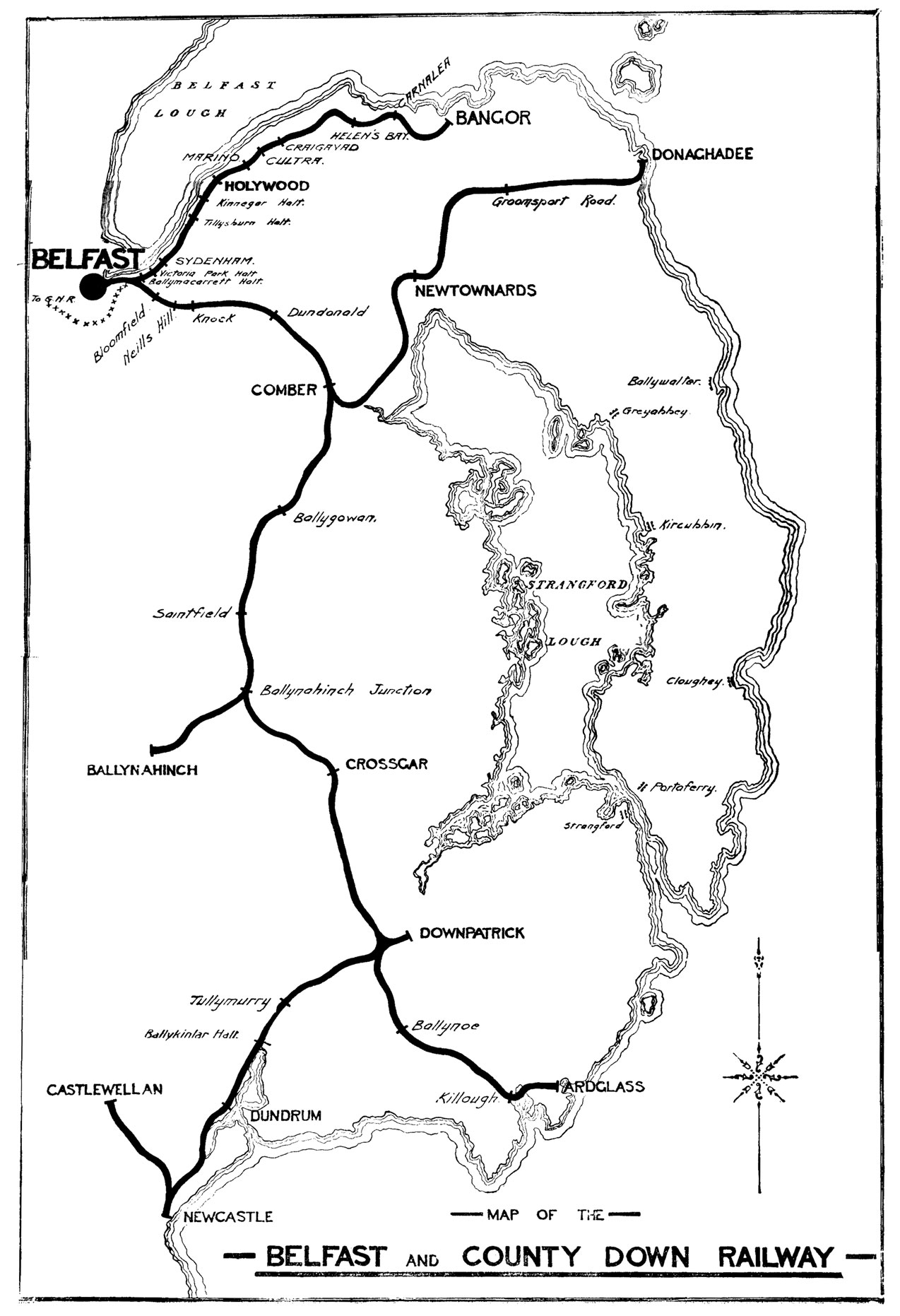
http://www.downrail.co.uk/history/index.htm. We are even more lucky as they offer a contemporary map of the railway:
http://www.downrail.co.uk/history/photos/BCDR/BCDRmaplarge.jpg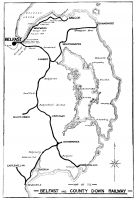
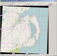
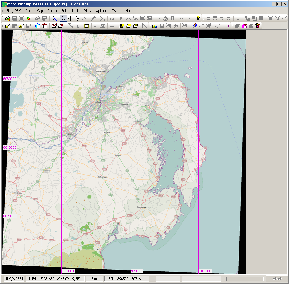
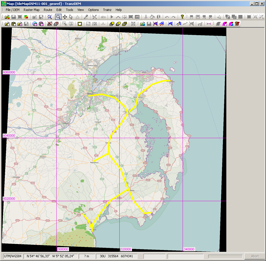
With the whereabouts now known we can start in TransDEM and an overview map. Easiest is a map tile service. I picked Open Street Map and went to zoom level 11, map size 1536 pixels. In TransDEM it will look like this:
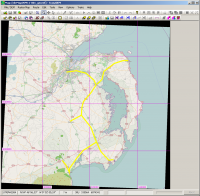
For the detailed maps, where we want the historical ones, we need a path. We have two options here. The quicker one is to roughly sketch the course of the former lines onto our Open Street Map clipping. It will be accurate enough. The slower one would be to georeference the old BCDR map and re-draw the line on top of that one. I'll show both.
This is my sketch on top of Open Street Map:
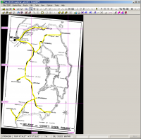
And this is my attempt to georeference the old map and draw upon that one. I used 3+1 corner georeferencing and entered the coordinates for Belfast, Donaghadee, and Newcastle which I obtained from my Open Street Map clipping I kept open in a separate TransDEM window.
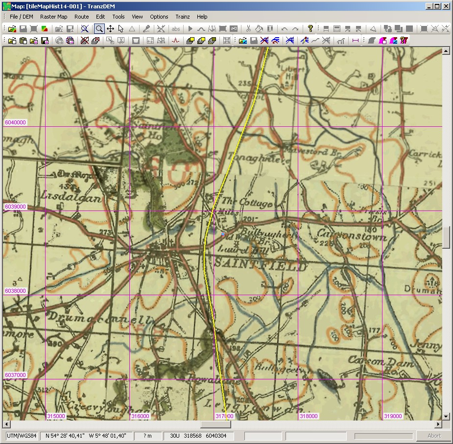
Now, either with the OSM overview map or with the original BCDR map and the path just drawn, I open the Map Tile client again and selected the historic 1:63,000 topographic map ("Historic Ireland"/"Other 1"). I left the map size at 1536 pixels, set the zoom level to 14 and started downloading along the path. The server is somewhat slow, so it will take a while.
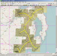
I zoomed in and retraced the railway, now at the detail level of the topographic map.
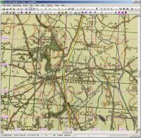
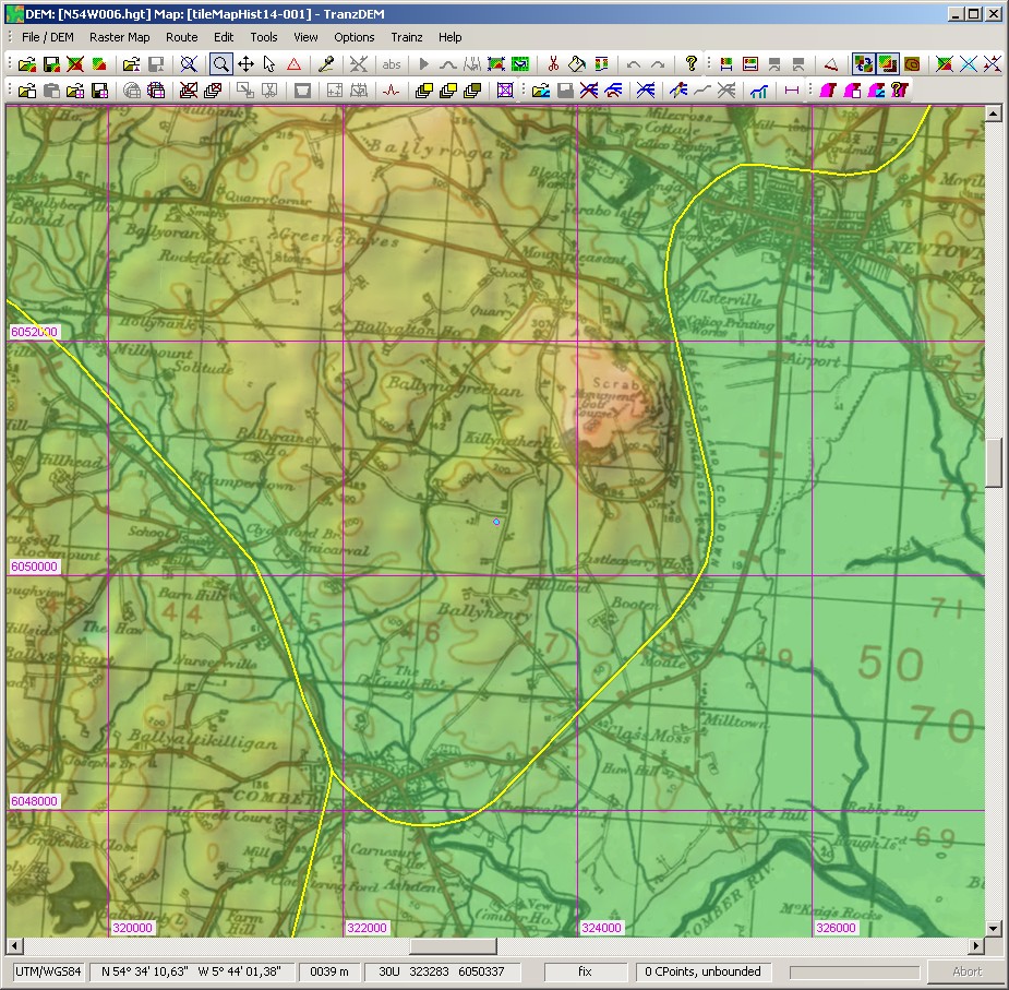
Finally I combined with the DEM (and zoomed in again for some hills and dales):

At this point we are ready to export to Trainz. We have a DEM, a topographic map at a suitable scale for ground textures and basic vector data to guide the export process.


