TransDEM Forum

TransDEM News, Support, Hints and Resources
It is currently 16 Apr 2024 09:39

All times are UTC + 1 hour


Post new topic Reply to topic  [ 6 posts ] 
Author Message
PostPosted: 10 Feb 2012 23:23 
Offline

Joined: 10 Feb 2012 06:25
Posts: 6
Okay I'm home now and I've found some time to fiddle with TransDEM. I figured out why the 'View' menu was disabled, and I've been reading the tutorials all over the place; I'm working on the second project I was referring to on the Auran forums(with the actual images as well as DEM), the LGV Mediteranée. Everything works fine apart from converting the geo-referenced Google maps to UTM. I think it has to do with the .kml/kmz placemark files, but I place them properly in Google Earth, along the line between the two ends, and then save them(placemark(s) 1-62), and open the corresponding placemark for each map image, but I can't save(Alt+S). In the status bar, after 'converting to UTM', it looks like this:

| UTM/WGS84 | N0º 00' -0.00" E0º 00' -.00" | ? m | 31N 166021 0 | | | | | |============| | Abort |

I will also point out that there are no purple grid lines in TranzDEM on this computer; however they do appear on my PC laptop, but I can't work very well on a laptop.


Top
 Profile  
 
PostPosted: 11 Feb 2012 08:13 
Offline

Joined: 05 Jan 2011 16:45
Posts: 1464
From this status line I would guess that whatever you have currently open in TransDEM does not seem to be georeferenced or georeferencing is incorrect. Could you post a screenshot?


Top
 Profile  
 
PostPosted: 11 Feb 2012 17:27 
Offline

Joined: 10 Feb 2012 06:25
Posts: 6
Phil,

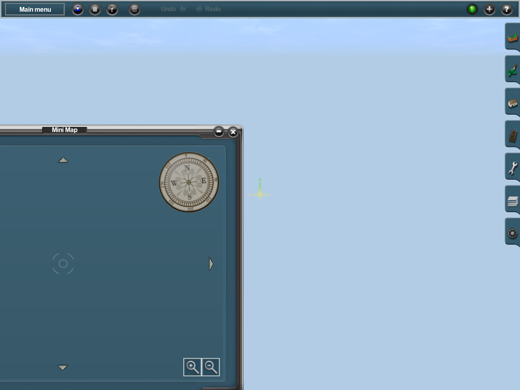
Thanks for your reply. I decided not to continue running TransDEM on my Mac through Wine/Crossover. Instead I've got it set up on my PC Laptop, and transfer the route files to my Mac via Dropbox. I do, however, have one issue. Not sure what can be done here, but it exported fine with one problem: the entire layout is invisible, no map, no terrain.
Image

Now, I'm wondering if I should have added UTM tiles. I didn't do that the first time, so I'm going to make the assumption, that I should have in the first place.


Top
 Profile  
 
PostPosted: 11 Feb 2012 22:04 
Offline

Joined: 05 Jan 2011 16:45
Posts: 1464
Not sure what is going wrong there. Files may have suffered from modification during the Windows/Mac exchange procedure (happens to binary files between Windows and Unix, if not handled carefully). However, Trainz Content Manager should have detected inconsistencies.


Top
 Profile  
 
PostPosted: 12 Feb 2012 05:32 
Offline

Joined: 10 Feb 2012 06:25
Posts: 6
That's a possibility. I wonder if it may have to do with the fact I must have tried adding UTM tiles to the map and I had too large an area so TransDEM skipped over it. If the UTM tiles aren't added to the map, I suppose it would turn out like this? I prefer laying my own track down in the program, so I'm not too concerned about vector data/polylines.


Top
 Profile  
 
PostPosted: 13 Feb 2012 14:27 
Offline

Joined: 05 Jan 2011 16:45
Posts: 1464
With or without UTM tiles, the map should be visible in Surveyor, in the main window and in the minimap. TransDEM sets the initial view point close to the geometric centre of the route, but to a baseboard that actually exists, to cover crescent-shape route layouts.


Top
 Profile  
 
Display posts from previous:  Sort by  
Post new topic Reply to topic  [ 6 posts ] 

All times are UTC + 1 hour


Who is online

Users browsing this forum: SemrushBot [Bot] and 2 guests


You cannot post new topics in this forum
You cannot reply to topics in this forum
You cannot edit your posts in this forum
You cannot delete your posts in this forum

Search for:
Jump to:  

Imprint & Privacy

Powered by phpBB® Forum Software © phpBB Group