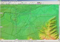
Some progress. In my lab environment, I have managed to extract data:

After the initial confusion with the custom definition for a well-known projection, the remaining meta information all made sense. Unfortunately, it points to a branch in TIFF encoding which TransDEM had not encountered before. Some additional code is required, that will also imply some refactoring in the existing GeoTIFF handling. It will take a bit of time.
In any way, the overall amount of data in that tif file is far too big to be opened in one go. But TransDEM already has an option to only extract a subset of the data and that will be obligatory when using the 10m source. But from the results in my lab test, that subset dialog also needs some adjustment.


