1m DEM for NorwayNorway offers spectacular 1m LIDAR DEM (DTM1, Digital Terrain Model 1 metre) for many areas of the country. The data is free of charge. TransDEM 2.6.2.2 or higher is needed to process it. This is a short tutorial on acquiring these DEMs.
The concept for downloading is that of a “seamless server” as we have seen from a few other geo data providers around the world.
- Open https://hoydedata.no/LaserInnsyn/ in your web browser. At the time of writing there is no need to register an account and to log-in.
- Select the language, if you - like me - don't speak Norwegian, in the upper right hand corner.
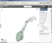
- Click on the Info tab to hide the right side panel. We will not make any changes there.
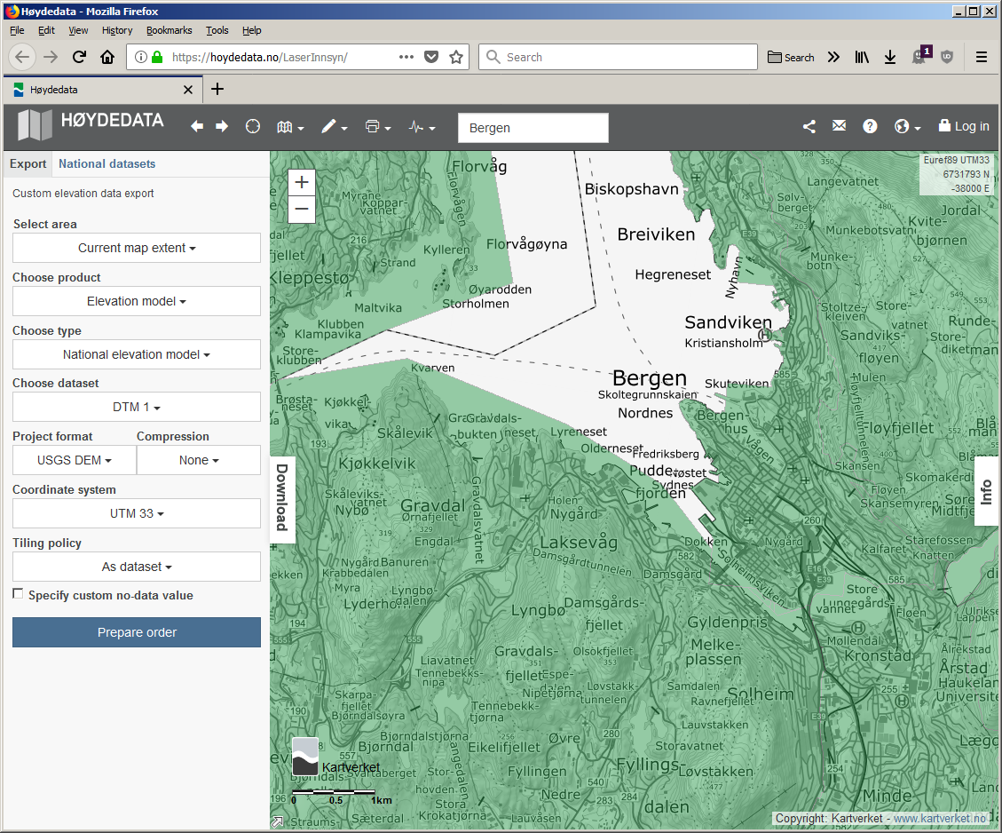
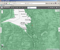
- Move to your area of interest. In this example, I looked for the city of Bergen. You can use text search or navigate with pan and zoom. We will use the current map extent as the area for download. Choose wisely, as data size is really an issue with 1m resolution.
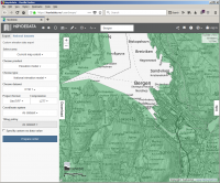
- Click on the Download tab to bring out the left side panel.
- Make the following selections
- Select area: Current map extent
- Choose product: Elevation Model
- Choose type: National Elevation Model
- Choose dataset: DTM 1
- Project format: Either GeoTIFF or USGS DEM.
Both are compatible with TransDEM 2.6.2.2
For GeoTIFF:
- Compression: LZ77
- Coordinate system: As dataset
- Tiling policy: As dataset
- Do not Specify custom no-data-value
For USGS DEM

- Compression: None
- Coordinate system: UTM 33
- Tiling policy: As dataset
- Do not Specify custom no-data-value
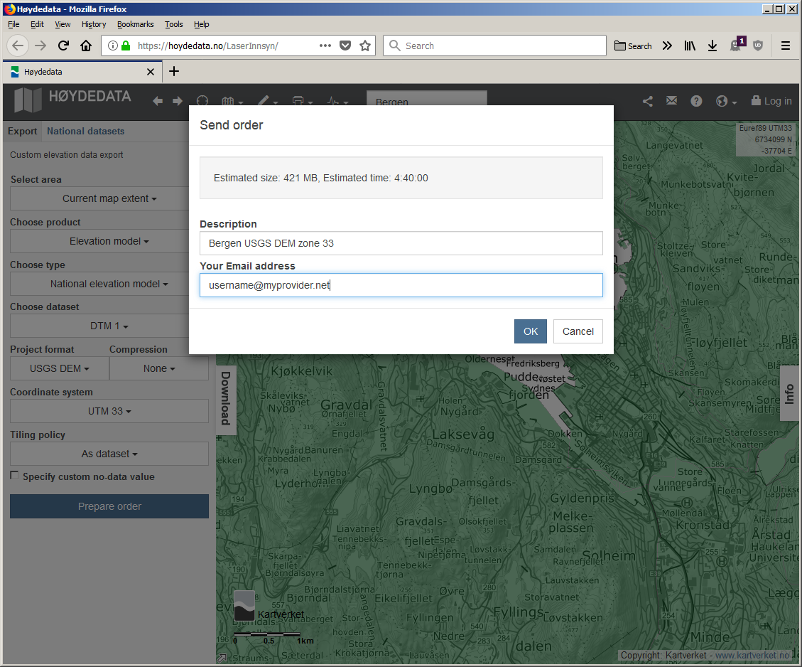
A note on the UTM zone: Norway extends from UTM zone 31 to 35. However, in the far north, this only has a minor impact on possible distortion. By default, all Norwegian geo data appears to be referenced to zone 33, even as in this example, the native zone for Bergen would be 31. Unless your other route data is in a different zone, select zone 33 for your download. TransDEM can always convert zones. - Click on Prepare order
A pop-up dialog will show with an estimation for dataset size (on the low side in my experience) and an estimated processing time.
- Add a meaningful description for this data set and enter your email address. You will receive an email with the download address once the data is ready.
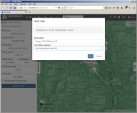
Click on OK.
- Wait for emails from hoydedata@kartverket.no. You will get three. The first is an acknowledgement for your order:
Forvaltningsløsning Høydedata - Eksport (bestilling nr xxxx) er registrert,
the second notifies you that your order is in the queue:
Forvaltningsløsning Høydedata - Eksport (bestilling nr xxxx) er startet
and the third will give you the download link once your order has been completed. This can take a few hours.
Forvaltningsløsning Høydedata - Eksport (bestilling nr xxxx) er klar til levering
- When you receive the third email, open the URL, it's named Leveransekatalog, save to your machine and unzip.
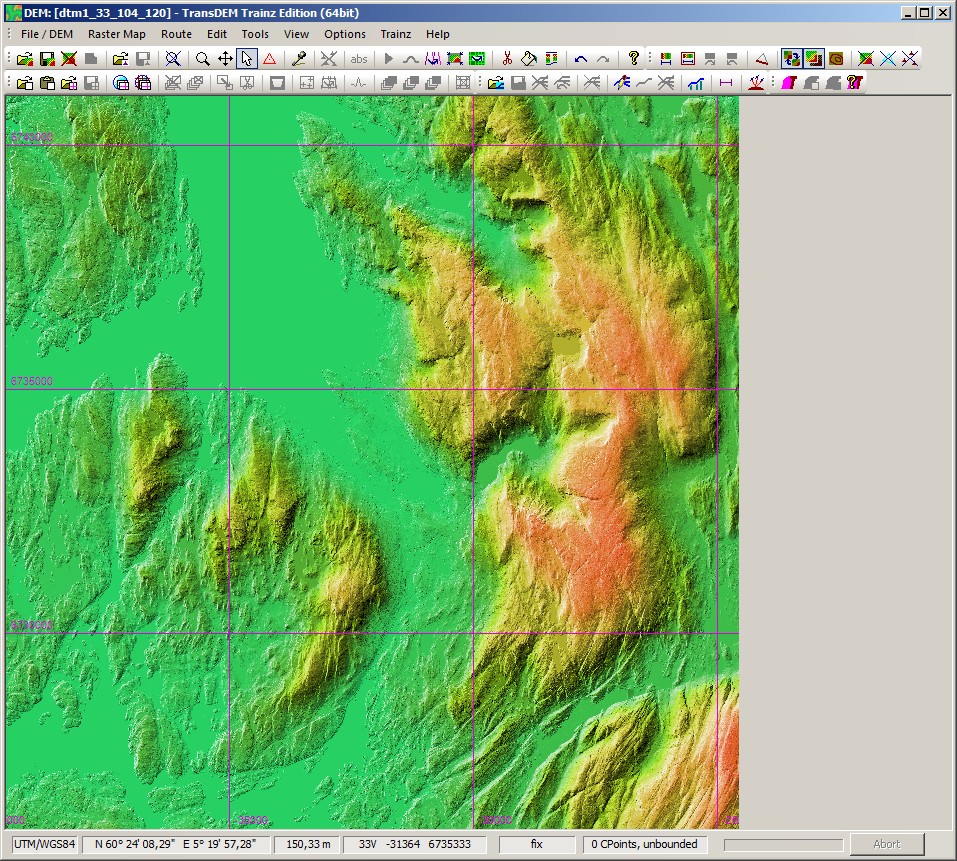
- The data will be in sub-folder dtm1\data. Open in TransDEM (2.6.2.2 or higher)
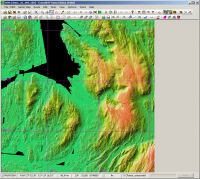
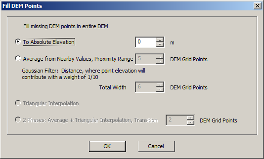
- There may be void data for sea water level, shown in black. Use the paint bucket tool in TransDEM, click on a black patch and set to absolute elevation 0.

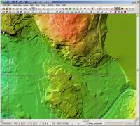
- Enjoy the fantastic richness of details
- When exporting to Trainz, TransDEM will automatically and temporarily reduce the DEM resolution to 5 or 10m, according to your export settings. From version 2.6.2.2 onward this is no longer a plain re-sampling but the arithmetic average of the source points related.