TransDEM 2.6 has been released.
Version 2.6 brings full compatibility with T:ANE including SP1.
Some of the map processing features added in this version (see release notes for more details):
- New DEM merge function “Fill up” to better combine high and low resolution data.
- More flexible map tile server configuration, to allow an arbitrary number of servers per provider and overlapping requests.
- Supports HTTPS for WMS (on Windows 7 and up).
- ”Snap to nearest” function in Simple Route Editor for easy sketching of junctions.
What is TransDEM about?
TransDEM Trainz Edition is a helper tool for building prototypical routes in Trainz. It processes geo-data, in particular DEMs (Digital Elevation Model = height data) and cartographic map images and creates Trainz terrain from it.
New Users: How much does it cost?
TransDEM Trainz Edition is Payware. The fee for a personal non-commercial license is €23.90 including applicable VAT and PayPal fees.
(This is about GBP 20.00, USD 28.00, CAD 39.00, AUD 39, NZD 41.00, PLN 110 or CZK 670, including VAT and PayPal fees. Currency conversion rates as of 29 December 2015.)
New Users: How can it be ordered?
You can order TransDEM or request more information with a simple email: info@rolandziegler.de. I will send you an info letter with further details of the purchasing and downloading process. When ordering please indicate your full name and address.
Current Users: Update Policy
There will be a free update for current TransDEM users who purchased their license within the last 12 months. These users should receive an email from me with further details within the next couple of days.
All other users can obtain an upgrade license for a fee of €8.90, including applicable VAT and PayPal charges. Please email me at info@rolandziegler.de if you are interested, including enough information to find you in my database: your full name and current address plus original order ID.
Resources
Updated TransDEM configuration samples for WMS and map tiles can be downloaded here (without any warranty!).
What kind of features does TransDEM offer?
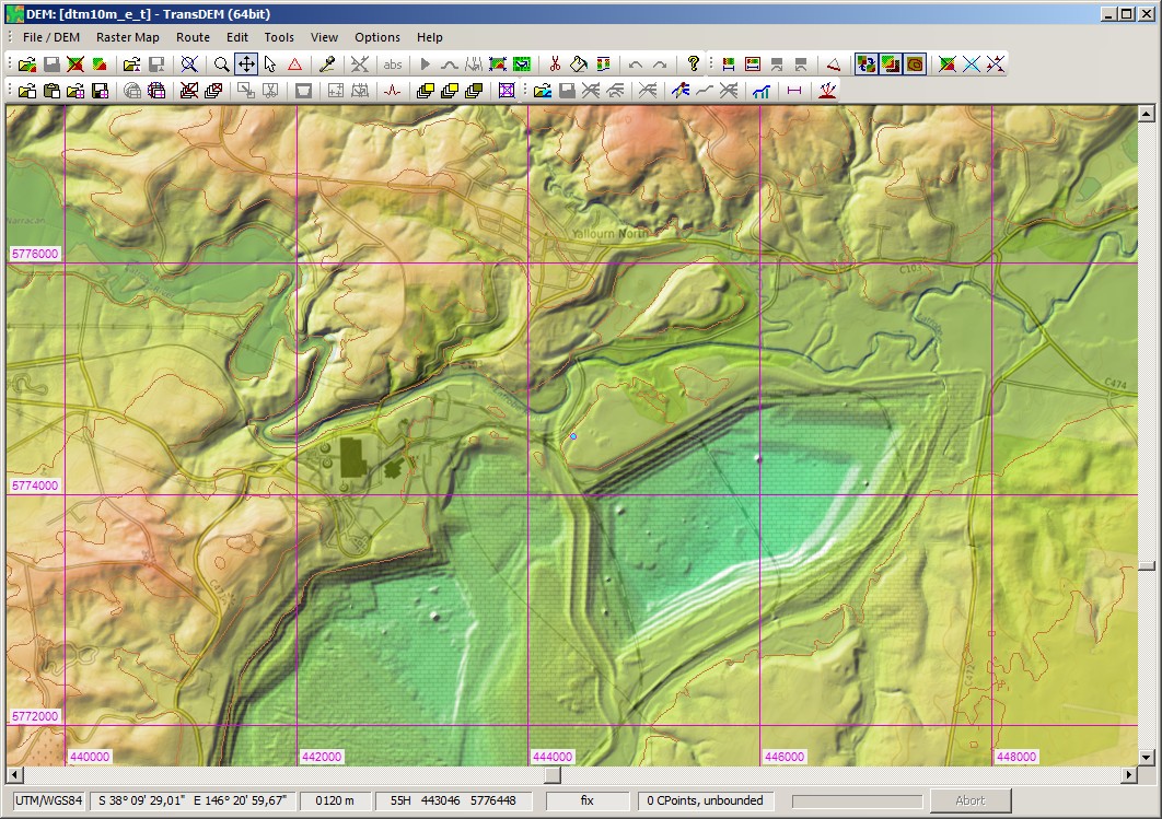
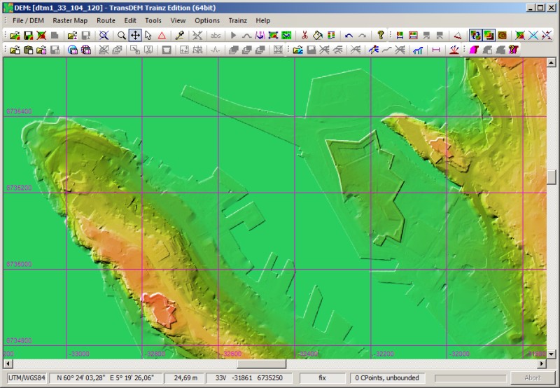
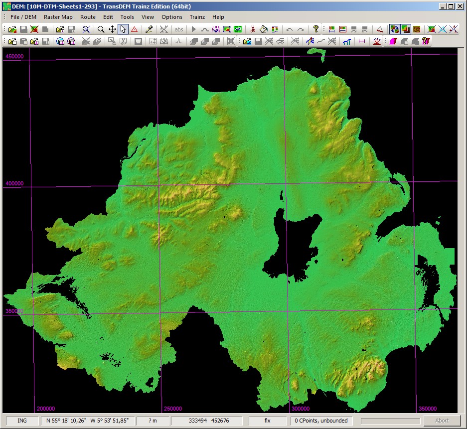
Geo-Data: Digital Elevation Models (DEMs)
- Direct support for SRTM 3 and 1 arc sec, USGS NED and ASTER GDEM (GeoTIFF), Canadian CDED DEMs, various ESRI formats and ERDAS Imagine, many including projected coordinate systems, plus MicroDEM format for other DEM types.
- DEM Editing capabilities: adjustment of elevations (Triangulated Irregular Network algorithm - TIN), hole filling, smoothing, clipping, re-sampling, horizontal and vertical shifting, plus contour tracing for DEM refinement.
- DEM shading, DEM based contour lines to ease to enhance DEM visualisation.
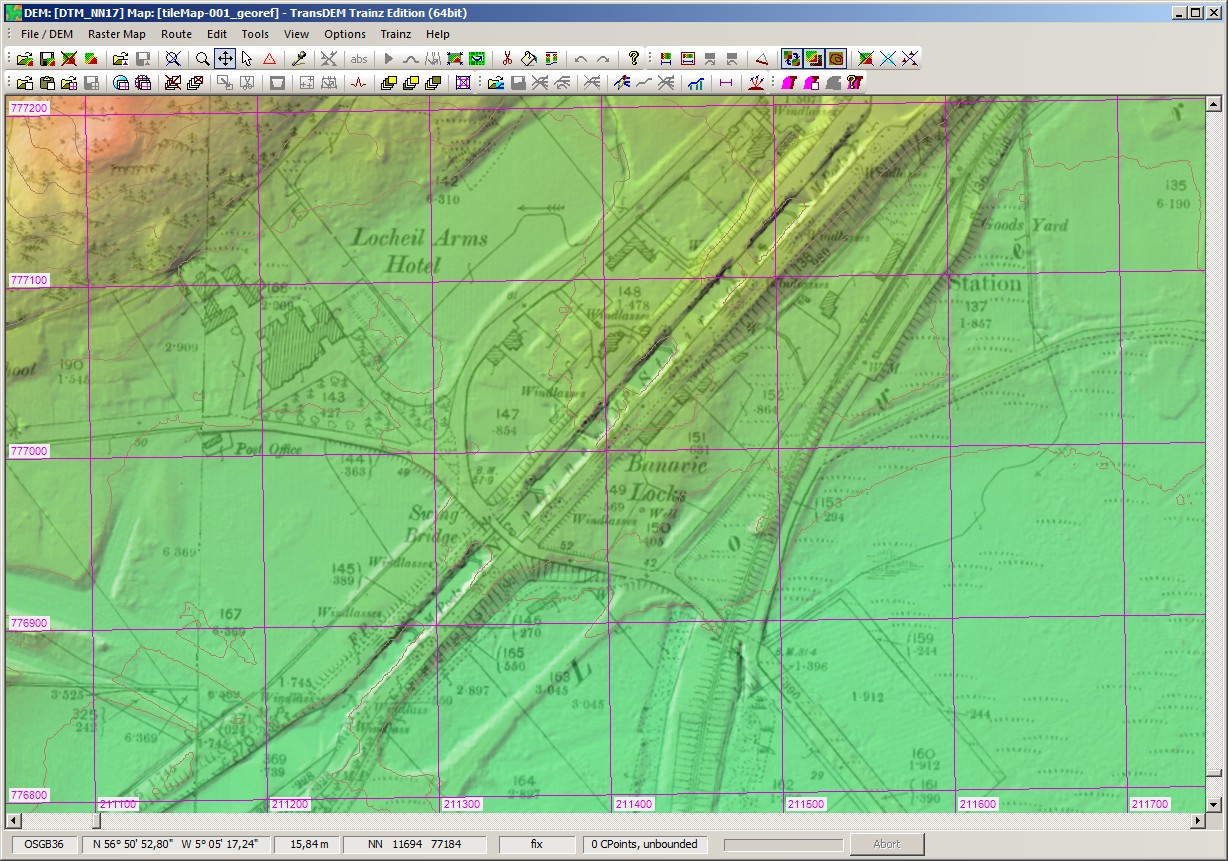
Geo-Data: Raster Maps, Orthophotos
- Georeferencing of topographic raster maps with coordinates, dedicated functions for easy-handling of this often error-prone task.
- Easy-handling of maps from on-line geo-servers (conventional browser interface).
- Automatic georeferencing of GeoTIFF and GeoPDF images (GDAL required for GeoPDF).
- Function to create transparent margins to avoid occlusion with overlapping maps and plans.
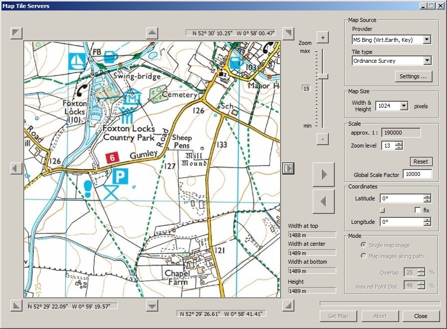
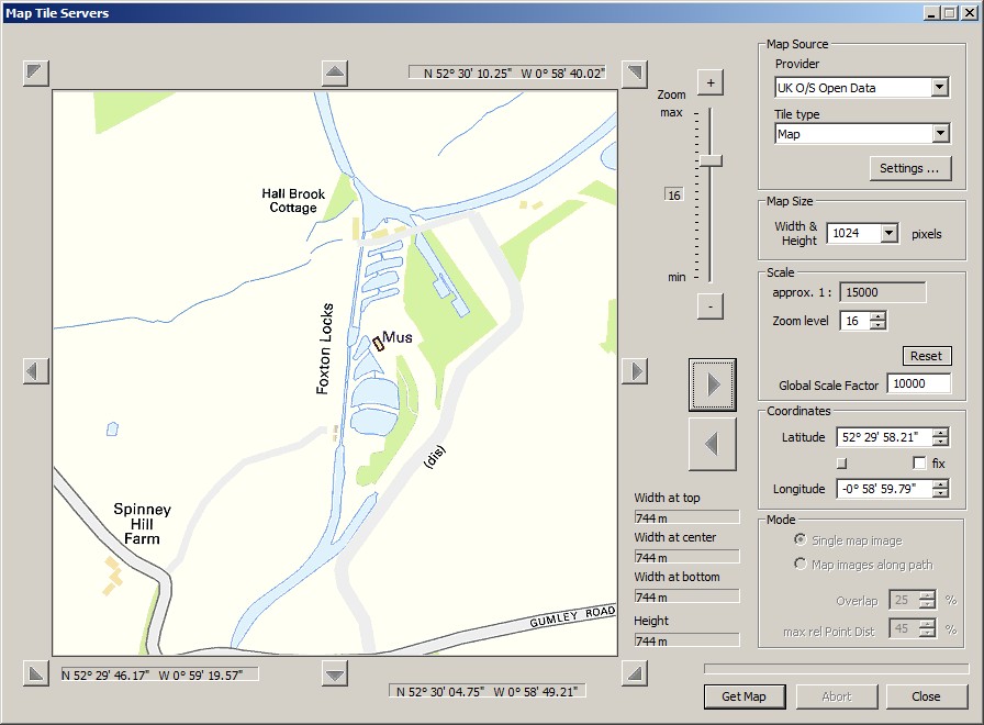
- WMS client (“Web Mapping Services” standard) for automating the cartographic map image acquisition.
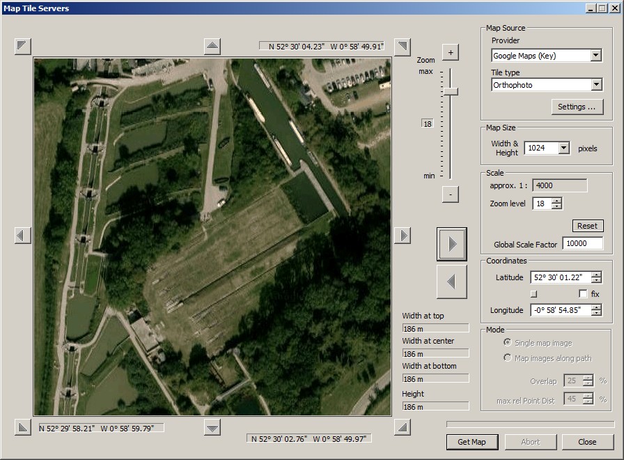
- Map Tile client, similar to WMS client, for raster maps in Mercator projection and organised as a quadtree structure. Examples are the (road-)map and orthophoto services by Google, Microsoft or Open Street Map.
- Semi-automatic georeferencing of Google Earth™ images, using “placemarks”.
- Support for UTM, geographic coordinates (lat/long) and a number of national coordinate systems in use in North America, Europe, Australia and New Zealand.
Geo-Data: Vector Data
- Vector overlays and polyline editor, read and write support for various file formats, shp, dxf, kml/kmz and others.
- Data exchange with GPS devices via .gpx data.
- Import conversion for data in national coordinate systems.
Trainz Map Creation
- Direct creation of all files making a Trainz route map.
- Fully compatible with all versions of Trainz from TRS2004 to T:ANE.
- Baseboard alignment with the UTM grid. Allows for a modular route building approach.
- DEM shaped terrain.
- Ground texture and minimap based on raster map (limited resolution). Optional 5m grid for TS2009 and above.
- Support for custom ground texture set, including removal. Custom textures for ortho-imagery included.
- Automatic placement of UTM tiles (2D or 3D texture carrier objects with higher raster map or orthophoto resolution), 1000m and 500m. 3D tiles require N3V Trainz Mesh Importer.
- Direct creation of Trainz spline objects from 2D and 3D vector data, allows to “lay track” in TransDEM.
- Usage of the Trainz World Origin object for maintaining an absolute coordinate reference which allows adding of UTM tiles or spline objects at a later stage.
- Lowering or raising a conventionally built Trainz route to merge it it with a DEM based route.
Support for GPS devices
- Import: Live track log option for GPS devices via NMEA1083 protocol to record GPS positions as vector data, COM or USB (USB needs 3rd party converter).
- Export: Option to save georeferenced raster maps as a .kmz package with geographic coordinates and automatic tiling for Garmin® GPS devices (and Google Earth™).
Documentation
TransDEM comes with extensive English documentation in pdf format, about 280 pages in two manuals. Tutorials make up a major part. They cover various aspects of TransDEM's capabilities including the mainstream functions of generating terrain for Trainz quickly.
System Environment
- TransDEM 32 bit variant: Windows XP SP3 and higher, 32 bit or 64 bit (x64)
- TransDEM 64 bit variant: Windows XP SP3 and higher, 64 bit (x64)
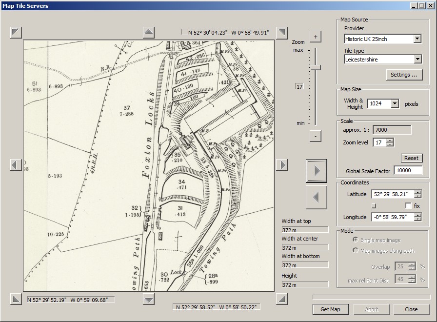
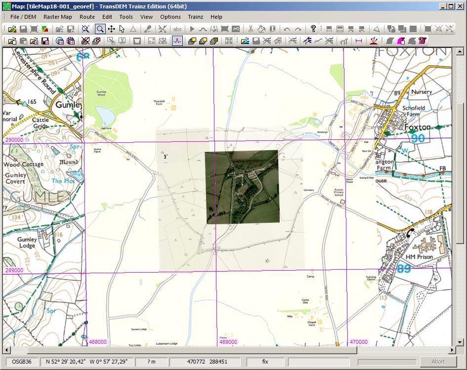
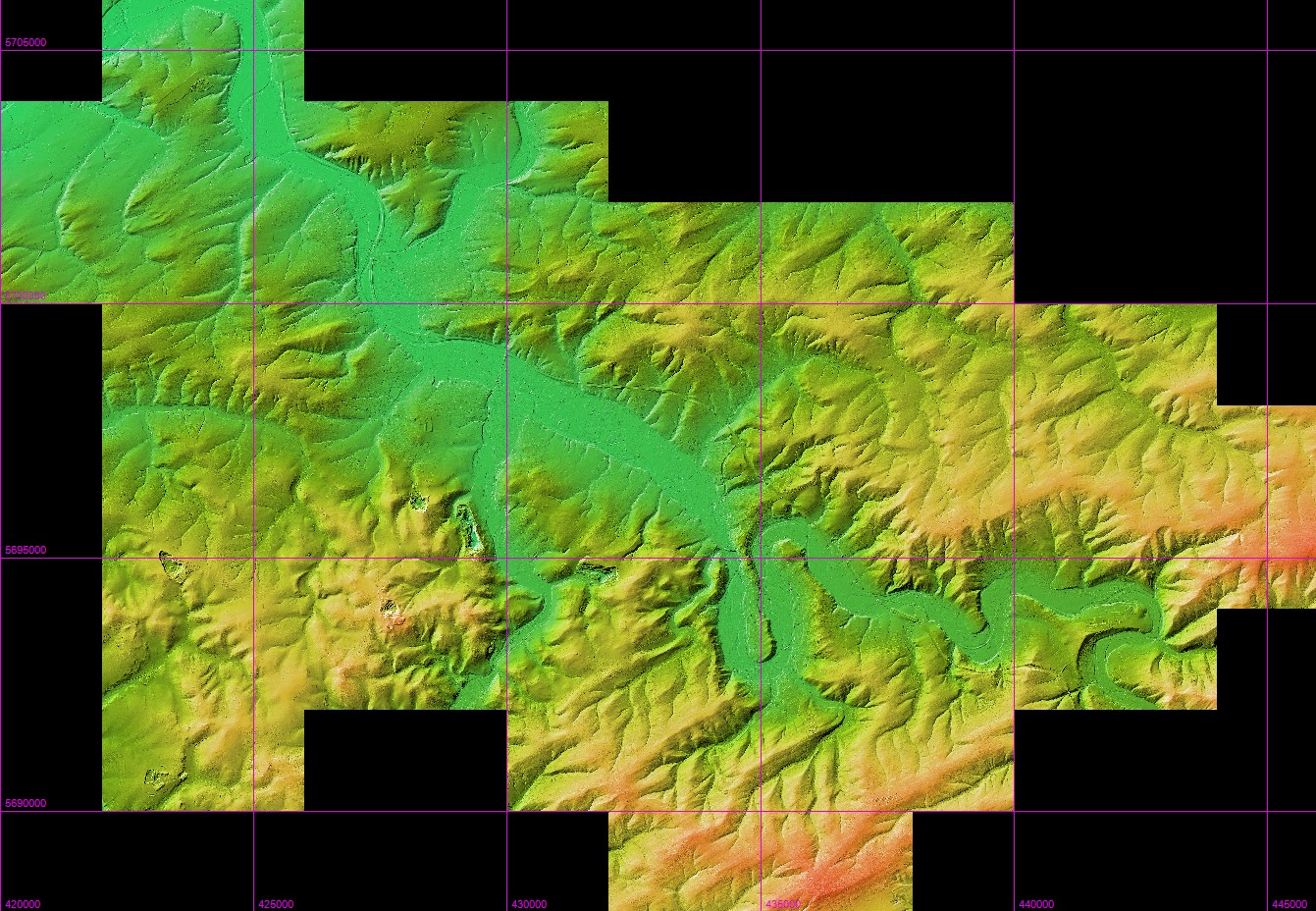
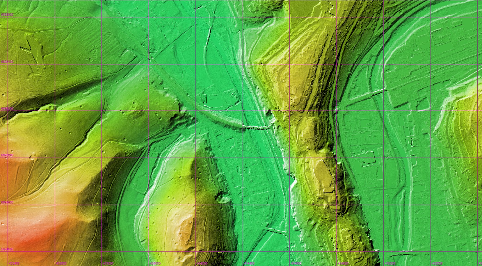
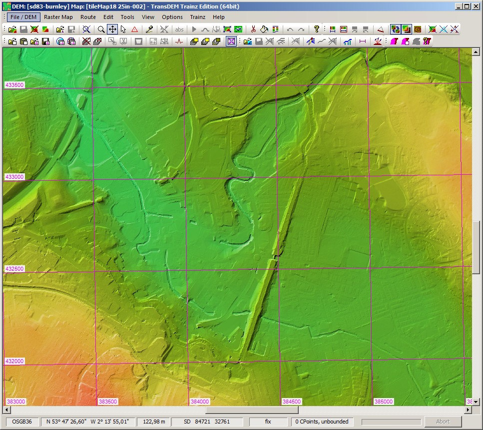
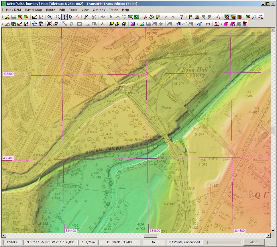
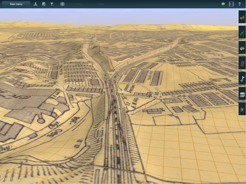
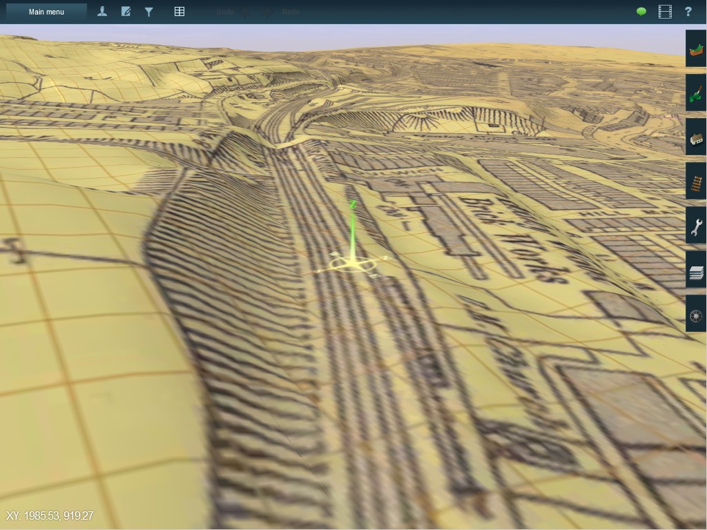
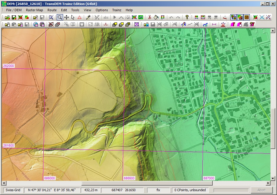
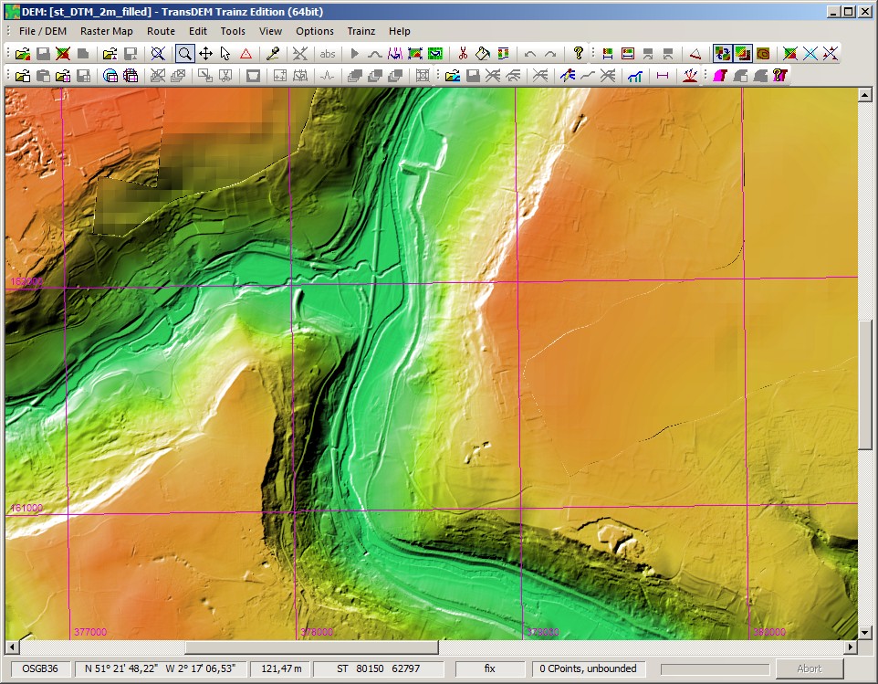
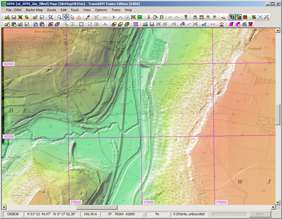
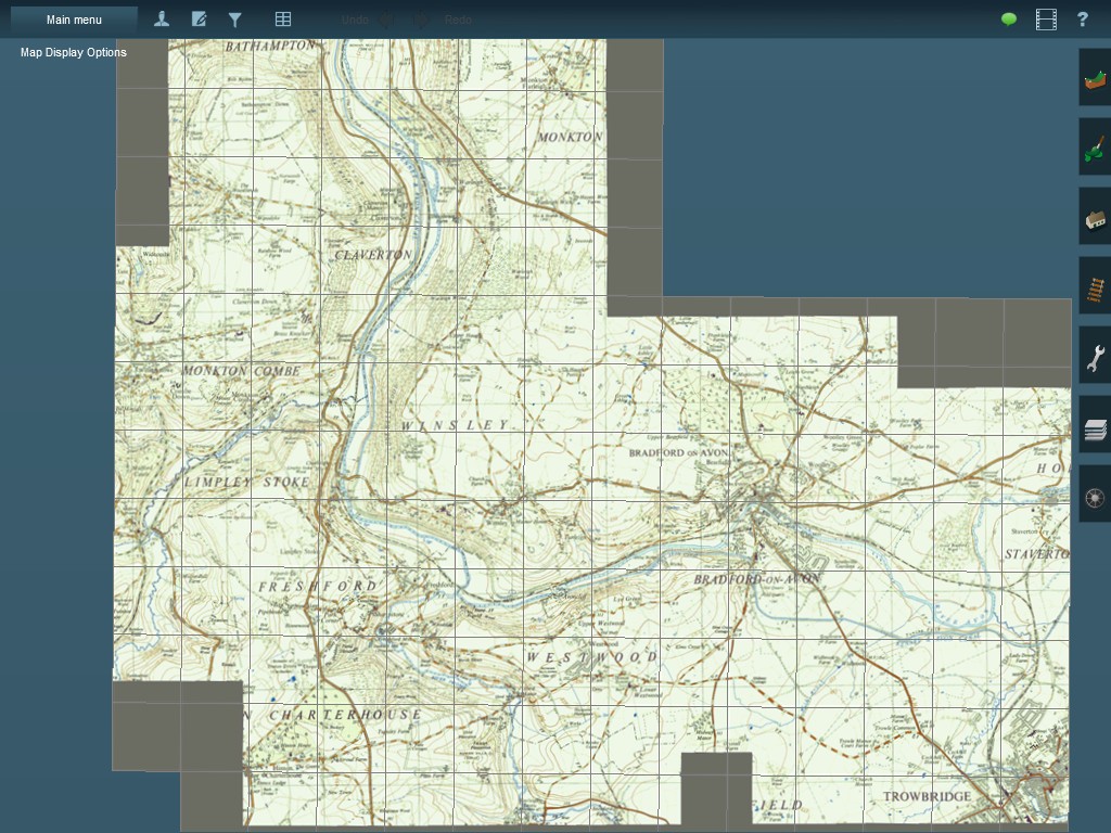
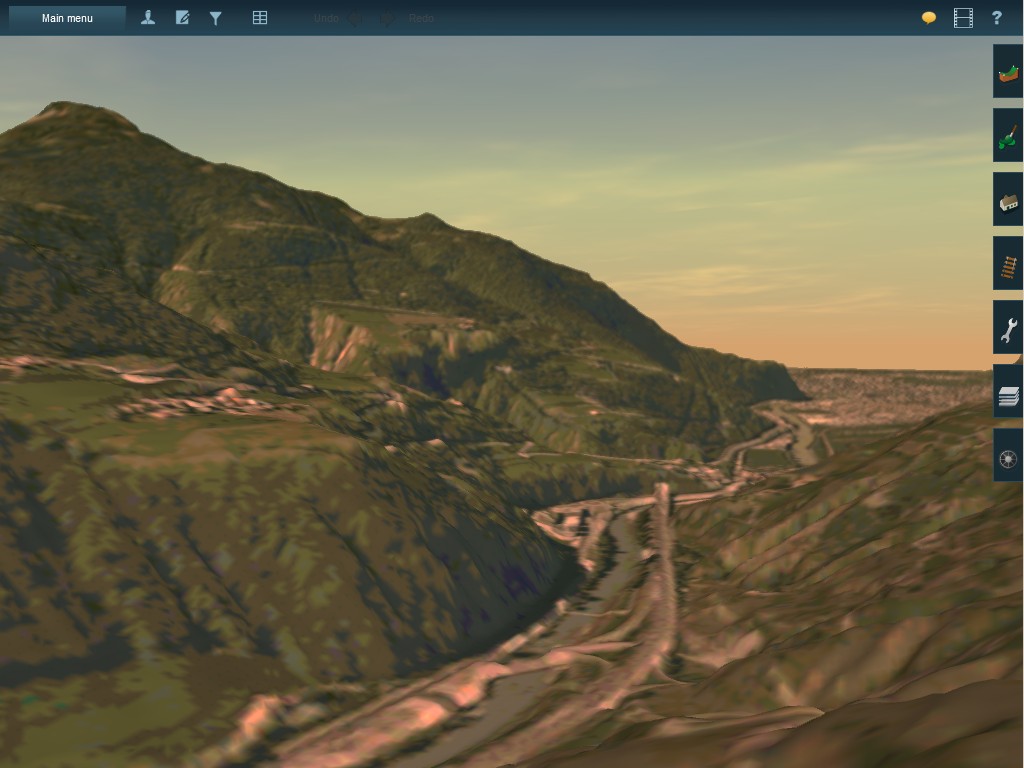
Example: Large scale geo data in England
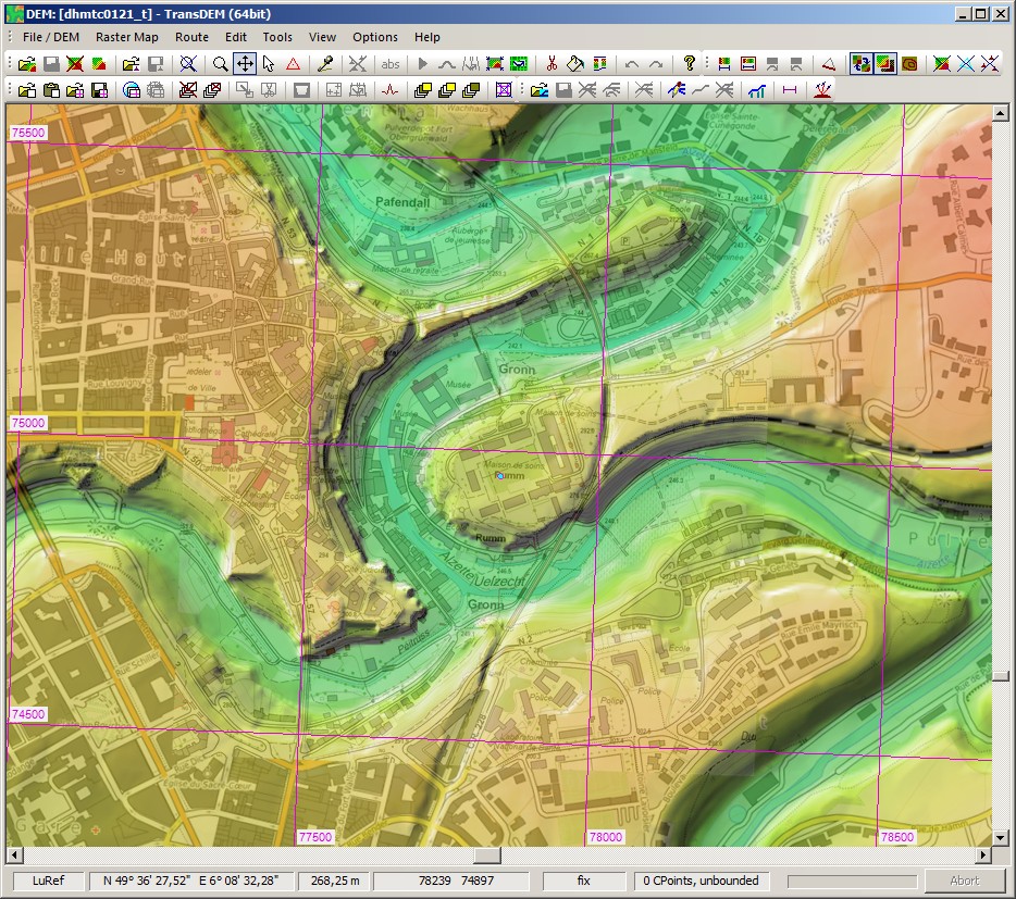
This example combines high resolution 2m DEM data (LIDAR) with the historic Ordnance Survey large scale 25 inch map (1:2500). We are looking at the River Avon valley in Somerset/Wiltshire between Bath and Bradford.
The new free 2m LIDAR DEM (Environment Agency) is complemented with 50m data, using the new “Fill up” function. Railway, canal, river and roads can be clearly distinguished.
Overlaid with the historic 25inch map, acquired with overlapping requests from two server addresses.
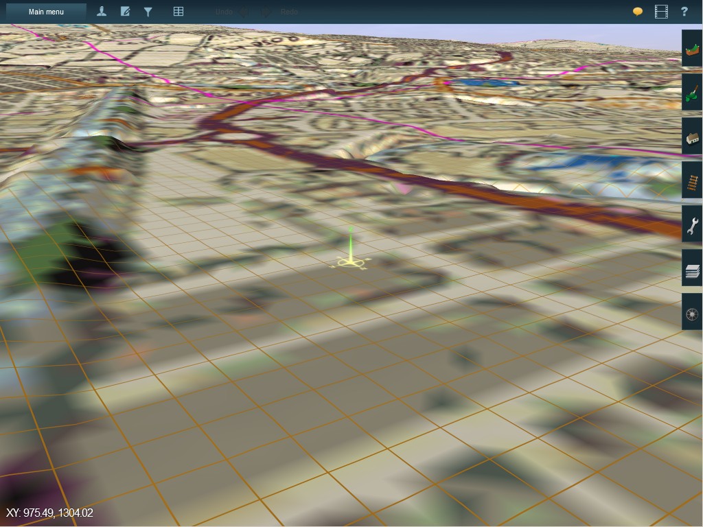
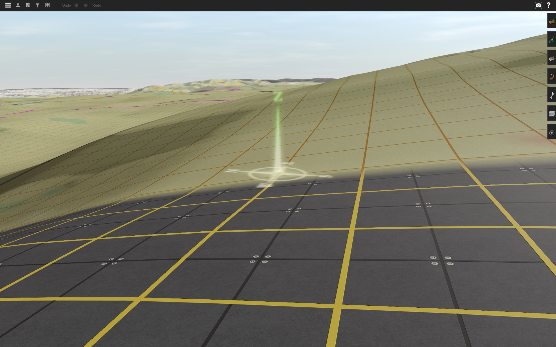
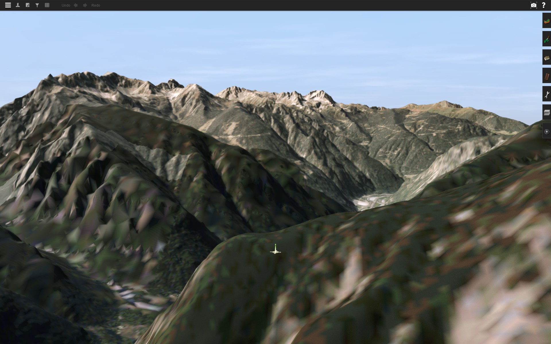
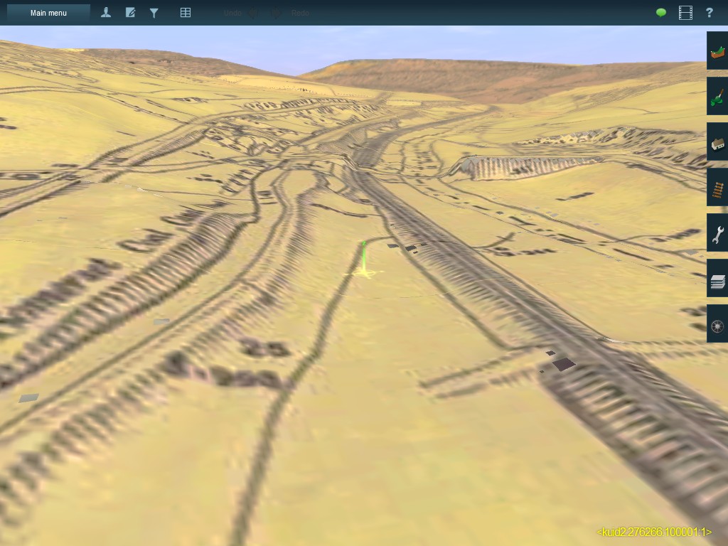
Initial total view in T:ANE Surveyor, historic 1:25,000 O/S map used for ground texturing.
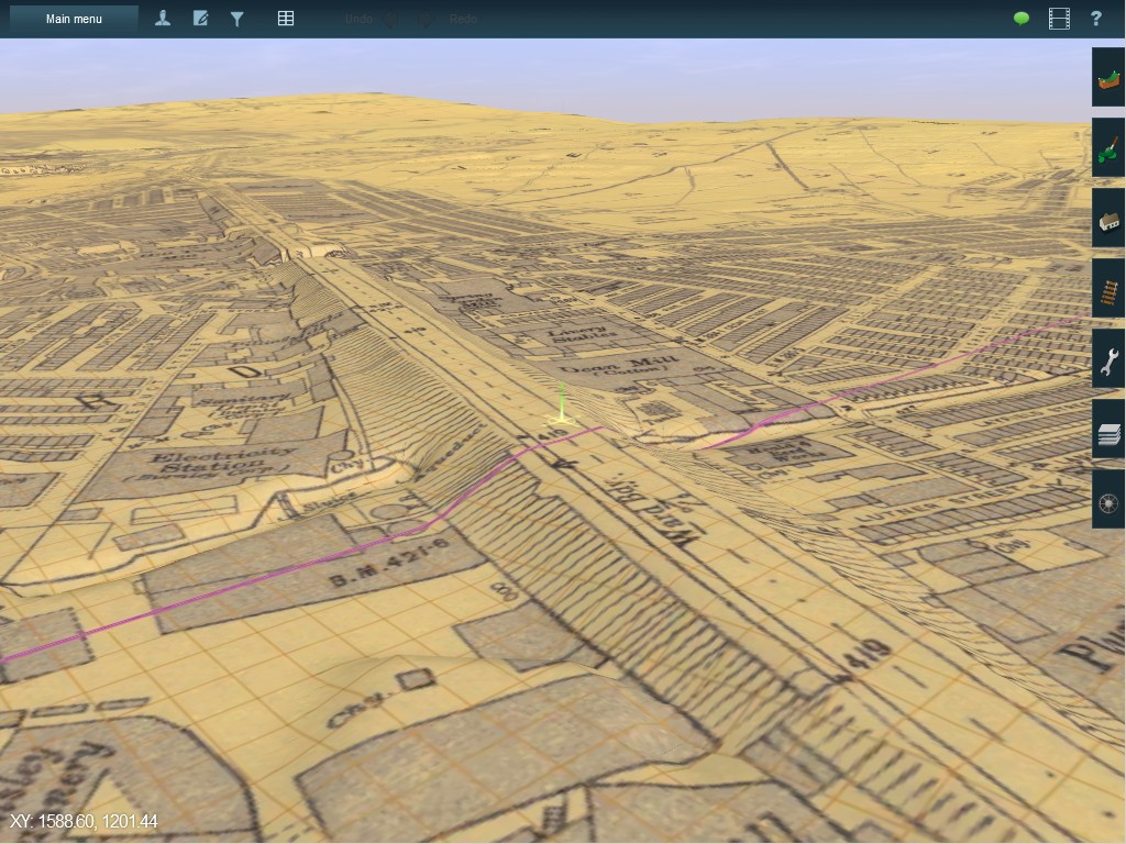
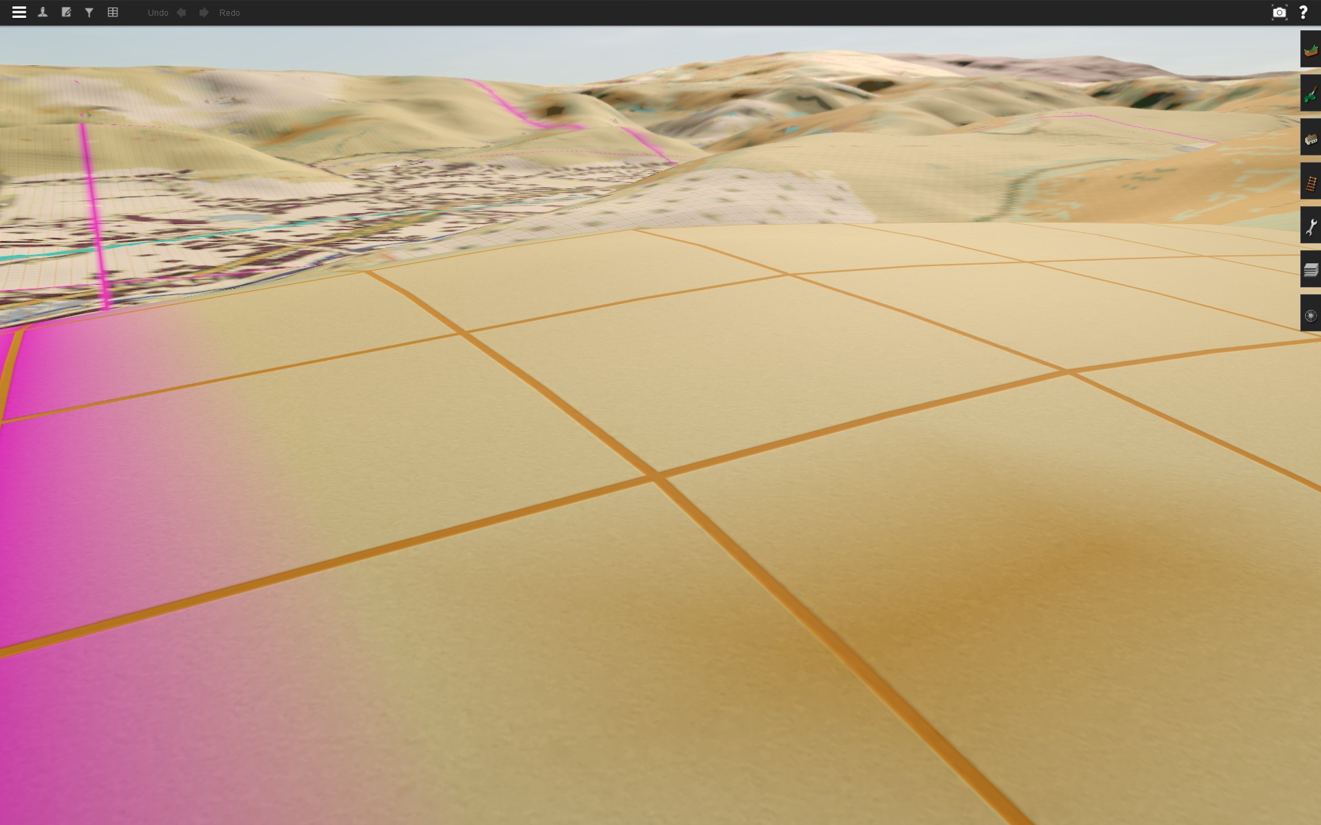
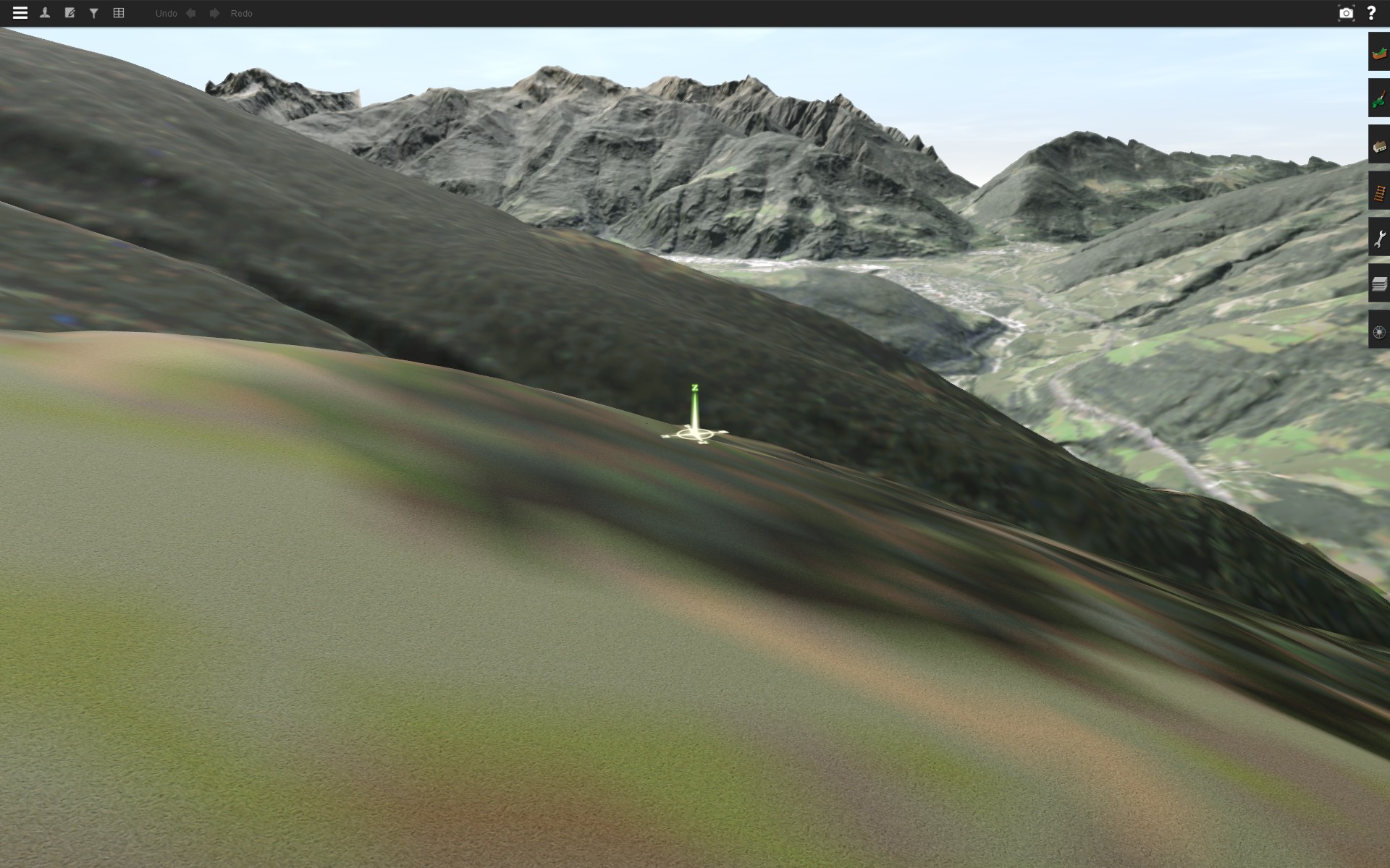
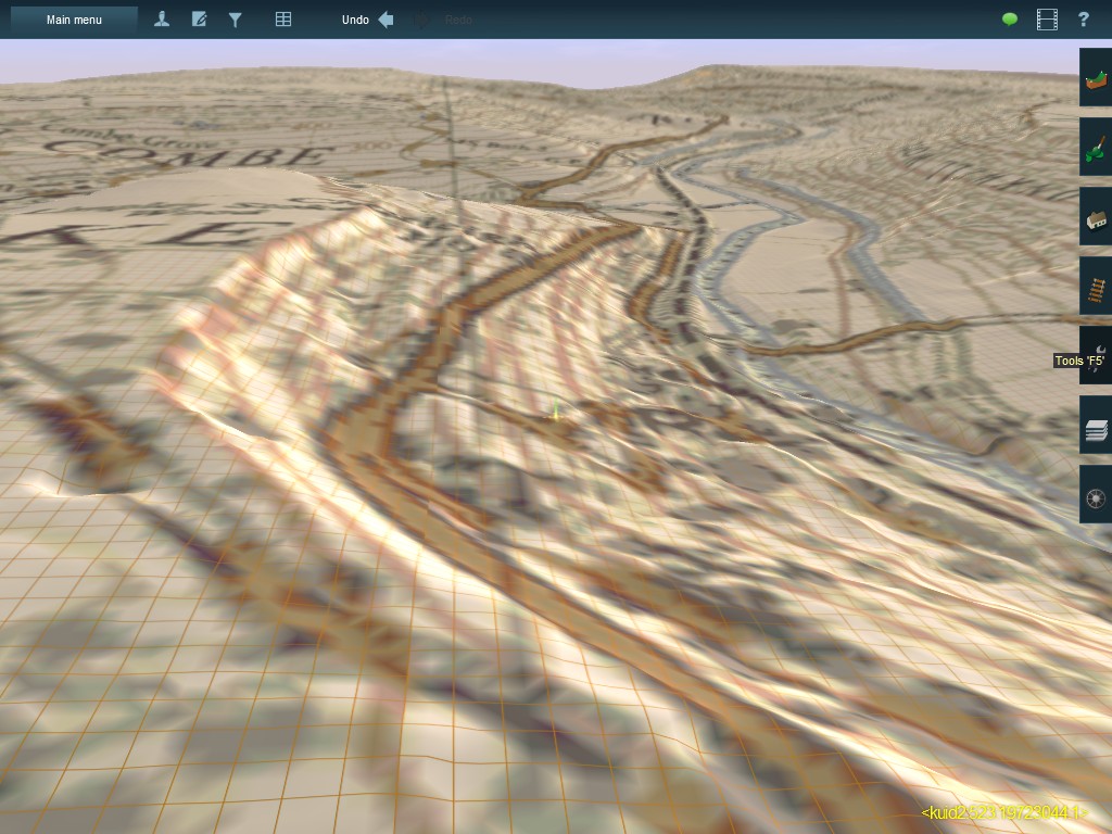
3D UTM tiles that carry the 25 inch map:
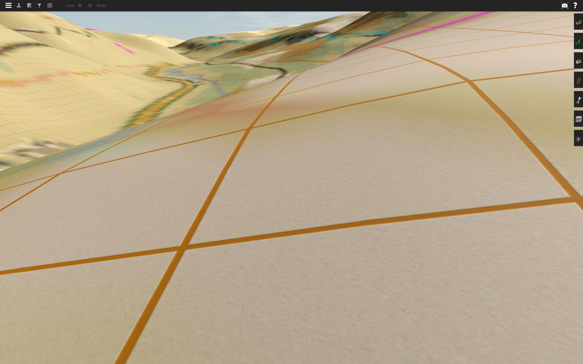
Ground textures only (1:25,000 map):
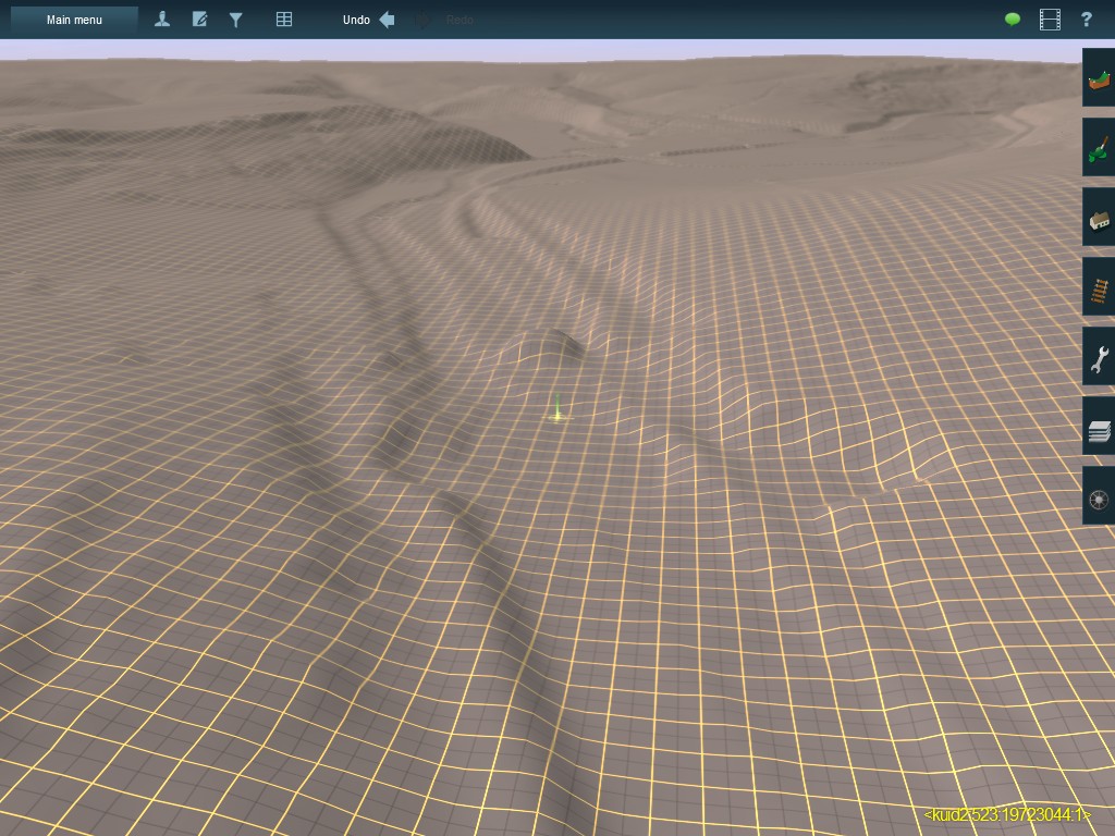
And finally bare bones terrain, with the TransDEM ground textures by the respective TransDEM function. It's not as crisp as in the TransDEM screenshot, but Trainz terrain here is only 5m vs 2m for the LIDAR DEM:
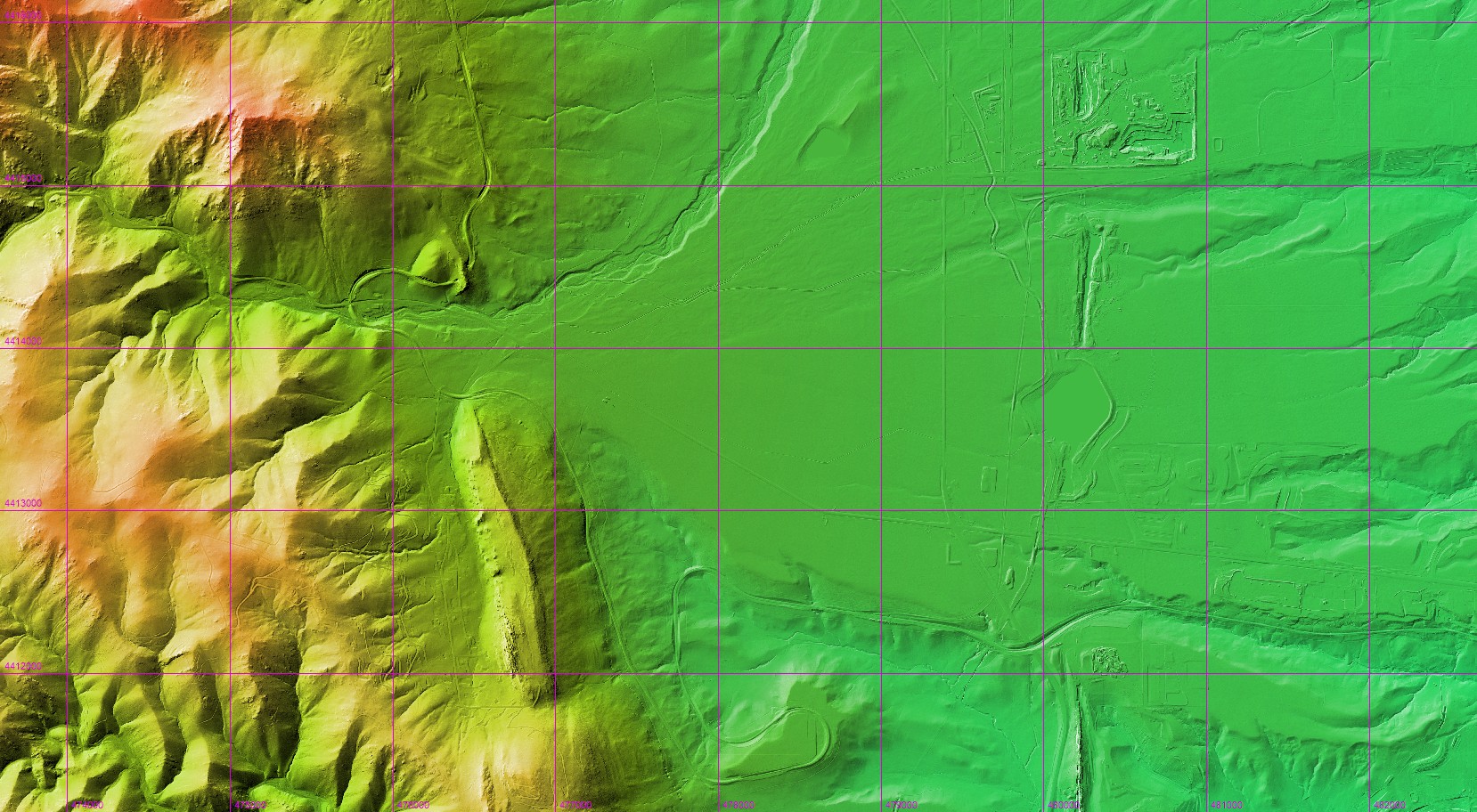
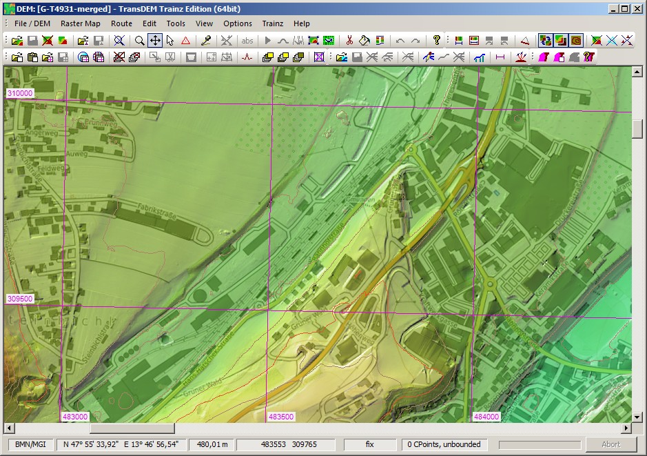
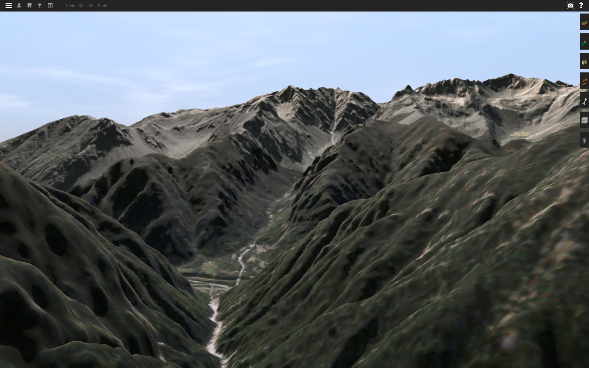
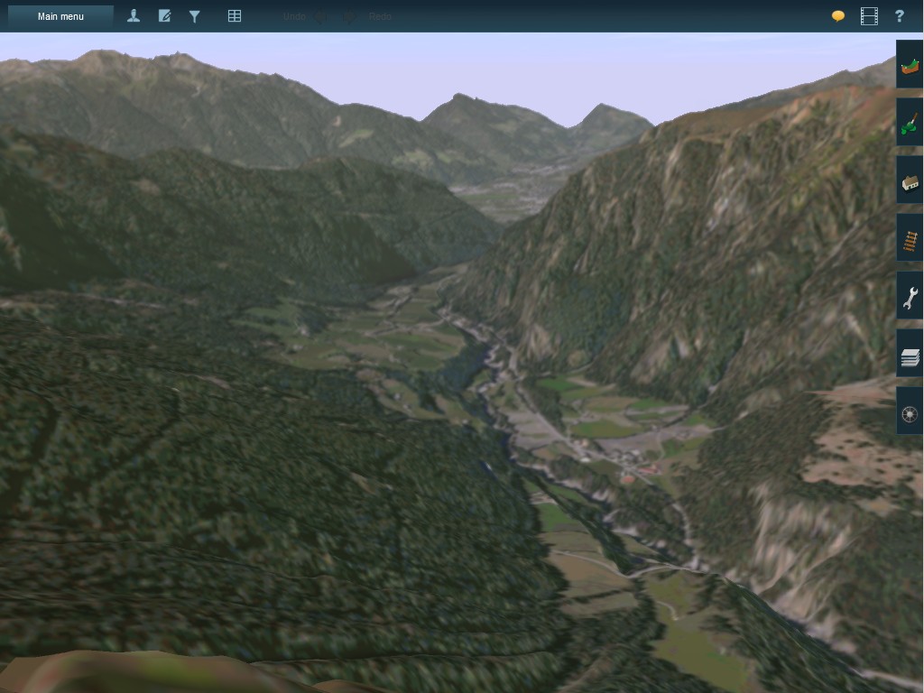
Example: Orthophoto ground textures in T:ANE
Brenner route in South Tyrol. 2.5m DEM, re-sampled for Trainz to 5m, with TransDEM orthoimage ground texturing. Larger viewing distance in T:ANE, but still below 15000m. No editing in Surveyor at all.
Enjoy TransDEM 2.6
Roland Ziegler (geophil)