Version 2.5 brings some new features again:
- 3D UTM tiles. Terra-formed “basemaps”, created, textured and placed automatically.
- 64bit variant (x64) of the TransDEM executable, easier handling of large DEMs.
- New custom ground texture set, optimized for aerial images, to serve as backdrop texturing.
What is TransDEM about?TransDEM Trainz Edition is a helper tool for building
prototypical routes in Trainz. It processes
geo-data, in particular DEMs (Digital Elevation Model = height data) and cartographic map images and creates Trainz terrain from it.
New Users: How much does it cost?TransDEM Trainz Edition is Payware. The fee for a personal non-commercial license is €23.90 including applicable VAT and PayPal fees.
(This is about GBP 20.00, USD 30.00, CAD 35.00, AUD 37, NZD 39.00, PLN 105 or CZK 670, including VAT and PayPal fees.
Currency conversion rates as of 31 December 2014.)
New Users: How can it be ordered?You can order TransDEM or request more information with a simple email:
info@rolandziegler.de. I will send you an info letter with further details of the purchasing and downloading process. When ordering please indicate your full name and address.
Current Users: Update PolicyThere will be a free update for current TransDEM users who purchased their license within the last 12 months. These users should receive an email from me with further details within the next couple of days.
All other users can obtain an upgrade license for a fee of €8.90, including applicable VAT and PayPal charges. Please email me at
info@rolandziegler.de if you are interested, including enough information to find you in my database: your full name and current address plus original order ID.
ResourcesUpdated TransDEM configuration samples for WMS and map tiles can be downloaded
here (
without any warranty!).
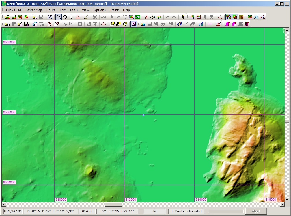
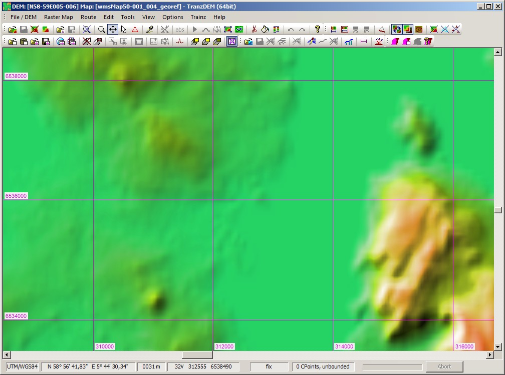
What kind of features does TransDEM offer?Geo-Data: Digital Elevation Models (DEMs)- Direct support for SRTM, USGS NED and ASTER GDEM (GeoTIFF), Canadian CDED DEMs, various ESRI formats and ERDAS Imagine, many including projected coordinate systems, plus MicroDEM format for other DEM types. (SRTM support includes “Viewfinder-Panorama” 1 and 3 arc sec DEMs.)
- DEM Editing capabilities: adjustment of elevations (Triangulated Irregular Network algorithm - TIN), hole filling, smoothing, clipping, re-sampling, horizontal and vertical shifting, plus contour tracing for DEM refinement.
- DEM shading, DEM based contour lines to ease to enhance DEM visualisation.
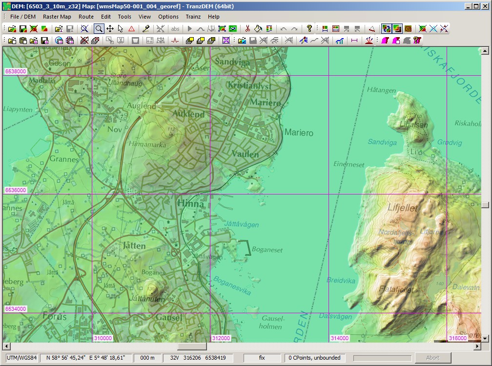
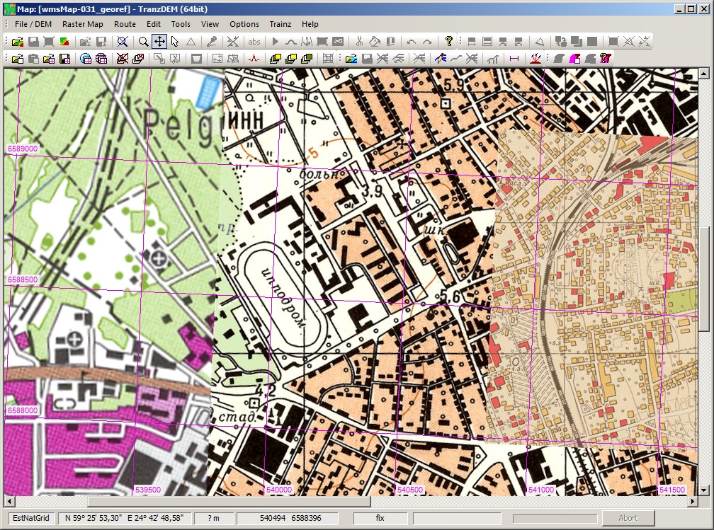
Geo-Data: Raster Maps, Orthophotos- Georeferencing of topographic raster maps with coordinates, dedicated functions for easy-handling of this often error-prone task.
- Easy-handling of maps from on-line geo-servers (conventional browser interface).
- Automatic georeferencing of GeoTIFF and GeoPDF images (GDAL required for GeoPDF).
- Function to create transparent margins to avoid occlusion with overlapping maps and plans.
- WMS client (“Web Mapping Services”) for automating the cartographic map image acquisition. Compatible servers exist in several countries, e.g. USA, Canada, Norway.
- Map Tile client, similar to WMS client, for raster maps in Mercator projection and organised as a quadtree structure, as offered by certain Web servers. Examples are the (road-)map and orthophoto services by Google, Microsoft or Open Street Map.
- Semi-automatic georeferencing of Google Earth™ images, using “placemarks”.
- Support for UTM, geographic coordinates (lat/long) and a number of national coordinate systems in use in North America, Europe, Australia and New Zealand.
Geo-Data: Vector Data- Vector overlays and polyline editor, read and write support for various file formats, shp, dxf, kml/kmz and others.
- Data exchange with GPS devices via .gpx data.
- Import conversion for data in national coordinate systems.
Trainz Map Creation- Direct creation of all files making a Trainz route map.
- Fully compatible with TRS2004, TRS2006 family (including TRS2007 and Trainz Classics), TS2009 (SP2), TS2010 (SP3) and TS12 (SP1).
- Baseboard alignment with the UTM grid. Allows for a modular route building approach.
- DEM shaped terrain.
- Ground texture and minimap based on raster map (limited resolution). Optional 5m grid for TS2009 and above.
- Support for custom ground texture set, including removal. Custom textures for ortho-imagery included.
- Automatic placement of UTM tiles (2D or 3D texture carrier objects with higher raster map or orthophoto resolution), 1000m and 500m. 3D tiles require N3V Trainz Mesh Importer.
- Direct creation of Trainz spline objects from 2D and 3D vector data, allows to “lay track” in TransDEM.
- Usage of the Trainz World Origin object for maintaining an absolute coordinate reference which allows adding of UTM tiles or spline objects at a later stage.
- Lowering or raising a conventionally built Trainz route to merge it it with a DEM based route.
- Optional horizontal baseboard grid offset for TransDEM-generated terrain to achieve better matching with existing conventionally-built Trainz route modules.
Support for GPS devices- Import: Live track log option for GPS devices via NMEA1083 protocol to record GPS positions as vector data, COM or USB (USB needs 3rd party converter).
- Export: Option to save georeferenced raster maps as a .kmz package with geographic coordinates and automatic tiling for Garmin® GPS devices (and Google Earth™).
DocumentationTransDEM comes with extensive English documentation in pdf format, about 280 pages in two manuals. Tutorials make up a major part. They cover various aspects of TransDEM's capabilities including the mainstream functions of generating terrain for Trainz quickly.
System Environment- TransDEM 32 bit variant: Windows XP SP3 and above, 32 bit or 64 bit (x64)
- TransDEM 64 bit variant: Windows XP SP3 and above, 64 bit (x64)
Recommend hardware: Quad-core CPU. 8GB of main memory for 64bit, 4GB for 32bit.
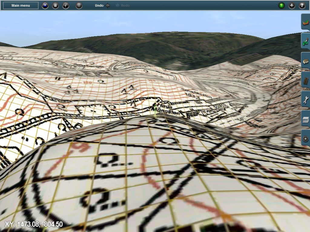
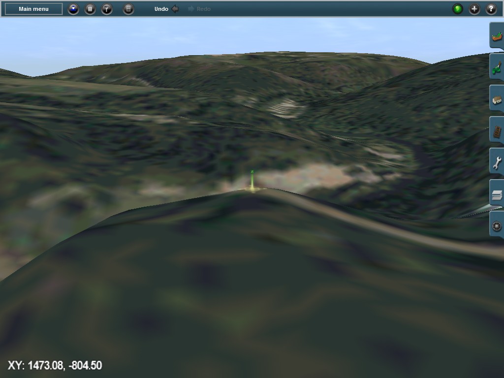
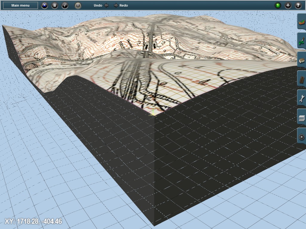
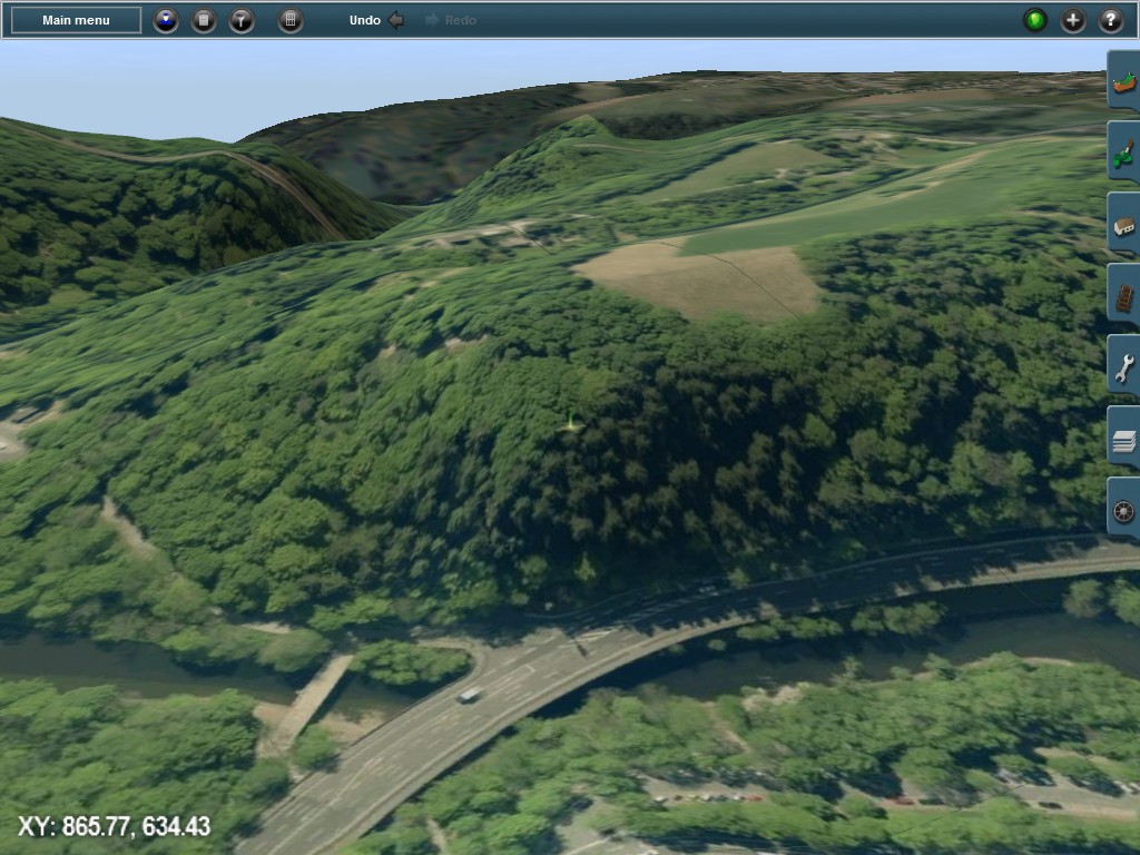
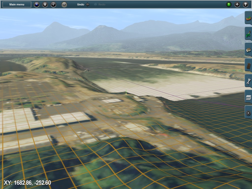
Example: Muengsten RevisitedThe new 3D UTM tiles offer a fresh perspective to geo-data based Trainz route building with TransDEM. In combination with the new ortho-imagery ground textures they allow a couple of variations.
All TransDEM users are familiar with the Muengsten tutorial. It is here where it all begins. We still have the same DEM but make a few alterations to ground and UTM tile textures.
3D UTM tiles with 1:5000 topo map in the foreground, aerial images used for ground texture (background):
Same spot, UTM tile layer switched off, ortho-imagery ground textures alone. Probably not ideal for the foreground, but perhaps quite acceptable as quick backdrop texturing:
3D UTM tile objects, terrain switched to wire-frame mode (wire-frame replacement texture):
Hi-res ortho-photos for 3D UTM tiles:
 Example: South Tyrol, Brenner Pass
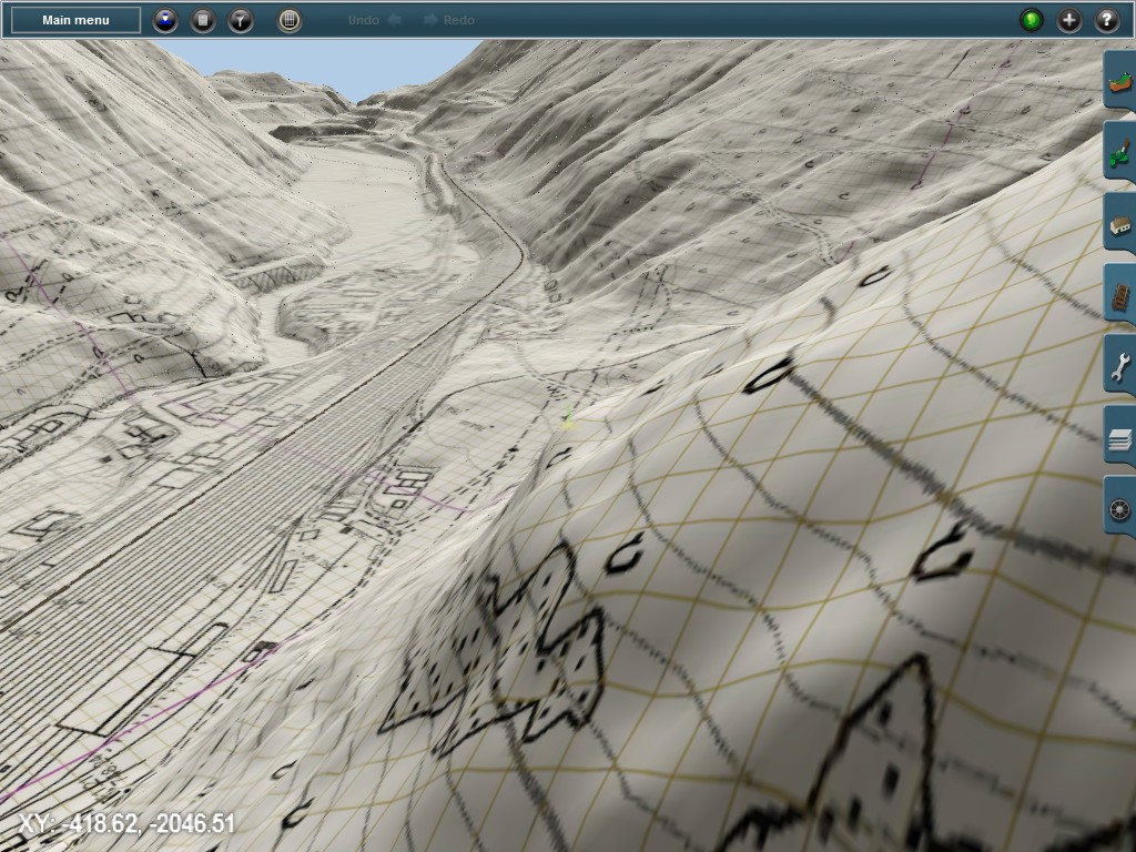
Eisack river valley, Franzensfeste railway station. 2.5 m DEM (re-sampled to 5m), 1:5000 topo map, 3D UTM tiles at 5m resolution. Wire-frame view.
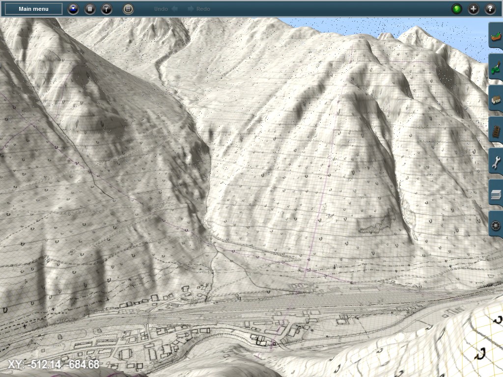 Example: Bonneville Dam, Columbia River, Oregon/Washington
USGS 1/9 arc sec DEM (re-sampled to 5m), USGS 1 m ortho-imagery, 3D UTM tiles at 5m. Wire-frame view.
 Enjoy TransDEM 2.5
Roland Ziegler (geophil)