A new version of TransDEM has been released: 2.6.6.1.
Download from my
website under
Download. Or directly:
Update Trainz Edition 2.6.* - 2.6.6.1 (English/German, 64bit) This is a free update for TransDEM 2.6 users. It requires the full TransDEM product being installed, minimum version 2.6.0.0. Please note that this update is 64 bit only.The update is cumulative again. It will figure out which version is currently installed and patch it to the latest one. If some files are reported to be already up to date during the patching procedure, then that’s an info, not an error.
TransDEM-Version 2.6.6.1- Support for DB_Ref, the coordinate system of Deutsch Bahn (German Railways) (Gauss/Krueger-Potsdam, adapted to ETRS89), EPSG 5682 – 5685 (deprecated 5832 – 5835).
- XYZ import
- Support for Gauss/Krueger xyz data with zone prefix in the easting value.
- Caching of projection parameters, manually entered via dialog.
- Estimation of grid width, based on the xyz data read.
- GeoTIFF DEM
- GeoTIFF DEMs which miss the obligatory GEOKEYDIRECTORY tag are no longer rejected. Instead, they are assumed to be in geographic WGS84 coordinates.
- Allows to read Indonesian DEMNAS files.
- The non-standard but widely used GDAL_NODATA tag will now be read. It defines the encoding of values not present.
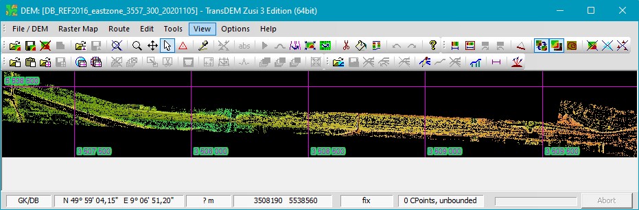
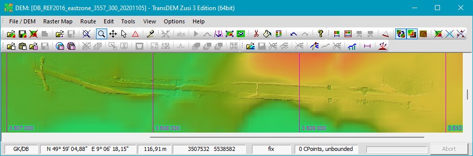
Screenshots for DB and other 1m DTMXYZ import, in 1m nominal raster. West of Aschaffenburg main station, north-western Bavaria. Apparently, this is a raw scan, the matrix isn’t fully populated.:
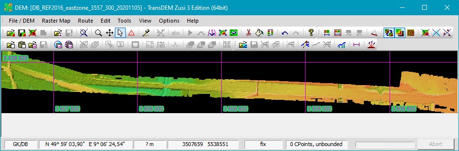
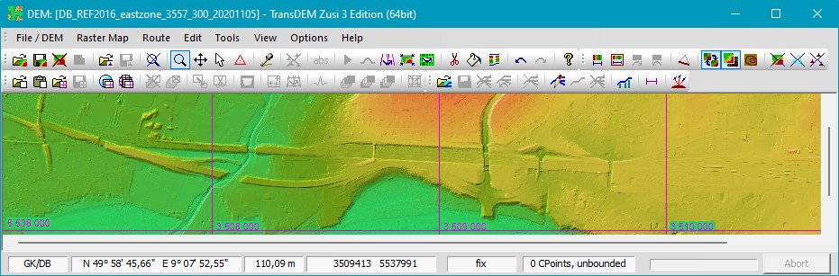
After filling up the missing points with the built-in TransDEM function:
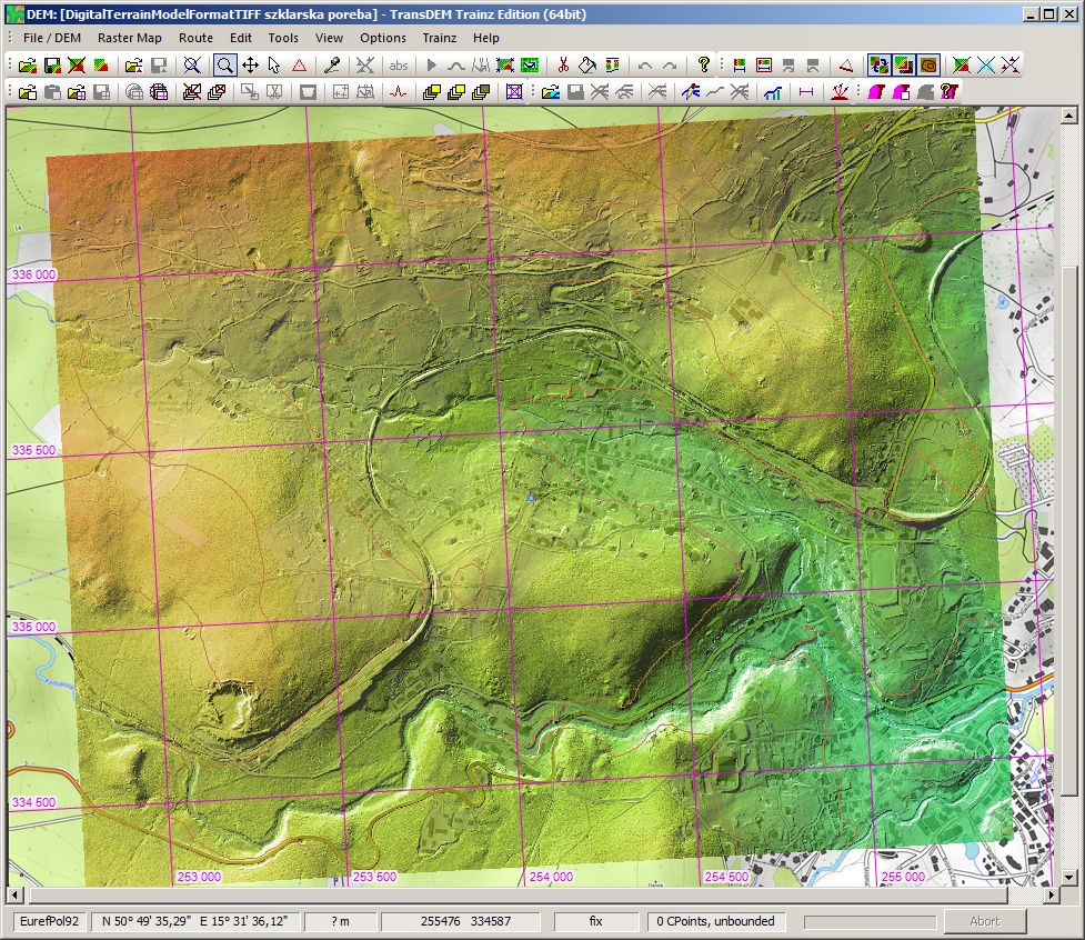
Surrounded by legacy 50m DEM for Bavaria:
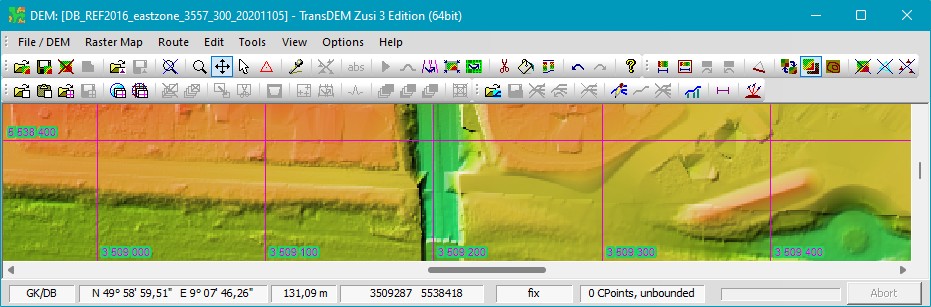
And here with the new Bavarian 1m data, which only have become available for free in January this year:
Even zoomed in, no seam can be detected. This means that not only the coordinate conversion from DB_REF to UTM is correct but also the elevation base is the same for both data sources:
Still not all German federal states have released their 1m data to the general public, so that external sources, like DB here, can still be quite helpful (if you happen to come by such data).
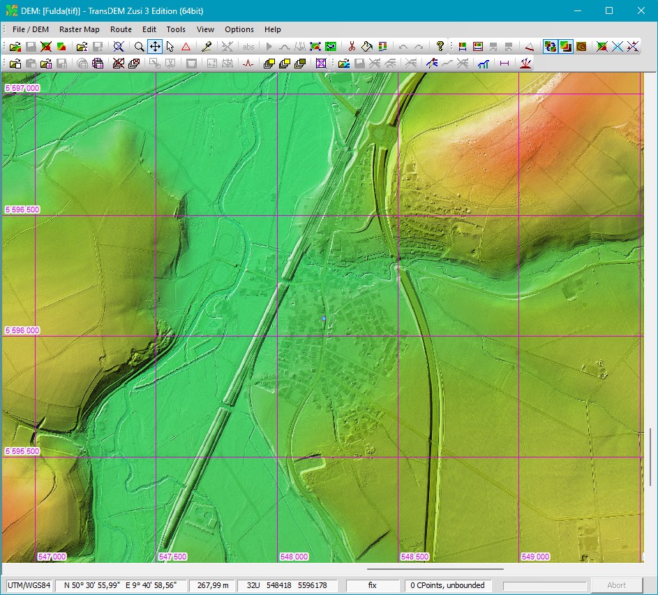
To finish the images on xyz import and 1m data another example from the state of Hesse, their hi-res LIDAR DTM also available for free now.
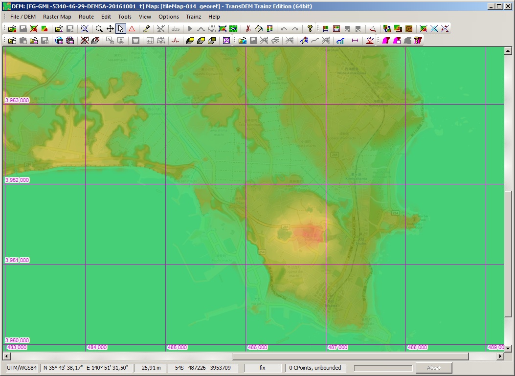
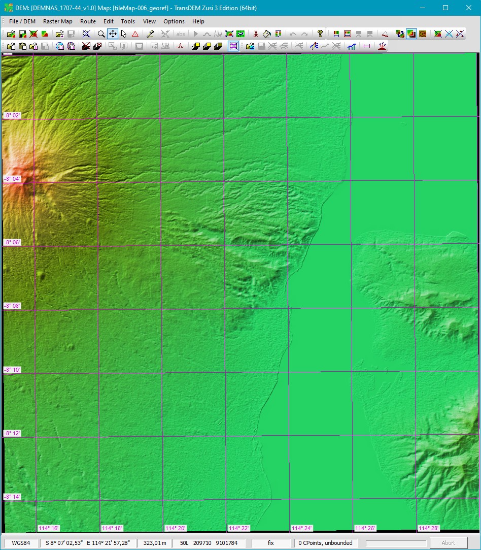
 Example for GeoTIFF DEMNAS, Indonesia
Source:
DEMNAS (Registartion required and you might need an online translation tool). I was pointed to this data source by a TransDEM user:
viewtopic.php?p=3430#p3430The sound between Java and Bali, with a volcano adding to the picture. Nominal raster width is 0.27 arc minutes, around 8m, actual resolution seem lower though:
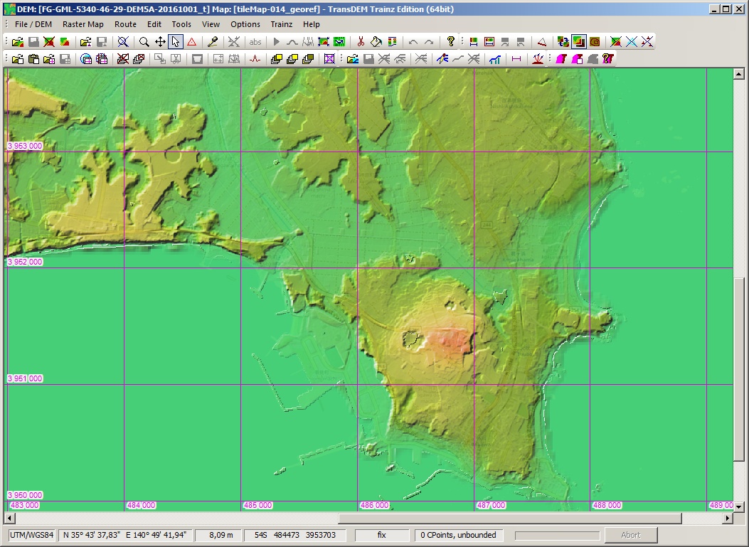
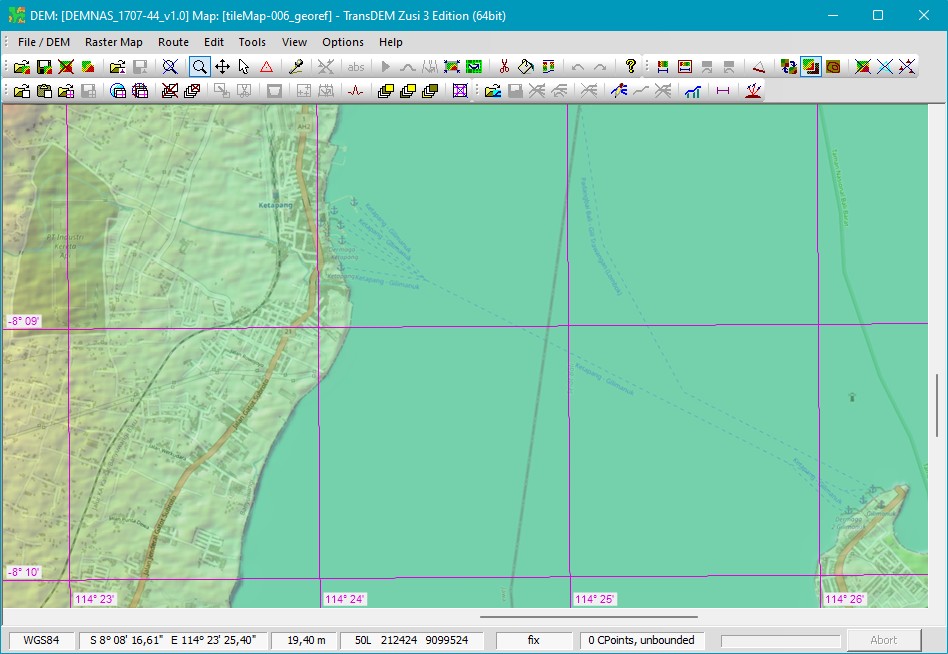
Overlay with OpenTopoMap – for those Bali holiday makers, who travel in style by train all across Java and take the ferry from here:
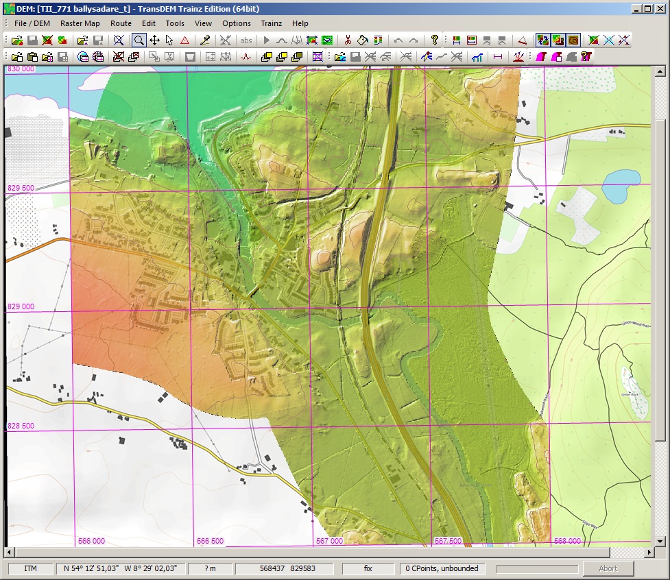
 Example for missing data in GeoTIFF
 1m data from Belgium, Monntzen yard and Moresnet viaduct, close to the German border. Missing values are encoded as -9999. TransDEM up to now didn’t recognise this. And it couldn’t be easily fixed by post-processing, because the data is not native UTM but Belgian Lambert, and interpolation during conversion integrated and altered the no data values:
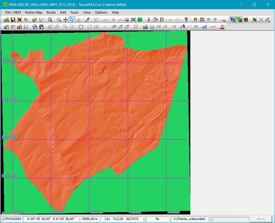
Latest TransDEM Version 2.6.6.1. The GDAL_NODATA tag now works: