I've only been using the program for a month and a bit. So a lot still to pick up on.
Anyhow, may I ask what this refers to in the post you linked to?
I am not sure whether or not you mean UTM, and raster in the lines below from the post.
Quote:
The DEM data is 1/9 arc sec. For this reason I created 3D UM tiles with 5 m resolution - which takes ages to produce. I also selected the "Draw Grid" option to get the 10 grid lines.
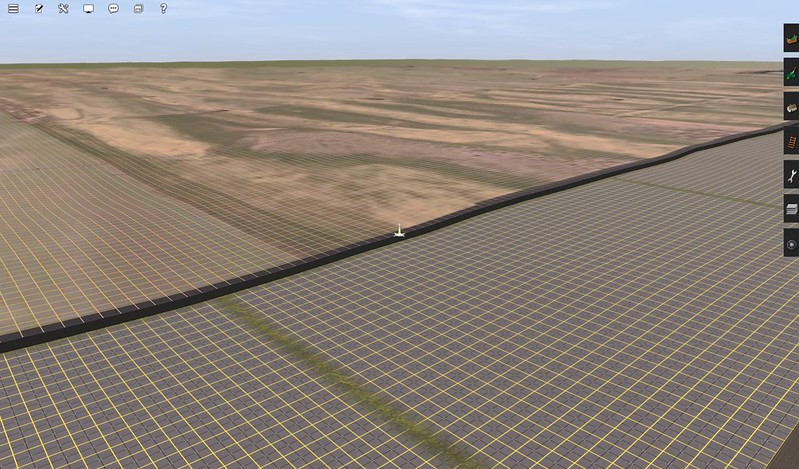
This is the rater small "layout", about 70 sq km:
How do you create 5M resolution tiles in TransDEM? And how did you get them to stick to the terrain like glue in the image shown in your post?
I'm also curious. How wide should a baseboard be in TRS19 for distant scenery?
And my memory isn't exactly flawless. How would this kind of overlay be theoretically created? The one I tried for the mainline that this tacks onto is a mess in comparison, and consists of poorly aligned rectangles, with huge gaps, and nothing once one gets at about 1km into the route further east. The mainline is the troublesome one. This is something from a week ago, not today. Is there a way to open a text file or something to check which settings one used with TransDEM?

Edit: Also, is there a way to automate the scenery folder being named 'Scenery' with a capital S instead with the create new map option? i am so tired of lower case letters being the norm with new lines commencing. it gets so annoying.
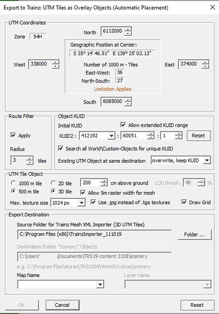
And this is what the DEM set up looks like in the program. There are a few parameters I'm unsure of. Are there inappropriate values shown?
 https://flic.kr/p/2oZD5xS
This is what the UTM export window shows.

[url=https://flic.kr/p/2oZDs8d]
The 'map name' field is blank, because I've been exporting to a folder separate from the default one, due to ongoing errors, and I moved the export folder to the main folder after exporting.


