geophil wrote:
The answer would be No, not in the way you are expecting it to work.
What TransDEM can do, in conjunction with the Trainz target landscape, is to cut 3D (!) vector data into the terrain. The DEM itself will not be affected.
To illustrate the process: TransDEM takes the DEM source of any resolution and re-samples it to a 10 or 5m grid which will be encoded as a Trainz "ground" file, representing the terrain for the Trainz railway simulator. TransDEM can then modify this terrain with 3D vector data. The 3rd dimension is important here for proper cuttings and embankments. Parameters determine the threshold for tunnels or bridges.
This screenshot with a Trainz landscape adjusted by 3D railway track geometry is taken from my website:
 Note 1: The abandoned project MS Train Simulator 2 claimed to support generic route generation based on freely available DEM and vector data all over the world. We have to assume that such vector data would have been 2D data. Details were not revealed, though. Note 2: USGS 1/9 arc sec DEMs provide a resolution large enough to model even smaller man-made features:
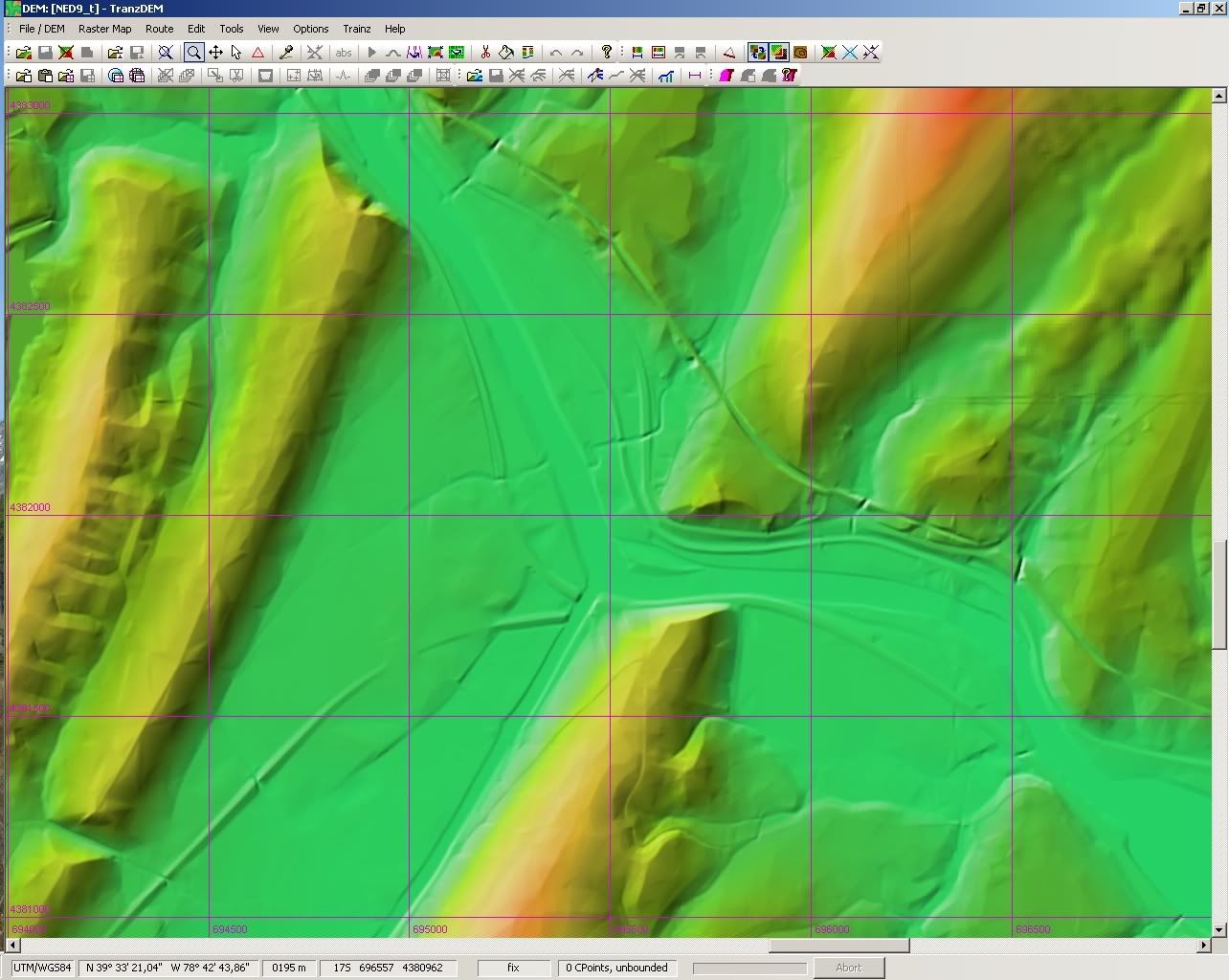
(Click to enlarge)
Hi Roland,
Would you be kind enough to remind me, where in the manual I can find how to fine tune Track vector line in the Trainz export module, to shape threshold for tunnels and bridges as well as for embankments.
I guess track is disconnected between tunnels on your pic, isn't it?
Thierry


