Some people will have noticed: Google Maps via the classic TransDEM Map Tile client stopped working for ortho-images in mid September.
Fortunately, my implementation for the alternative API key access is nearly finished - despite a necessary interrupt for some holidays - and will be released as TransDEM 2.6.1. It will work with Google Maps and Microsoft Bing Maps (aka Microsoft Virtual Earth). As intended, users will not note much difference, if any at all. Users must, however, obtain such an API key themselves and register with Google and/or Microsoft. TransDEM will provide the means to use the key but not the key itself. I will publish tutorials on how to register and create such a key. Rail Simulator/Railworks route builders may already be familiar with this procedure.
(API stands for application programming interface and is a commonly used term do describe the outer or public interface of software libraries and web services.) While TransDEM will support the API key for Google and Microsoft, at the moment you will only need this method for Google ortho-images. At the time of writing, all other tile types for Google and Microsoft, including Microsoft ortho-images, are still accessible via the classic web interfaces that do not require any key.
Let's see how it looks like.
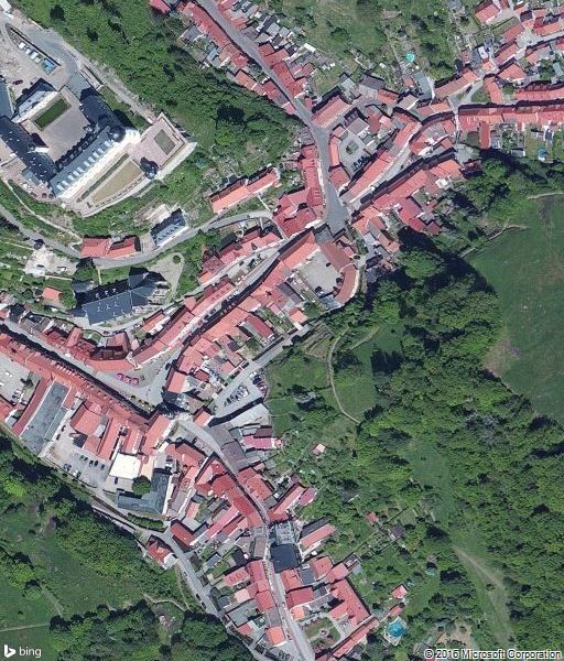
We start with the classic way, a preview for Mirosoft ortho-images, the idyllic timber-frame town of Stolberg in the German Harz mountains:

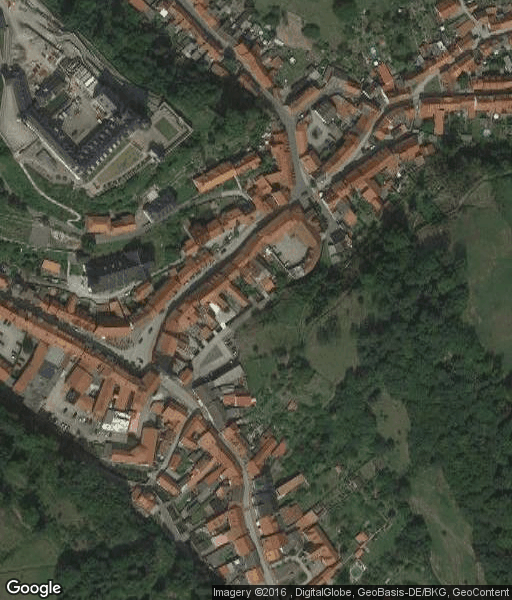
Now the same preview via the API key interface:
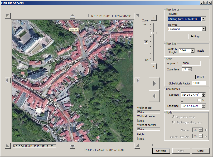
Basically the same. I deliberately picked the combined ortho-image/label type because that turned out to be the only type with any visual differences at all.
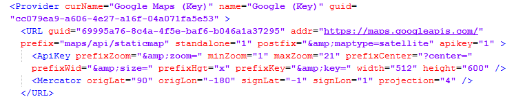
Technically, however, there are some substantial differences. The classic web service delivers tiles in a predefined coordinate raster (quad tree) and a fix size of 256 x 256 pixels. For the preview of 512 x 512 pixels, TransDEM acquires 4 tiles:

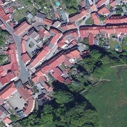
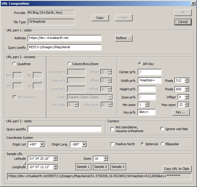
With the API key service, the tiles still exist but will be combined on the server side and the user is no longer restricted to the exact tile coordinates or the exact 256 pixel tile size. However, to be fully compatible with the classic tile system and the existing map tile implementation, TransDEM will continue to use precise tile addresses, now converted to WGS84 lat/long. As said, the API key web services allows for somewhat larger clippings. TransDEM will make use if this feature and go for 512x512 pixel plus some margin for the copyright. So, for the preview, it now only acquires one clipping. The same will apply when actually downloading clippings. The larger clippings will save web service calls and are also more efficient, particularly with respect to the limited contingent associated with an API key.
Please not that if you re-publish any of the map or image clippings, directly or indirectly, with or without your Trainz route, make sure that you adhere to Google and Microsoft terms of service and provide proper copyright notices and other applicable attribution. That is what we get with the new service, for both Google and Microsoft:
There will be an updated settings xml file, which, of course, will only work for TransDEM 2.6.1
You can also edit the API key settings yourself and you will need to open this editor to enter your Google and/or Microsoft API key:
Some work still needs to be done, fine tuning, more testing, writing a new chapter for the manual and writing the tutorials to obtain an API key. After that is finished, TransDEM 2.6.1 will be released as a downloadable update patch, free of charge to all TransDEM 2.6 users. New or upgrade customers will receive TransDEM 2.6.1 after its release without the need for an extra patch.


