Currently I am working on the manuals to get them ready for TransDEM 2.4. In this context I checked all the hyperlinks to various geo data resources.
It turned out that the Canadian
GeoGratis site has new portal. The new one is probably meant to be easier to use but I am less convinced since we can no longer browse the NTS map index grid which I find very helpful to identify the maps for download.
Anyway, the Canadians offer us DEM data, vector data and raster topo maps, the latter in three variants, as CanMatrix (slightly older) CanTopo (the new series) and Toporama. All now come with georeferencing info, when downloaded as GeoTIFF. And TransDEM can read them.
CanTopo is also available as GeoPDF and I tested it against the new GeoPDF feature in upcoming TransDEM 2.4. It appears to work.
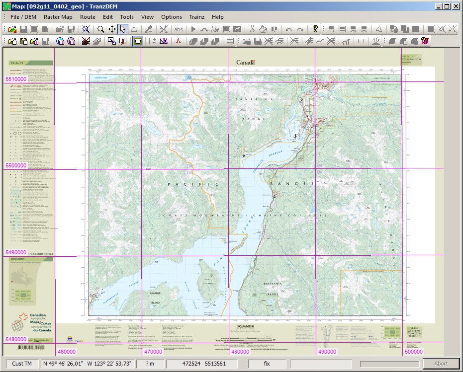
As with its USGS counterpart, CanTopo GeoPDF also has a "neatline" to mark the map collar (the margins) but is quite generous in defining it, see semi-transparent pale yellow area in the screenshot below.
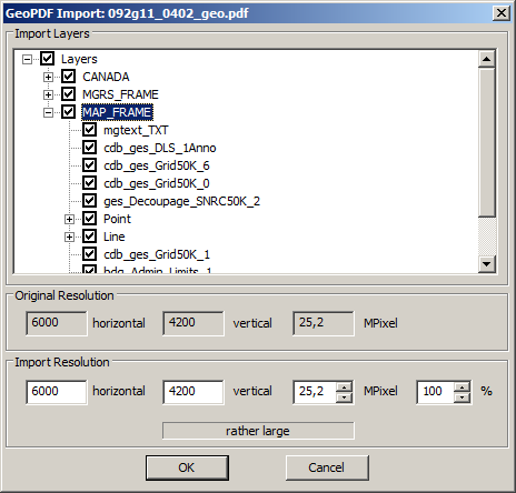
CanTopo also has layers, but I have not experimented with them:
Meta data encoding in CanTopo is similar to that in the USGS maps, but not identical. The format is more or less standardized, so-called "Well Known Text" (WKT) but there appears to be some freedom when it comes to filling the fields. CanTopo provides more clues here because they also include the truly well known EPSG codes, much better than all textual descriptions. For the time being TransDEM takes a somewhat heuristic approach to make its best guess. It has worked for the vast majority of USGS samples I tested, both historical and modern. And it also seems to work for CanTopo.
CanTopo as GeoPDF is somewhat slow to pre-process. You may want to go for GeoTIFF anyway. It want to get the map frame without any collar (margin area), then Toporama may be for you. Toporama, however, used to be less detailed, at least in the past.


