TransDEM Forum
https://forum.transdem.de/

Comparison of USGS NED DEMs
https://forum.transdem.de/viewtopic.php?f=2&t=24
Page 1 of 2

Author:  geophil [ 21 Jan 2011 19:13 ]
Post subject:  Comparison of USGS NED DEMs

USGS NED DEMs are offered in two sometimes three different resolutions: 1 arc sec, 1/3 arc sec and, for some areas, also 1/9 arc sec.

All NED DEMs are terrestrial, the elevation should identify terrain height, not roofs or tree tops. They are also available in GeoTIFF format with floating point vertical resolution, that is, resolution is in fractions of a meter, not in integral meters.

1/9 arc sec NED DEMs are supported in TransDEM from version 2.1. They are the optimum for the Trainz 5 m grid.

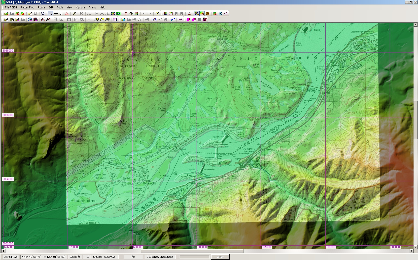
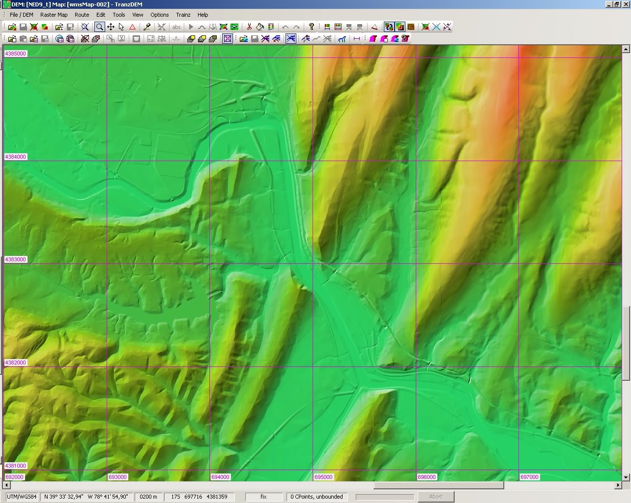
The series of DEMs for this comparison shows an area at the Potomac, near Cumberland, WV, a classic coal and steel district.


Click on the thumbnails for full size images.

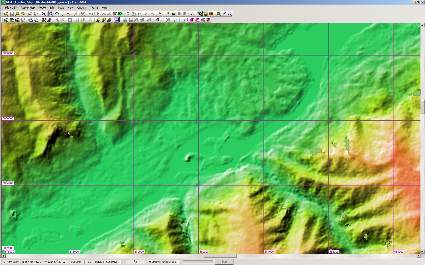
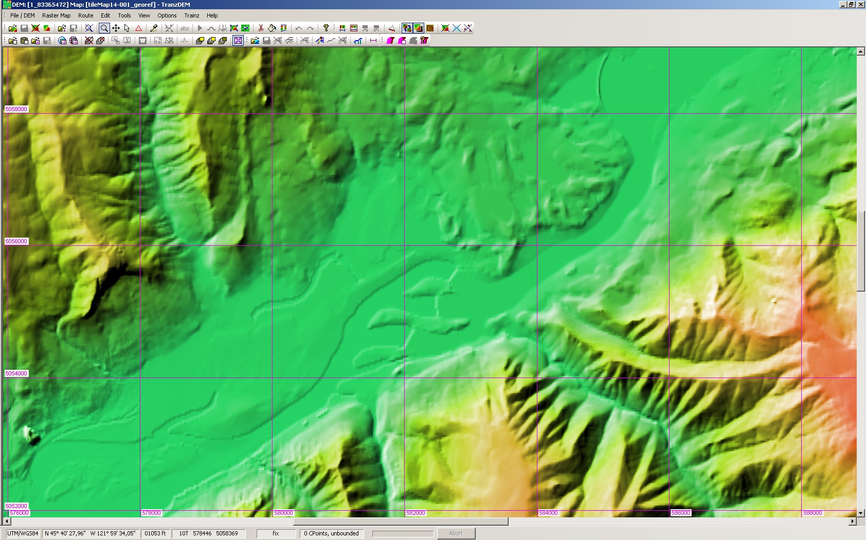
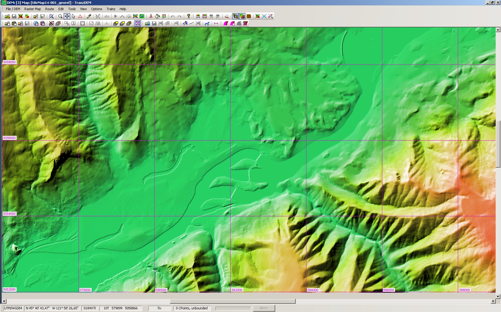
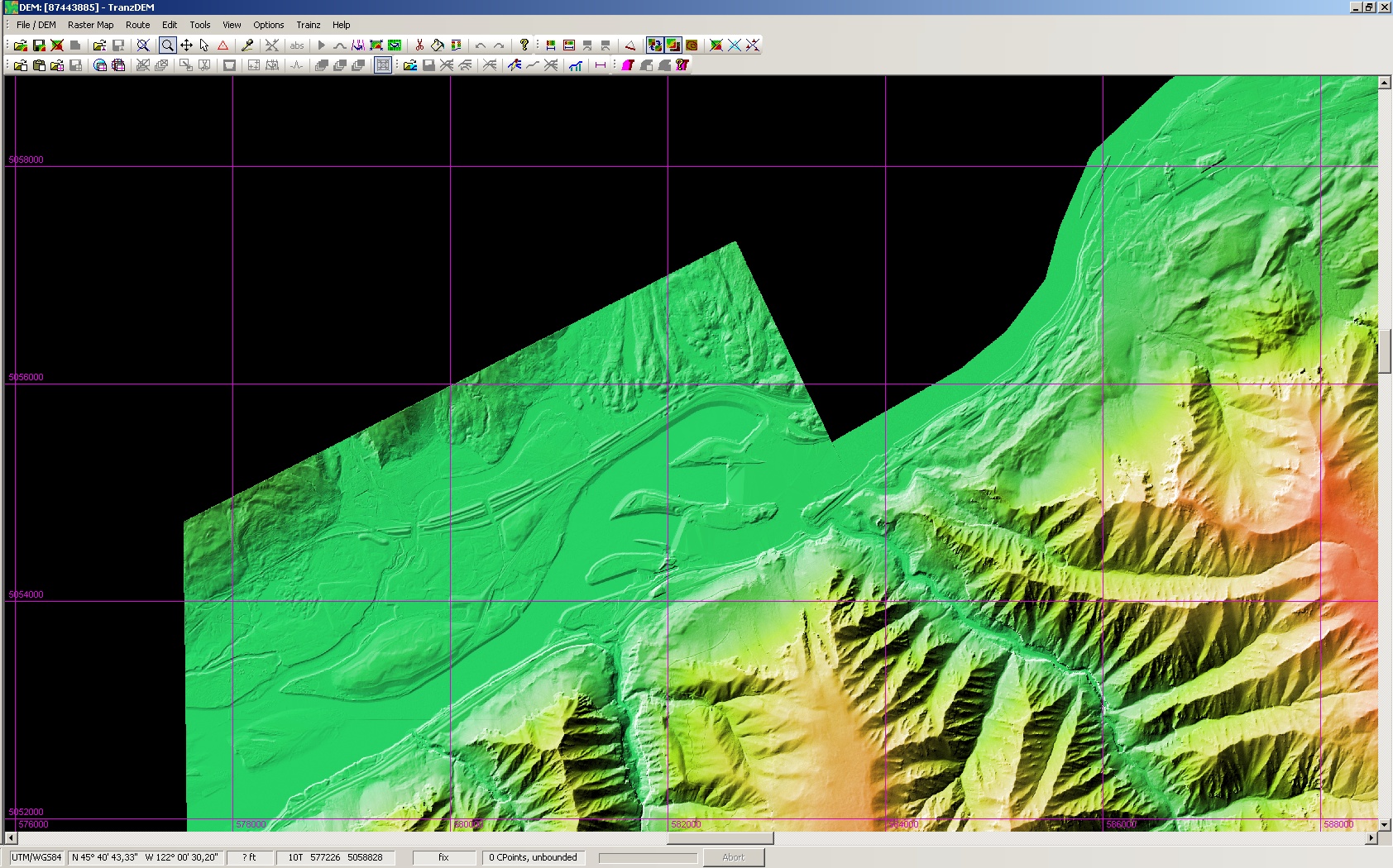
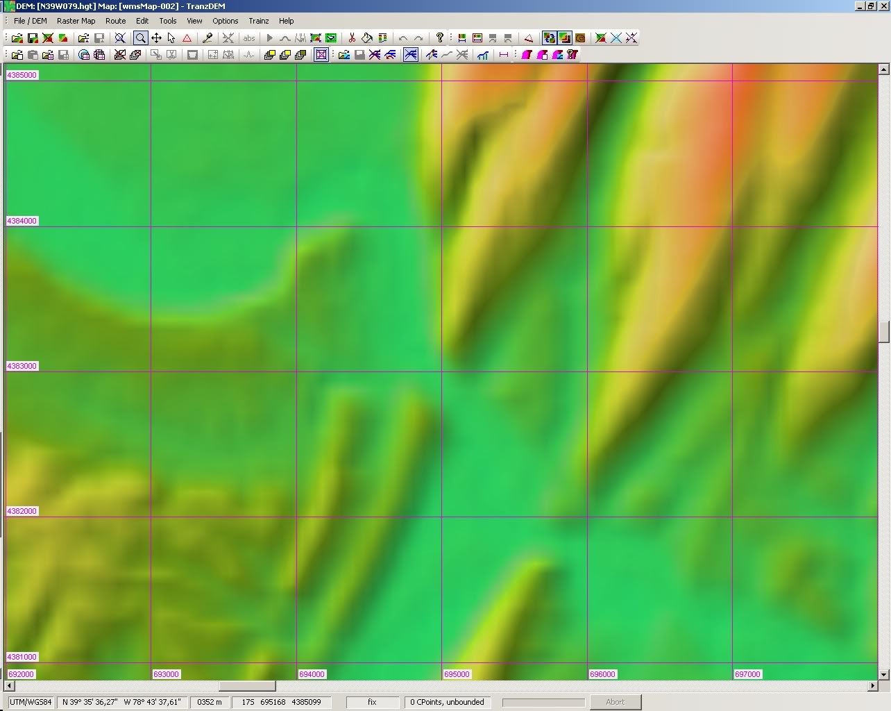
The first samples depict an area of 6 x 4km.

We start with a low resolution of 3 arc sec. This first image is not yet NED, but SRTM. It's the standard resolution for DEMs available worldwide. 3 arc sec at this latitude gives a 60 x 90m DEM, shown as a 60m raster in TransDEM. Workable, but needs refinement for rail, road, and water.
Image

Next is the first NED, in 1 arc sec, shown in TransDEM as a 25m raster. Now you get an idea where the river flows and may even sense some cuttings or embankments. If you have a slow internet connection or plan a larger route and do not want to deal with too much data, go for 1 arc sec.
Image


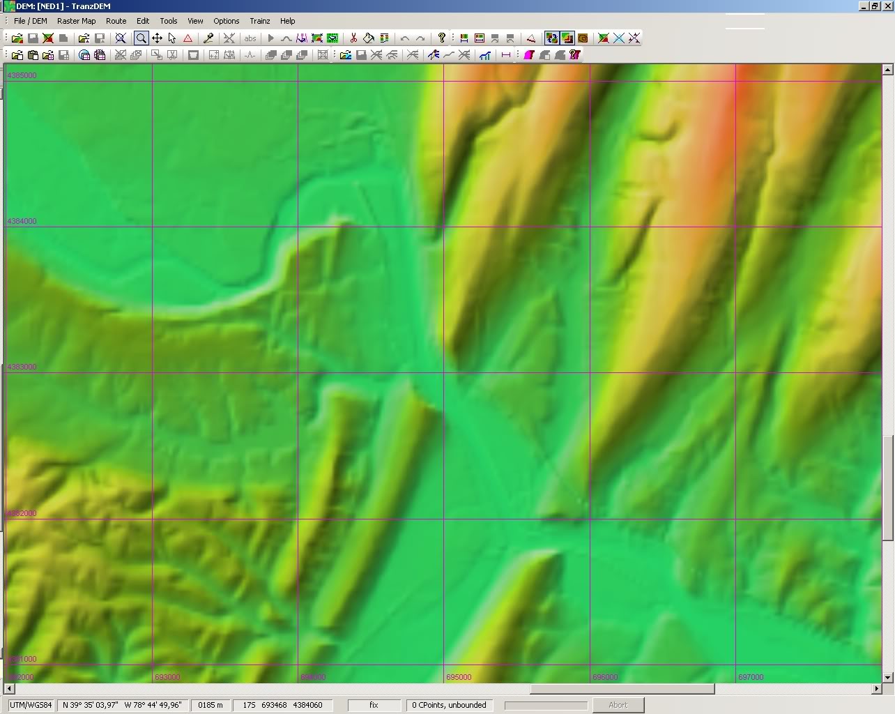
Then we have 1/3 arc sec, shown here as a 10m grid. This is the nominal grid of Trainz terrain before TS2009. Cuttings and embankments appear much sharper.
Image


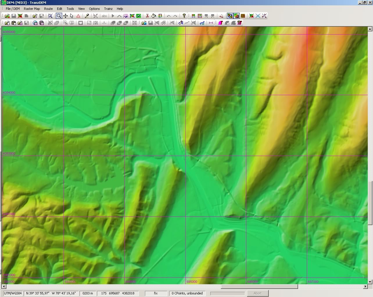
Finally 1/9 arc, shown as a 3 m grid. A perfect source for the Trainz 5m grid, introduced with TS2009. For this image, however, the difference in detail is not fully apparent at the current zoom level.
Image


The last two images are taken at a greater zoom level and show a smaller area of only 3 x 2km. This gives a better idea of the DEM detail for the high-res rasters.

The 1/3 arc sec DEM again (10m):
Image


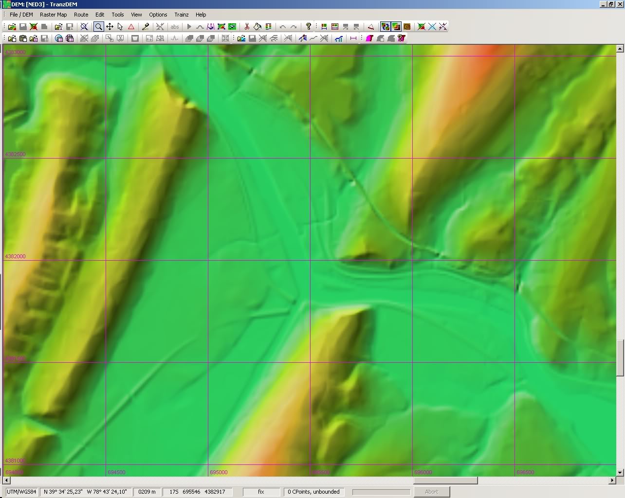
And finally 1/9 arc sec (3m) in its full glory:
Image

There is a catch, though. With each level, 3 -> 1 -> 1/3 -> 1/9 arc sec, the amount of memory needed does increase by factor 9! The same area at 1/9 arc sec resolution will take up 81 times the space needed for 1 arc sec or 729 times the space needed for 3 arc sec.

Author:  backyard [ 21 Mar 2011 03:59 ]
Post subject:  Re: Comparison of USGS NED DEMs

8-) Thanks for the info Roland,

I had downloaded practically all of the Southeastern USA in 3 arcsec, then I found out about 1/3 arcsec...the detail was astounding.

Aside from some territories out west, 1/3 is available for the 48-states whilst 1/9 does have limited availability at this point but the USGS Seamless Server website is updated every three months.

Author:  PDX-Mike [ 22 Apr 2011 07:16 ]
Post subject:  Re: Comparison of USGS NED DEMs

Since 1/9 arc sec coverage is somewhat limited, can you mix 1/3 and 1/9 arc sec? The area I'm currently interested in has 1/9 arc sec available in the urban areas, but only 1/3 arc sec in the outlying areas.

Sorry if this is covered in the documentation, I just got the upgrade this morning, and am working my way through the docs...

Author:  geophil [ 22 Apr 2011 09:43 ]
Post subject:  Re: Comparison of USGS NED DEMs

Yes, you can mix higher and lower resolution. Always start with the higher resolution and then merge adjoining lower resolution DEMs into it. The first DEM will determine the prevailing resolution.

If you look closely at my 1/9 arc sec screenshot you will notice a faint border line in the north east corner. This is were I added 1/3 arc sec data as 1/9 arc sec coverage was not available there.

Author:  PDX-Mike [ 25 Apr 2011 23:48 ]
Post subject:  Re: Comparison of USGS NED DEMs

Thank you for your reply.

Having a bit of a problem. I am trying to work with a route that seems to have a hole in the 1/9 arc sec coverage. I downloaded and have joined all the 1/9 files in TransDem. then I went back t the seamless server and downloaded a 1/3 arc sec file to fill in the hole, but every time I try to add it to the existing 1/9 dem, I get a DEM operation aborted error.

Update... I *think* the problem is I have too much for TransDem to handle... I successfully added the 1/3 dem file to a few of the 1/9 files and it worked just fine, but when I try to add the rest of the 1/9 files it errors out.

I guess I need to figure out how to trim things down a bit....

Author:  geophil [ 26 Apr 2011 08:46 ]
Post subject:  Re: Comparison of USGS NED DEMs

Remember that 1/9 arc sec DEMs are huge. Extremely huge. You will only be able to process relatively small areas before running of of memory. On a 32bit Windows NT series system TransDEM can allocate up to 2GB of virtual memory without tweaking the operating system, and 3GB after changing a system flag (see TransDEM manual). On a 64bit Windows system TransDEM can allocate up to 4GB of memory. This is independent of physical memory present.

If you exceed available memory, split the route project into smaller modules. You will be able to seamlessly merge in Trainz Surveyor later, as baseboard edges will always have the same geo coordinates (as long as you stay in the same UTM zone).

Author:  PDX-Mike [ 27 Apr 2011 00:35 ]
Post subject:  Re: Comparison of USGS NED DEMs

I'm running Win7 64bit with 12GB ram... It didn't seem like I was nearing the 4GB limit, but I didn't take into consideration the amount of memory the program was taking. I was just looking at the file sizes that I was trying to add. The 1/9 files added together and saved in a new file were 670000KB and I was trying to add the 1/3 file which was 121000KB.

I'll split the project up, and see how that goes...

Author:  geophil [ 22 Aug 2012 11:48 ]
Post subject:  Re: Comparison of USGS NED DEMs

Another example of NED DEMs, for Bonneville Dam, Columbia River, OR/WA:

SRTM 1 arc sec:
Image

NED 1 arc sec:
Image

NED 1/3 arc sec:
Image

NED 1/9 arc sec (as available):
Image

NED 1/3 arc sec with US topo 1:24k overlay:
Image

Author:  SharkNose [ 20 Nov 2012 18:46 ]
Post subject:  Re: Comparison of USGS NED DEMs

geophil wrote:
Yes, you can mix higher and lower resolution. Always start with the higher resolution and then merge adjoining lower resolution DEMs into it. The first DEM will determine the prevailing resolution.


Hello. I've been spending quite a bit of time getting acquainted with TransDEM lately and thought it was about time to join the forum. I wanted to ask about the topic above and here it's already been answered! :lol: I've been gathering my DEMs as USGS quads in New Jersey, USA and some of them only had partial 1/9 arc sec data and the rest of the quad was blank. I then used the 1/3 arc sec DEMs to "fill in the blanks".

Thanks for a great product! I'll be back with more questions, I'm sure.

Andrew

Author:  geophil [ 23 Nov 2012 09:21 ]
Post subject:  Re: Comparison of USGS NED DEMs

SharkNose wrote:
I've been gathering my DEMs as USGS quads in New Jersey, USA and some of them only had partial 1/9 arc sec data and the rest of the quad was blank. I then used the 1/3 arc sec DEMs to "fill in the blanks".
Good to hear you succeeded.

Page 1 of 2 All times are UTC + 1 hour
Powered by phpBB® Forum Software © phpBB Group
http://www.phpbb.com/