Meanwhile the Norwegian 1m DEMs appear to work in my lab environment with both the "USGS DEM" and the GeoTiff formats. I have to merge that into the release version and prepare a patch. New version will be TransDEM 2.6.2.2, hopefully over the weekend.
Damien_Zhar wrote:
I'm certain I picked 1m spatial resolution for those files yes. They are supposed to be produced from laser data that can go down to 0.25m There's an option to choose such resolution in sets at
https://hoydedata.no/LaserInnsyn/ (English interface is available) Would such a high resolution be wise, does TransDEM interpolate it all up to 5 metres of TANE terrain accuracy?
The problem with the hi-res LIDAR DEMs is that they are both great and awful at the same time. They are absolutely fantastic to look at but a pain to deal with because of their gigantic footprint. Downloads are usually hundreds of MB and opening in TransDEM requires lots of physical memory (64bit version is a must).
Trainz can only resolve 5m, that is true, but the other option hoydedata.no offers, DTM10, is lower that Trainz can resolve. So, DTM1 makes sense. TransDEM will automatically reduce 1m DEMs to 5m. You can also do it manually with the respective TransDEM function, but then you would lose some of the visual splendour.
Quote:
There's also an option to download the whole laser point cloud with insane data sizes and accuracy.
That appears to be the raw data, not much use to us. LIDAR raw data processing requires sophisticated algorithms which TransDEM cannot provide.
Quote:
I'm a bit lost there to be honest, perhaps you can make heads or tails of the Norwegian system in your spare time? So far I know only enough to select and download a dataset, that interests me.
What more do you want?

Anyway, I think I should write a short tutorial and explain the various options as far as we need them.
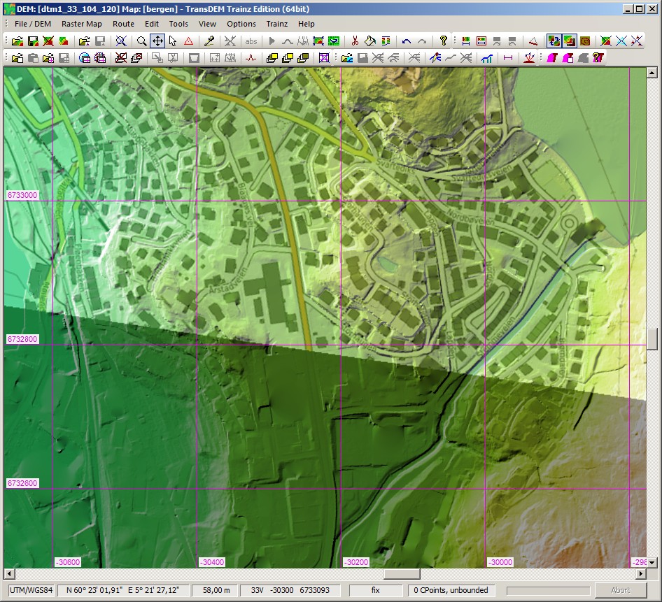
Here is a section of my test example, city of Bergen, with an OpenTopomap overlay, which you hardly need, as the DEM itself can be read like a map.


