TransDEM Forum

TransDEM News, Support, Hints and Resources
It is currently 27 Apr 2024 14:48

All times are UTC + 1 hour


Post new topic Reply to topic  [ 2 posts ] 
Author Message
PostPosted: 09 Dec 2012 19:05 
Offline

Joined: 05 Jan 2011 16:45
Posts: 1465
Until now, Australian Trainz routes were build either with 3 arc sec SRTM data or 1 arc sec ASTER GDEM. SRTM 3 arc sec is somewhat low on resolution, particularly in mountainous regions. ASTER, on the other hand, nominally has a higher resolution, but comes with a coarse surface. Hence, both are far from being regarded as the ultimate DEM data source.

Now, however, a gradual improvement seems on its way. It's called NEDF, National Elevation Data Framework, is operated by Geoscience Australia, and has opened its portal at http://nedf.ga.gov.au/geoportal/catalog/main/home.page sometime last year. (A TransDEM user pointed me to this address.)

They offer - for free - SRTM derived data. The derivatives are based on SRTM 1 arc sec (!), not 3 arc sec, and come in three flavours: regular, smoothed and hydrological.

Unfortunately, TransDEM 2.3.0.0 cannot yet read the data format, which is called ESRI Binary Grid, but I am working on it and achieved first results in my lab today. With a bit of luck, the task may be finished before Christmas.

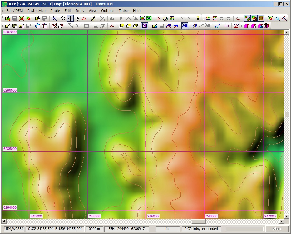
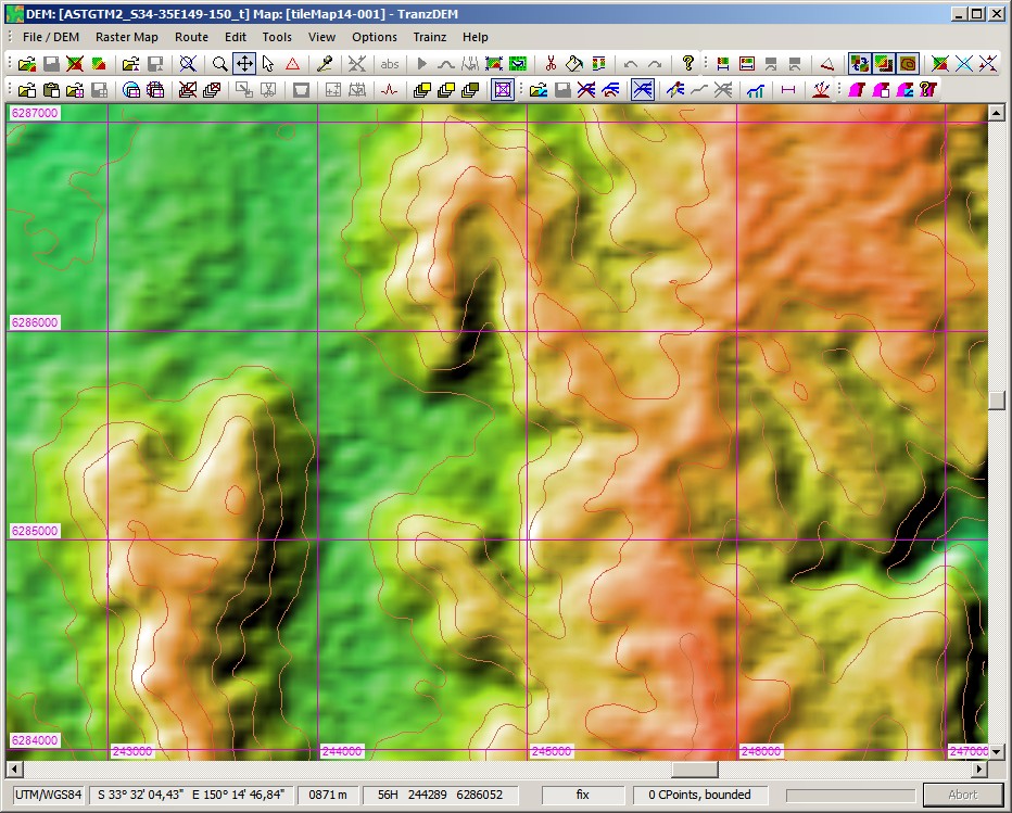
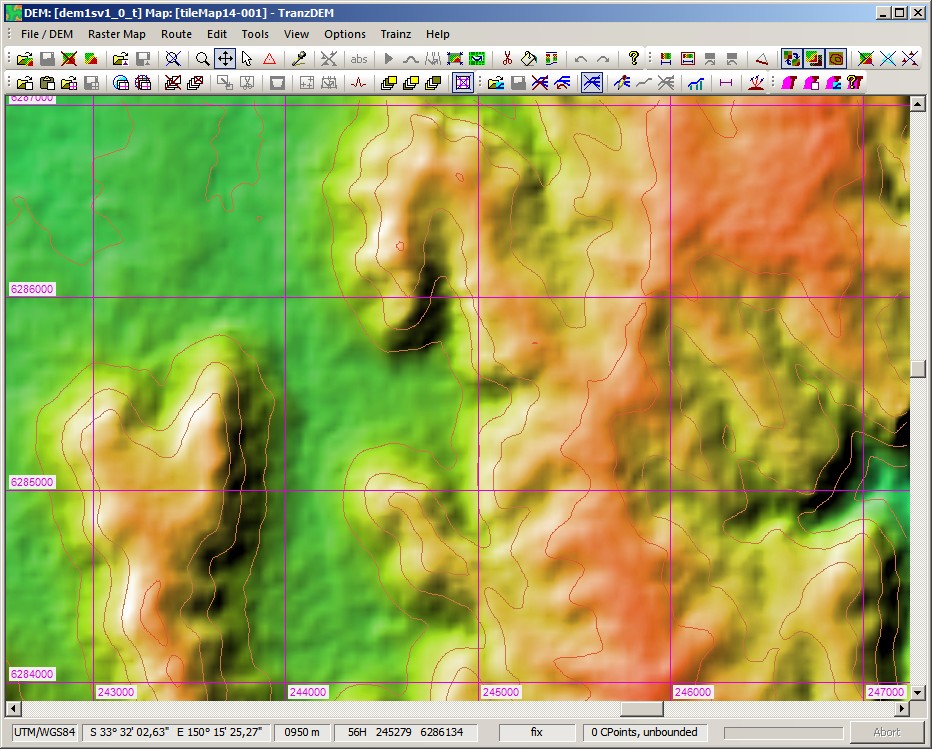
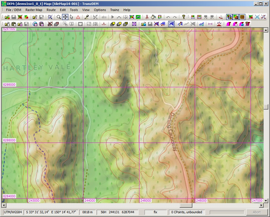
Let us compare a few samples. They are taken from the Blue Mountains, NSW, west of Lithgow. The clipping is 4.5 x 3 km.


SRTM and ASTER, the familiar sources

SRTM 3 arc sec, blurry by nature.
Image

ASTER GDEM 1 arc sec, sharper, but rather bumpy.
Image


Introducing NEDF

NEDF 1 arc sec, regular
Image

NEDF 1 arc sec, smoothed:
Image

NEDF 1 arc sec, hydrologically smoothed:
Image

In my opinion it looks best in "smoothed" flavour.

Is it accurate? One of the Open Street Map renderers has contour lines, I don't know what the source is, but our NEDF comes close.

NEDF 1 arc sec, smoothed, with OSM cycle map overlay:
Image

To me NEDF looks like being worth a try.


Top
 Profile  
 
PostPosted: 11 Dec 2012 03:38 
Offline

Joined: 30 Jan 2011 13:03
Posts: 170
G'day geophil,

Roland, please forward my 'congratulations' on to the TransDEM user who alerted you to this new 'development' in DEM technology for Australia (I was not aware of it, myself). I look forward, with bated breath (damn it, forgot to clean my teeth again, this morning), to the updates to allow us folks 'downunder' (and everyone, else, of course) to make use of this new resource...

Jerker {:)}


Top
 Profile  
 
Display posts from previous:  Sort by  
Post new topic Reply to topic  [ 2 posts ] 

All times are UTC + 1 hour


Who is online

Users browsing this forum: Baidu [Spider] and 41 guests


You cannot post new topics in this forum
You cannot reply to topics in this forum
You cannot edit your posts in this forum
You cannot delete your posts in this forum

Search for:
Jump to:  

Imprint & Privacy

Powered by phpBB® Forum Software © phpBB Group