Until now, Australian Trainz routes were build either with 3 arc sec SRTM data or 1 arc sec ASTER GDEM. SRTM 3 arc sec is somewhat low on resolution, particularly in mountainous regions. ASTER, on the other hand, nominally has a higher resolution, but comes with a coarse surface. Hence, both are far from being regarded as the ultimate DEM data source.
Now, however, a gradual improvement seems on its way. It's called NEDF, National Elevation Data Framework, is operated by Geoscience Australia, and has opened its portal at
http://nedf.ga.gov.au/geoportal/catalog/main/home.page sometime last year. (A TransDEM user pointed me to this address.)
They offer - for free - SRTM derived data. The derivatives are based on SRTM 1 arc sec (!), not 3 arc sec, and come in three flavours: regular, smoothed and hydrological.
Unfortunately, TransDEM 2.3.0.0 cannot yet read the data format, which is called ESRI Binary Grid, but I am working on it and achieved first results in my lab today. With a bit of luck, the task may be finished before Christmas.Let us compare a few samples. They are taken from the Blue Mountains, NSW, west of Lithgow. The clipping is 4.5 x 3 km.
SRTM and ASTER, the familiar sourcesSRTM 3 arc sec, blurry by nature.
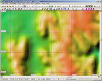
ASTER GDEM 1 arc sec, sharper, but rather bumpy.
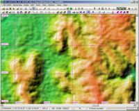 Introducing NEDF
NEDF 1 arc sec, regular
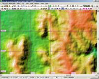
NEDF 1 arc sec, smoothed:
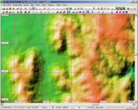
NEDF 1 arc sec, hydrologically smoothed:
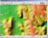
In my opinion it looks best in "smoothed" flavour.
Is it accurate? One of the Open Street Map renderers has contour lines, I don't know what the source is, but our NEDF comes close.
NEDF 1 arc sec, smoothed, with OSM cycle map overlay:
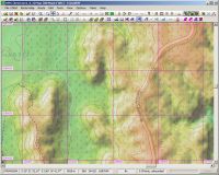
To me NEDF looks like being worth a try.


